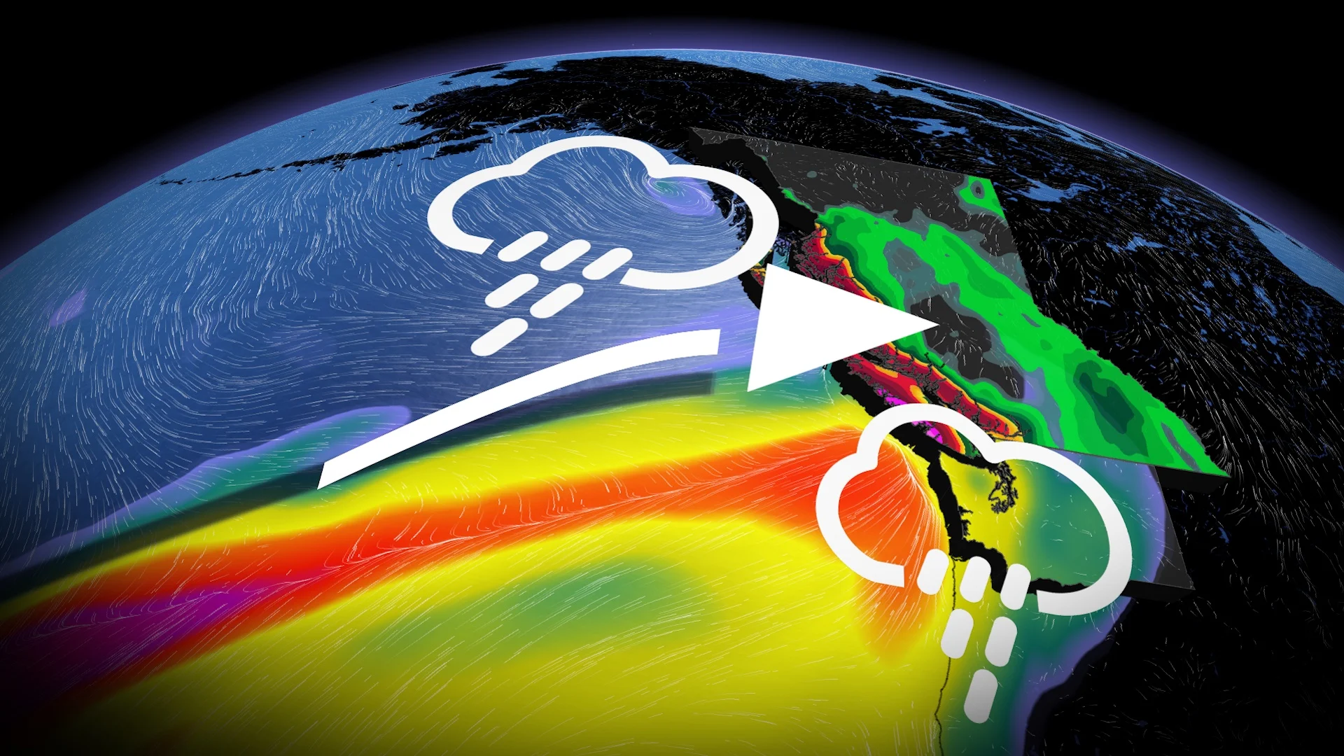
Snowfall will just be the opening act to B.C.'s weather story this week
A chilly pattern has pushed across British Columbia, but confidence is increasing in an atmospheric river by Friday.
Cold air from the Bering Sea is making its way towards us, and it’s set to make its presence felt across British Columbia this week. But, it likely won’t be the biggest story of the week.
Modified, chilly air from the Arctic will move over the Pacific, and this week, temperatures will dip below seasonal norms, making it feel more like November than October.
SEE ALSO: Hurricane Helene vs. B.C.'s 2021 atmospheric river—comparing devastating floods
Short range: Cold air and high-elevation snow
Those chilly troughs will pester the South Coast with shower activity through midweek and sprinkle high-elevation snowfall up and down the Coast and Rocky Mountains.
This week, snow may fall at relatively lower elevations as Whistler Village could pick up a little snowfall accumulation by Friday. Temperatures will fall just a couple of degrees above freezing with a wintry mix. Areas beyond Whistler will likely experience some snowfall, as well, as cold air is swept across the province.
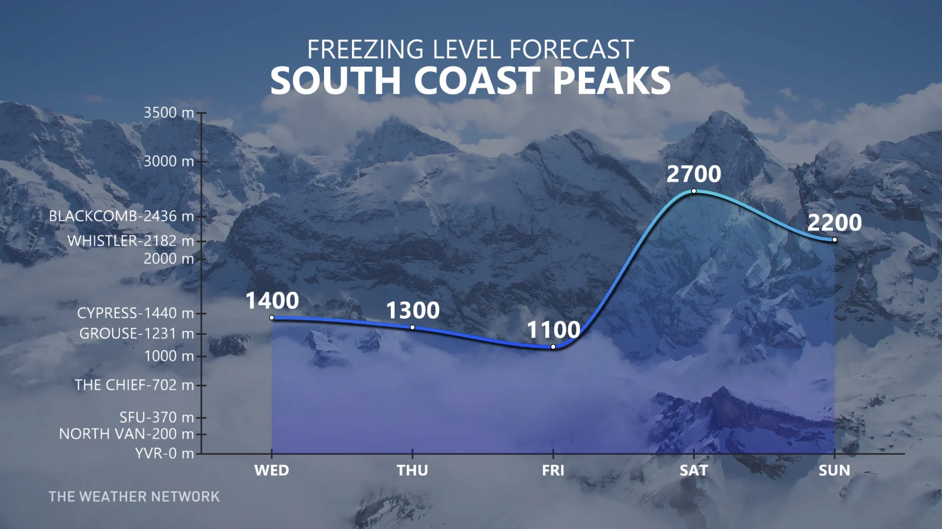
By Thursday, the freezing level, the line above which snow forms instead of rain, slumps to 1,200 metres across a wide swath of B.C. before higher-intensity precipitation moves in.
Speaking of Friday, that’s the start of an atmospheric river, the first of the season that targets the South Coast specifically.
Long-range pattern
Atmospheric river formation
Get ready for the first atmospheric river of the season. The moisture-laden system is expected to bring heavy rainfall starting Friday, targeting the South Coast.
A low-pressure system will gradually develop in the eastern Pacific as the temperature clash creates favourable dynamics to draw up tropic moisture, steering it towards the South Coast. Moisture will be funnelled between a trough off the coast of B.C. and a ridge of high pressure across Oregon and California.
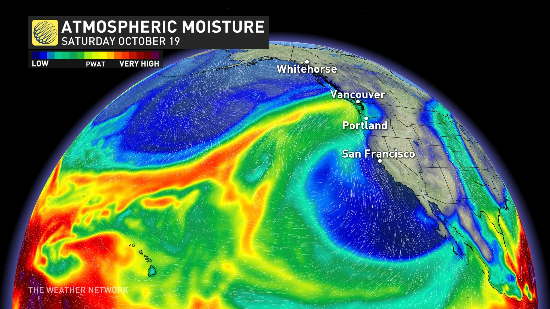
The ridge to the south won’t allow the atmospheric river to slump south quickly, increasing rainfall totals across western Vancouver Island and the higher terrain across the Lower Mainland.
Rainfall and impacts
Atmospheric rivers transport huge amounts of moisture, like rivers in the sky, and when this moisture hits the coast, it can release heavy rain.
Remember atmospheric river intensity is a factor of two variables: Time and integrated vapour transport (IVT).
IVT is simply the total amount of water vapour being carried by the wind across the globe. Integration can be thought of as measuring all the moisture in the atmosphere from the surface all the way up.
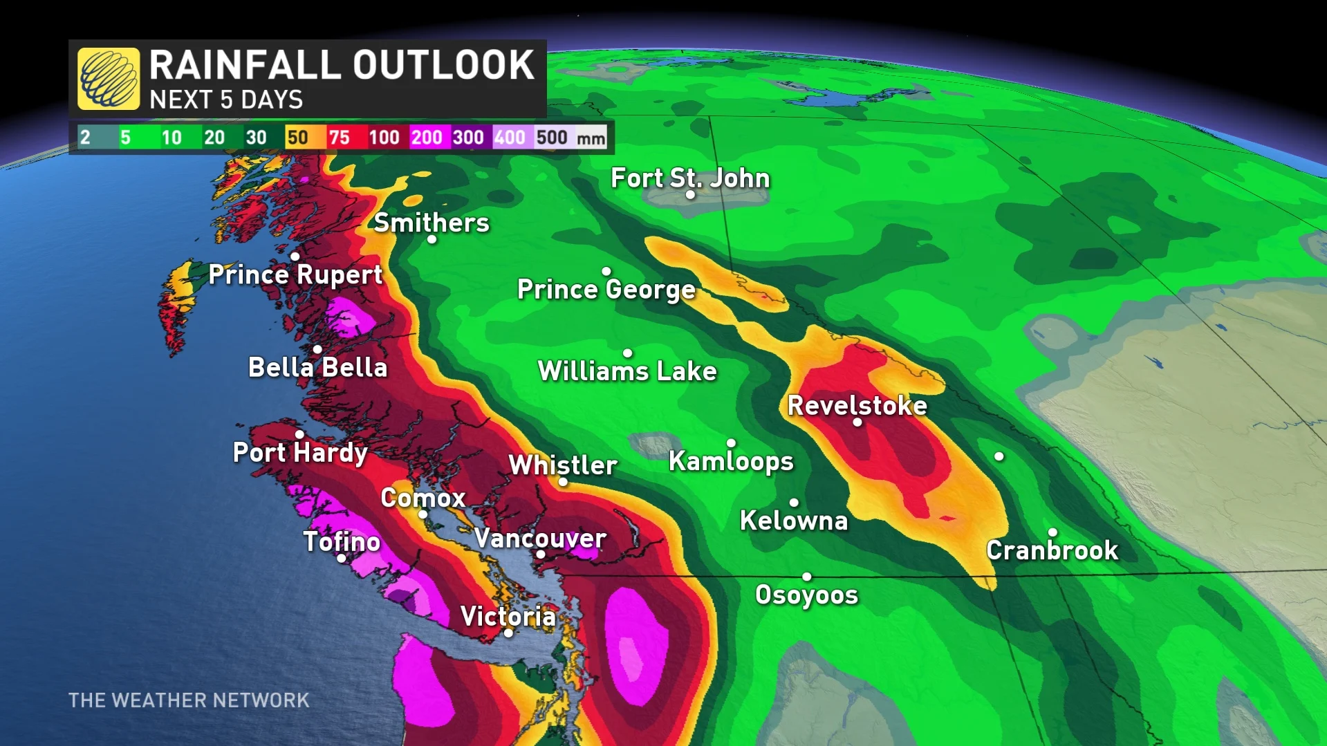
Preliminary rainfall outlook
48-hour rainfall totals:
Western Vancouver Island: Up to 200 mm
North Shore: 100-150 mm
Downtown Vancouver: 75-100 mm
Less than 50 mm south of the Fraser River
Inland Vancouver Island: 100 mm
Sunshine Coast: 75-100 mm
Eastern Vancouver Island: 50-75 mm
Greater Victoria: 30-50 mm
Timing will be from Friday afternoon to Sunday evening.
WATCH: Vancouver Island atmospheric river on the way
Impacts
Rivers and watersheds aren’t running particularly high, so the watershed can take an influx of moisture.
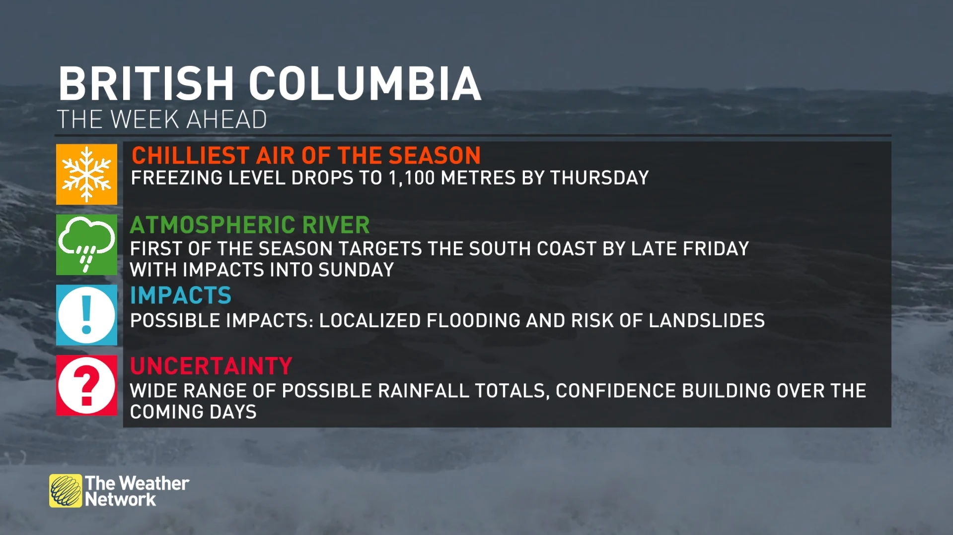
Expect ponding on low-lying roads, and landslides could become a concern in areas like Highway 4 on Vancouver Island.
The heaviest rainfall rate is expected Friday overnight into Saturday, with more waves of heavy moisture on Sunday, so expect a heightened risk of flooding and landslides during those periods.
An increased risk of landslides across Vancouver Island and the South Coast.
Winter driving conditions on higher passes and elevations before freezing levels spike on Saturday. Winds and power outages are not expected to be a primary threat.
Uncertainty
Model guidance is still adjusting, so the highest rainfall amounts might shift over the coming days.
Western Vancouver Island has the highest confidence to see more than 150 mm of rainfall, with the North Shore Mountains likely seeing a minimum of 100 mm.
A significant rain shadow will likely occur across portions of the South Coast, with underachieving rainfall amounts on the leeward side of the terrain.
Regions under the strongest rain-shadow effects could see less than 30 mm of rainfall throughout the event.
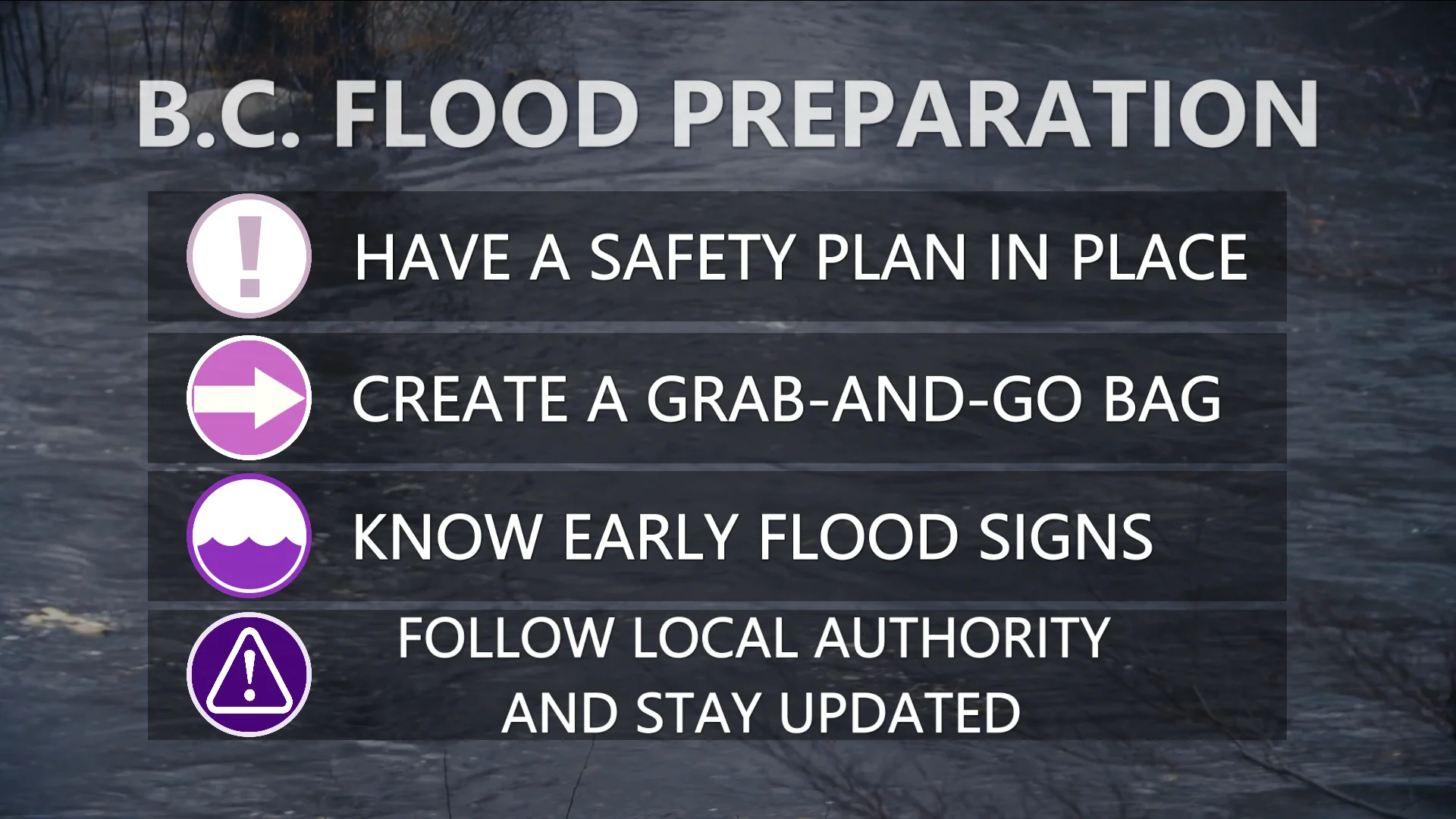
We’ll keep monitoring the system here at The Weather Network, so stay tuned for updates and be prepared for potential impacts from heavy rain later this week. Stay prepared and keep an eye on local alerts as the forecast evolves.


