Who got frosty first? This fall's unusual pattern across Canada
"It gets cold in winter in Canada" is hardly a stop-the-presses newsflash, but 2019 has been noteworthy so far for where it's getting cold.
Some unlikely cities are lagging in the race to reach the freezing mark, while other unlikely competitors have surged to near the front of the pack. If you had to pick between Victoria and Montreal, who would you say had the first frost? Or, to get cities south of the border involved, who froze first -- Toronto, or Dallas?
Okay, these are obviously trick questions, right? Let's look at the numbers.
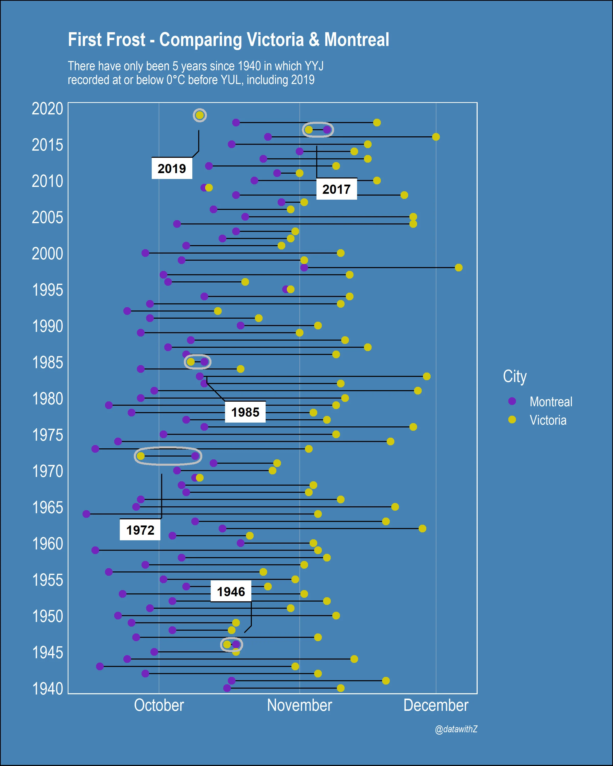
Photo courtesy: Zach Hamilton
Both Vancouver and Victoria have already seen overnight lows at or below freezing for fall 2019. While both cities do generally edge below zero through the winter, this year's lows are well ahead of average. In fact, Victoria has only ‘out-frosted’ the city of Montreal a total of five times.
The same can be said for much of the west (albeit with a snowier outcome over the Prairies), where temperatures over the past 30 days have averaged 5 to 10 degrees below the October norm.
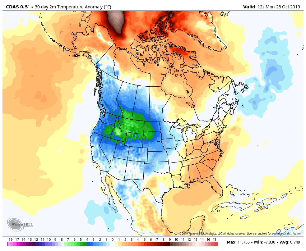
30-day average surface temperature anomaly, in Celsius. Image courtesy WeatherBell.
As you can see from the blues and greens on the map above, temperatures across much of western North America have been on the cold side of average for October. Conversely, those warmer tones in the east indicate temperatures running above average. And that pattern helps explain why neither Toronto nor Montreal has seen the thermometer hit zero yet this season.
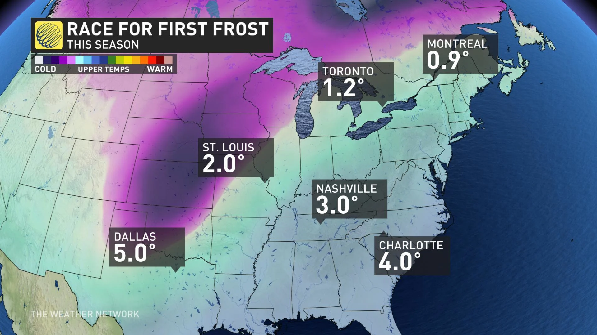
By way of comparison, Toronto's Pearson International and Montreal's Pierre Elliott Trudeau International Airports usually see their first frost dates between October 1 and 10.
Vancouver International doesn't typically dip below freezing until between November 1 and 10, while Victoria International's first frost date usually falls between November 11 and 20.
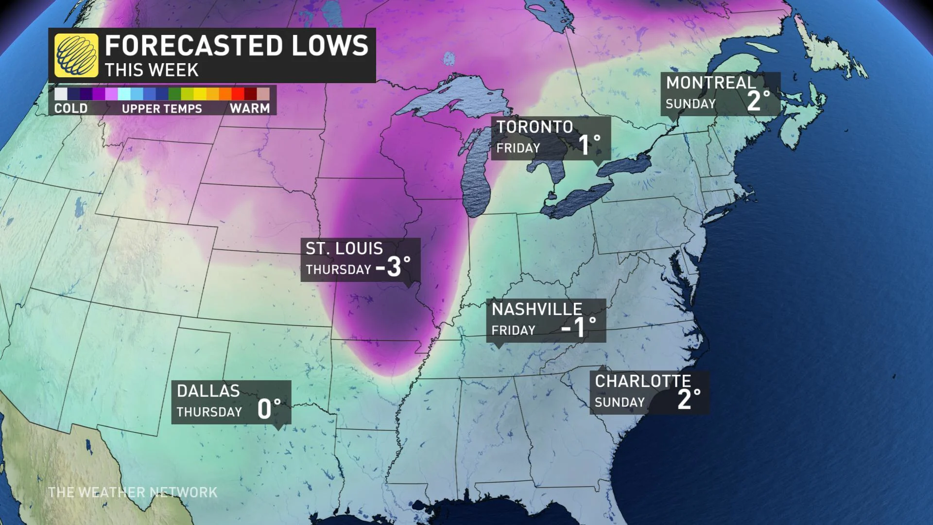
The western chill hasn't stayed north of the border, either. Cities like Denver have already dropped into the negative double-digits, and a deep dip in the jet stream heralds the first frost for points further south, too. By the end of the week, overnight lows down as far south as Dallas will be flirting with the freezing mark. That's again about a full month earlier than average. Further east, Nashville will also be headed for the freezing mark -- a week or two late.
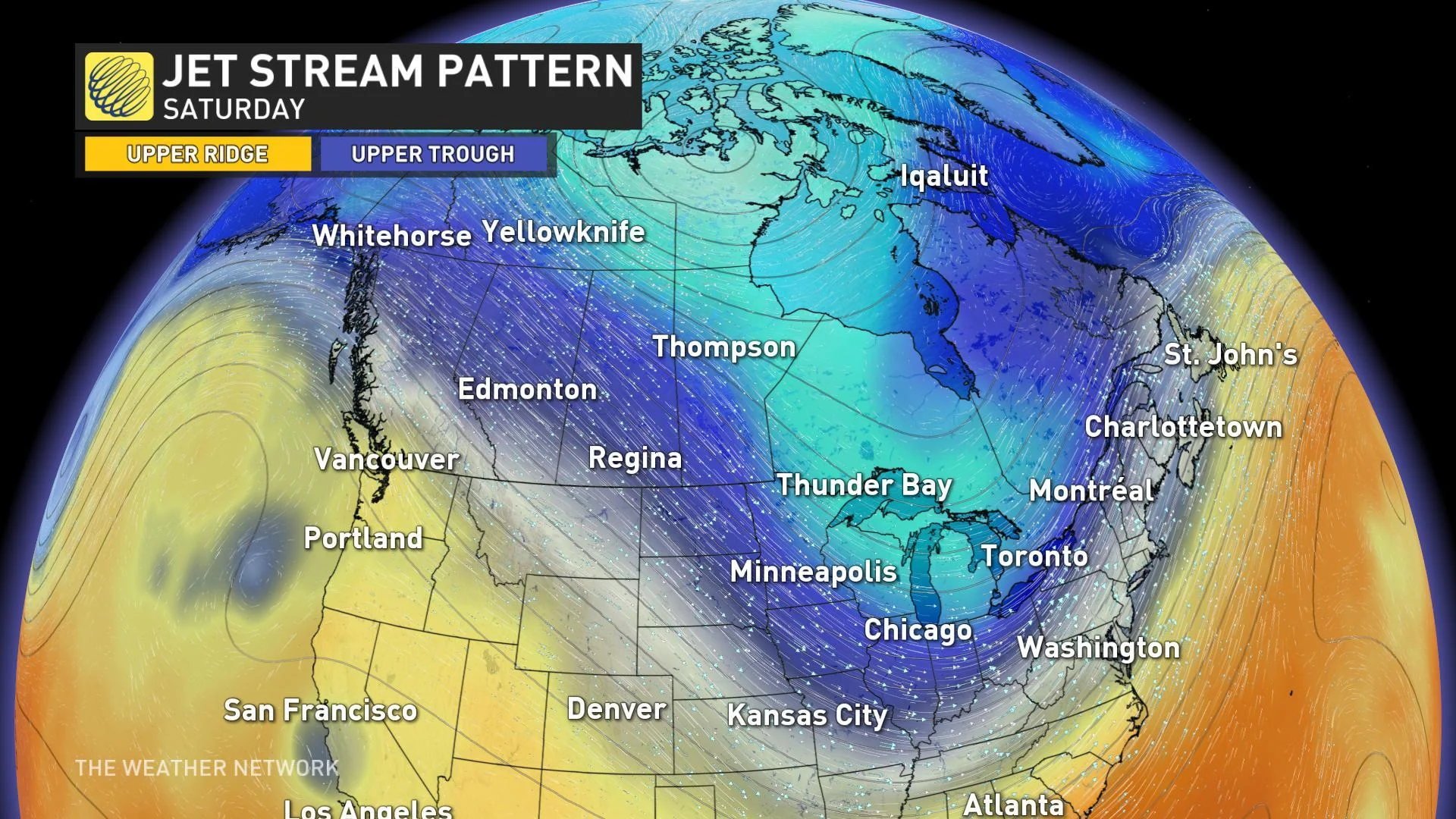
The pattern shift that's coming to cool down Nashville is ultimately expected to bring near-freezing temperatures to southern Ontario and Quebec, as well. By the end of the week, Toronto and Montreal's mild streaks may be coming to an end.
