Strong bomb cyclone threatens wicked winds and outages over B.C. this week
A rapidly intensifying low, also known as a weather bomb, will bring big waves, powerful winds, heavy snow, and rain to B.C. this week. Brace for outages and travel disruptions
Considerable travel and power impacts are possible as a bomb cyclone develops off the B.C. coast on Tuesday.
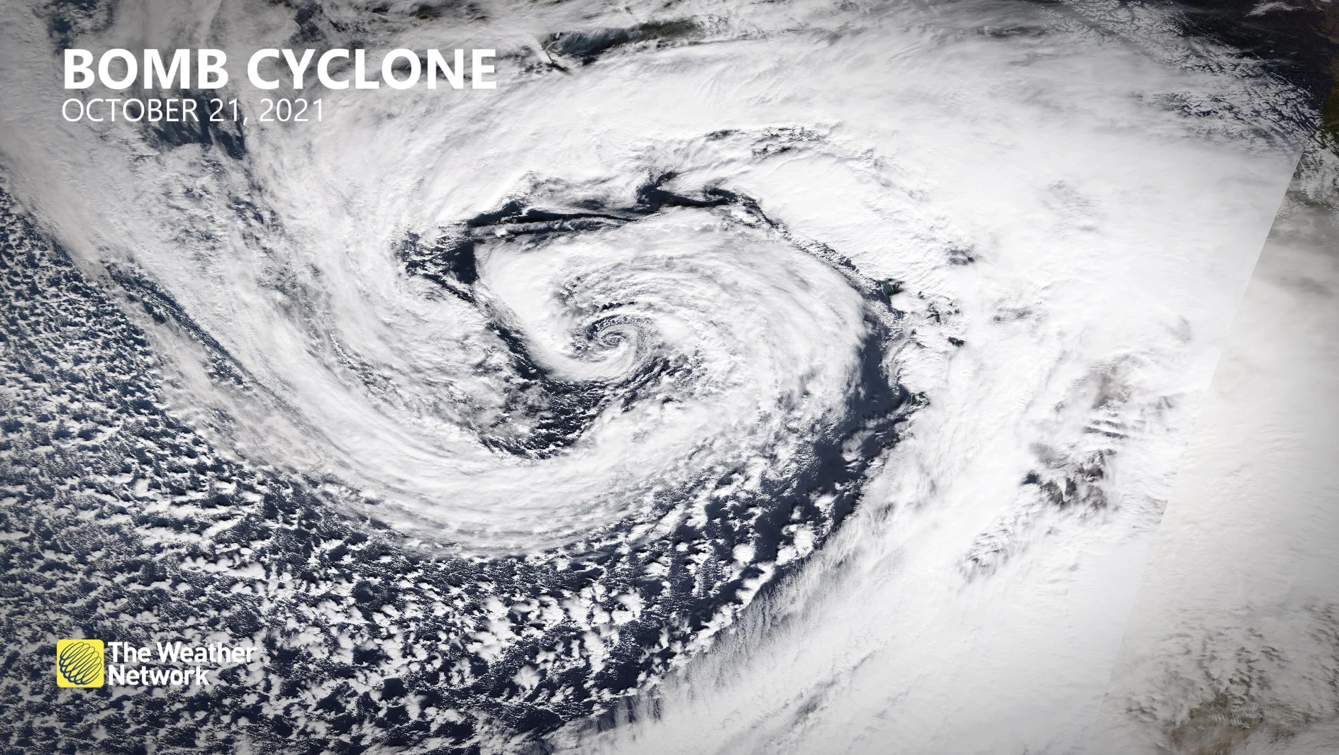
This powerful storm has some similarities with the historic low that hit the Pacific Northwest in October 2021. This particular storm will remain offshore and spare folks on land from its worst impacts, but it's still going to be an intense one for the region.
Damaging wind gusts are anticipated Tuesday into Wednesday, so there is a likely chance of power outages and ferry delays or cancellations. Heavy precipitation is also possible for some locations.

(RAAMB/CIRA/NOAA)
DON'T MISS: 'Weather bombs' are explosive storms that create ferocious conditions
Another feature also working to enhance the winds—in a striking similarity to the October 2021 event—is a strong, high-pressure setup over Alberta that'll strengthen the pressure gradient.
Bomb cyclone develops offshore
The energy that’ll kick off our upcoming storm spent the weekend traversing the Bering Sea. By Monday, we’ll see this feature move into the Gulf of Alaska filled with modified Arctic air.
A strong jet stream aloft and sharp temperature differences will work together to rapidly intensify a low-pressure system off the B.C. coast by Tuesday.
The minimum central pressure within this low could drop from 1004 mb on Monday evening down to 948 mb by Tuesday evening—–a stunning 60-mb drop over the course of a single day.

SEE ALSO: Heavy snowfall in B.C. leads to early opening at Big White Ski Resort
This would double the criteria for bombogenesis, the formal name for the rapid intensification that leads to a bomb cyclone.
A bomb cyclone is different from other storms because the dynamics within a rapidly intensifying storm can create ripping winds and extreme precipitation rates.
Tuesday and Wednesday: Brace for outages, travel disruptions as winds intensify
Light shower activity to begin the day Tuesday will give way to increasing southeasterly winds through the afternoon and evening hours.

Heavy alpine snow will develop as this system approaches the region. All local ski resorts are in line for copious amounts of snow as freezing levels fall below 1,000 metres on Tuesday.
Some areas could see close to 100 cm of snow from this event.

It’s the winds, though, that are likely to cause the greatest impacts as this system nears the region.
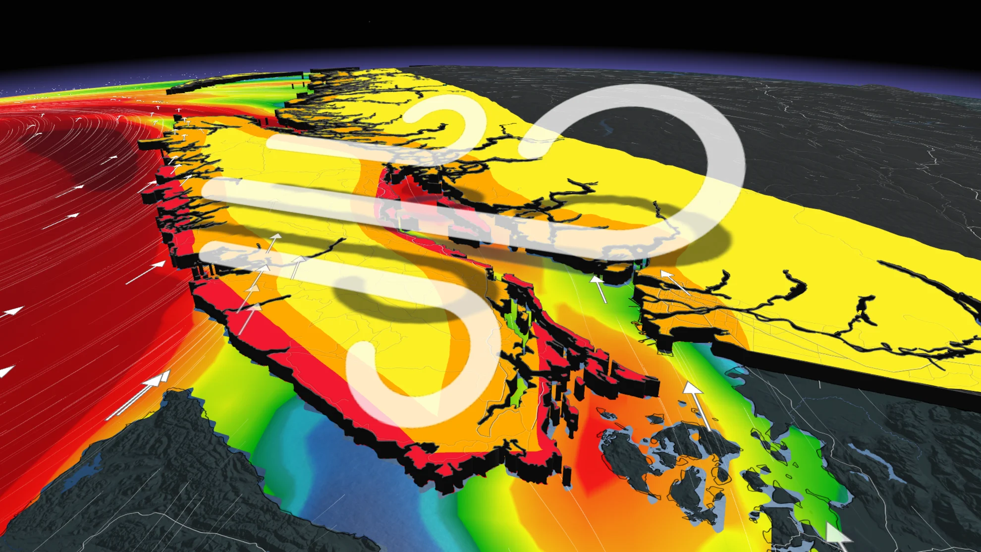
Winds will intensify into Tuesday night, up and down the Strait of Georgia and throughout coastal Vancouver Island. Gusts will generally peak around 90-100 km/h. Folks across the Lower Mainland can expect winds to peak around 50-70 km/h, with the strongest gusts likely along the western beaches.

What makes this even more interesting is how strong the winds will be for the east side of Vancouver Island from Nanaimo to Campbell River. Winds will be blowing from the southeast, but also paired with outflow winds for the mainland that will push those winds further onshore than normal.
With the high pressure to the north, this will cause outflow winds in the north as well, a bit early in the season for such a setup.

This is going to be a long-duration wind event, so ferry delays and cancellations will spill into the day Wednesday. Winds are forecast to peak early Wednesday morning but they will remain gusty all-day.
Widespread power outages are possible as a result of the high winds. Make sure you’re prepared in case the electricity goes out in your area.
Maximum wind gusts forecast:
Campbell River: 70-90 km/h (higher by the water)
Comox: 80-90 km/h
Tofino: 90-100 km/h+
Nanaimo: 70-80 km/h
Downtown Victoria: 90-100 km/h
Vancouver International Airport: 60-70 km/h
Delta: 70 km/h
Abbotsford: 60-70 km/h
Rainfall totals through Wednesday could exceed 100 mm near Tofino and western Vancouver Island, with 30-50 mm of rain for most other regions along the South Coast. Victoria will see under 10 mm of rain with a strong rain-shadow effect, courtesy of the Olympic Mountains.

Storm surge flooding may also be a concern for some locations. We’re just coming off a king tide cycle on Tuesday and Wednesday, so tides will be elevated right as the storm peaks. Some coastal inundation is possible Wednesday morning around communities like Victoria and Campbell River.
Stay with The Weather Network for all the latest on conditions across B.C.


