Summerlike heat exiting the Prairies as autumn vibes make a return
The Prairies heat is on its way out in a hurry as a dramatic temperature swing takes hold beginning on Monday.
Everything good comes to an end eventually.
Sunday’s heat in Saskatchewan likely registered as one of the warmest days ever recorded this late in the year across Canada.
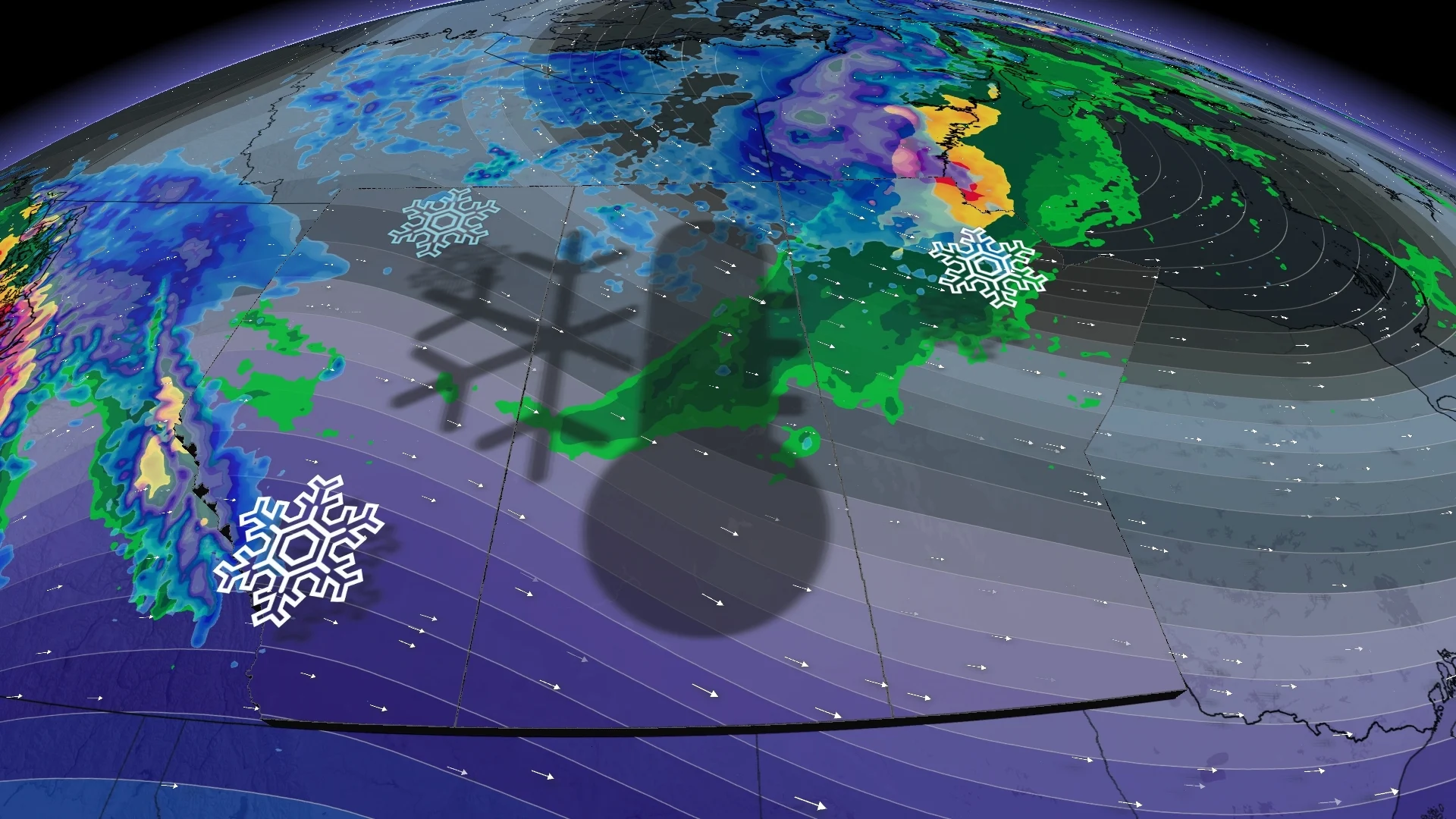
But that will be a thing of the past come Monday as autumnal weather makes a grand return, all thanks to a cold front and blustery, northerly winds.
RELATED: 3 important things to know about the fall season
Some communities on the Prairies will see temperatures drop nearly 20 degrees between between Sunday and Monday.
Temperatures flip to fall on Monday
The wind will take away what the wind gave.

RELATED: Why these Alberta winds are known as 'Devil Winds'
Folks across Saskatchewan will wake up to a return to autumn on Monday as temperatures plummet behind a cold front sweeping through the region.
Daytime high temperatures will struggle to climb into the lower teens across the Prairies, with brisk, northwesterly winds of 80 km/h making things feel even chillier compared to where we were on Sunday.

As the winds calm overnight Monday, gardeners across Alberta and Saskatchewan will have to watch for a risk of frost.
Sunday felt like a sizzling summer day
The penultimate day of September felt more like the middle of summer for a vast swath of the Prairies as a low-pressure system helped very warm air north of the border. This is the kind of setup you need to get summerlike temperatures across Canada this late in the year.
What’s the record for late-season heat? The warmest Canadian temperature this late in the year goes to Medicine Hat, Alta., which saw a high temperature of 33.9°C on both Sept. 29, 1967, and Oct. 6, 1889.

It looks like we may have broken that record with a preliminary high temperature of 34.5°C in Coronach, Sask.
It’s worth noting that the placement of that low robbed some areas of the heat. If you’re reading this from Edmonton, you’re probably wondering what we’re talking about as temperatures there are about half of what they were in parts of southern Saskatchewan.
Warmth returns to the southern Prairies on Tuesday
Manitoba will hang on to another dose of the milder weather in the high teens to low 20s on Monday, but the temperature drop comes shortly after for the region on Tuesday, with daytime highs sitting around 14°C.
SEE ALSO: Why Calgary can be a tricky place for migraine sufferers
Another cold front is expected midweek, keeping widespread temperatures in the low teens.

A warmer pattern is then expected to return by the weekend, and into the second week of October, so no need to worry about freefall into consistently cold weather just yet. The rest of October is forecast to have predominantly above-normal temperatures.
WATCH: Septembers in this town are warming up each year
Stay tuned to The Weather Network for the latest forecast updates on the Prairies.


