The wait is over: B.C. ski resorts brace for first major snowfall
Snow fell as early as late August across the Rocky Mountains, but now, patience is set to pay off for B.C.'s South Coast this week.
Although some regions across the province, like Sun Peak and the Interior, have already seen snowfall, a more widespread shot of the white stuff is advancing toward British Columbia this week.
Snow fell as early as late August across the Rocky Mountains, but now, patience is set to pay off for the South Coast.
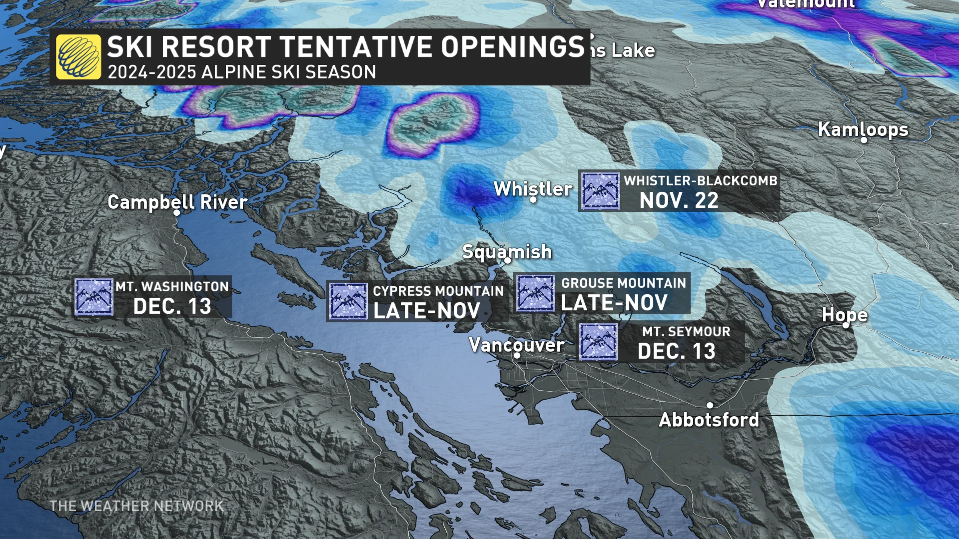
There was a light dusting on Oct. 18 at Grouse Mountain, but this time we’re expecting much more. This an encouraging sign for ski resort preparations and opening-day targets, with more snowfall opportunities in the next couple of weeks.
Before the taste of wintry weather, blustery winds are expected along coastal areas as the front approaches through Wednesday morning.
Wind warnings have been issued for Haida Gwaii and North Vancouver Island, with the threat for strong southeasterly gusts between 90 and 110 km/h. These winds could cause tree damage and isolated power outages.

The South Coast will be windy, but should stay below warning criteria this time around. Just last weekend, a damaging wind storm brought power outages to thousands of customers across southern B.C.
The wait for snow at local ski resorts is over
The winds will gradually ease through early Wednesday, followed by the first significant snowfall accumulations of the season for local ski resorts on Vancouver Island and around the Lower Mainland.
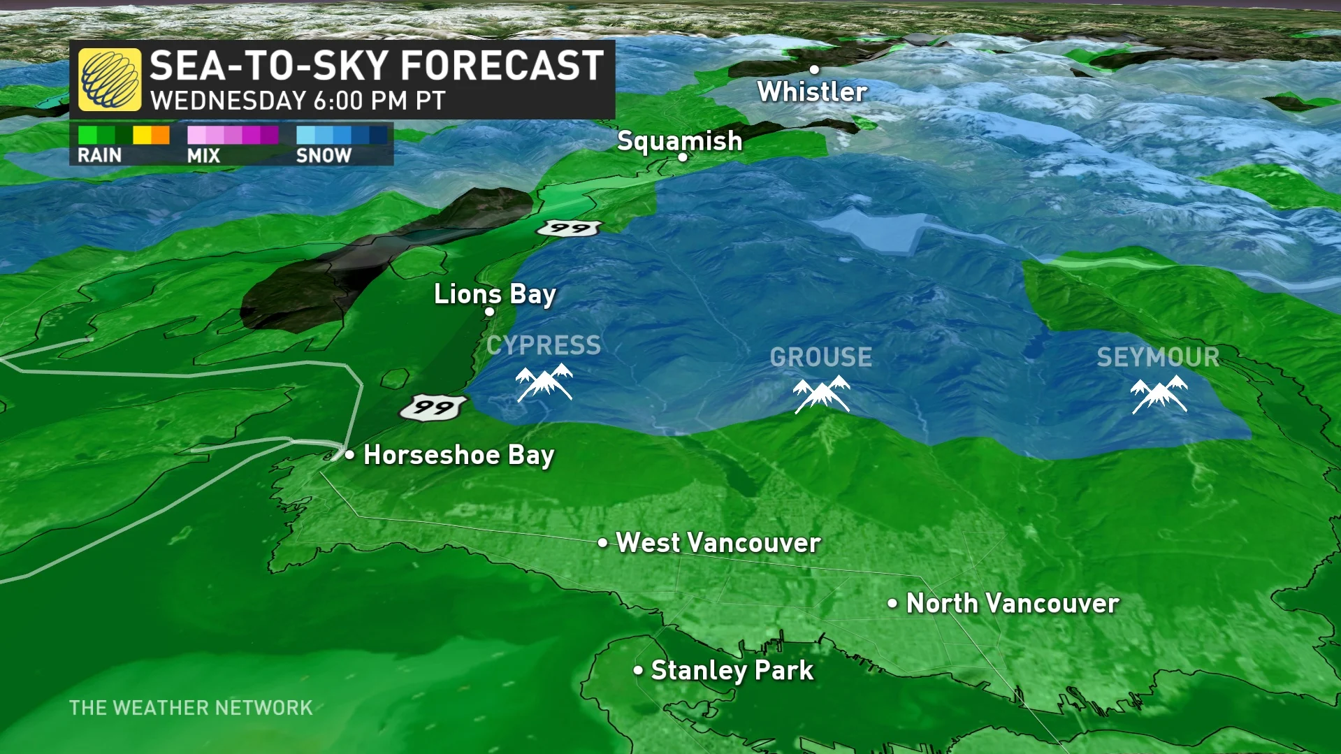
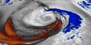
Cold air from the Bering Sea will merge with a storm system moving in from the Gulf of Alaska, keeping freezing levels below 1,000 metres on Wednesday.
This pattern is more typical later in mid-November in terms of freezing level, but it’s not unprecedented, either.
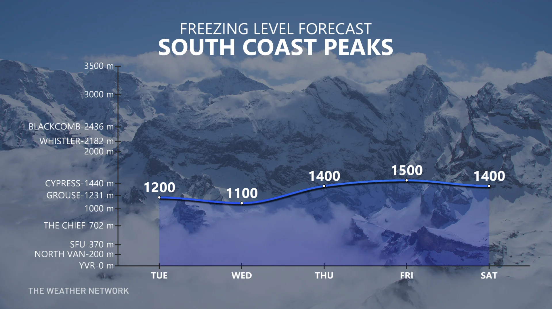
As the low-pressure system weakens, while tracking parallel to the coast, it will still deliver the season's first meaningful snow to the Coastal Mountains.
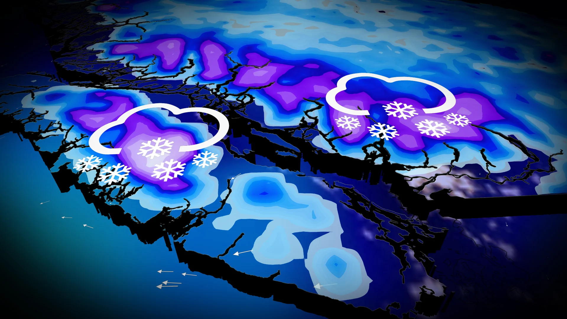
The heaviest snow is expected during the Wednesday evening and overnight hours, tapering to snow showers early Thursday.
10-20 cm of snow is possible for the North Shore ski resorts, with upwards of 30 cm possible across the higher elevations of Mount Washington.
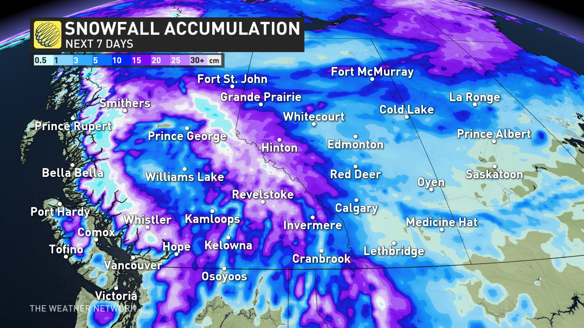
Poor driving conditions are expected across higher terrain above the snow line, with winter tires mandated on many higher elevation routes across the province.
This an encouraging sign for ski resort preparations and opening-day targets, with more snowfall opportunities in the next couple of weeks.
This is an encouraging early-season trend, especially in contrast to last year’s slow start to the ski season.
South Coast mountain fast facts
Grouse Mountain
Annual snowfall: 870 cm
Highest elevation: 1,231 m
Longest run: Three km (Peak-The Cut)
Cypress Mountain
Annual snowfall: 622 cm
Highest elevation: 1440 m
Longest run: 4.1 km (T33-Collins)
Mount Seymour
Annual snowfall: 1,000 cm
Highest elevation: 1449 m
Longest run: Two km (Brockton Gully-Manning-Rookies)
Whistler Blackcomb
Annual snowfall: 1,040 cm
Highest elevation: 2436 m
Longest run: 11 km (Peak-to-Creek).
This is one of the longest, continuous trails in North America.
Mount Washington
Annual snowfall: 1,100 cm
Highest elevation: 1588 m
Longest run: 3.8 km (Linton’s Loop)
WATCH BELOW: Will ski resorts open on time this year, Canada?
With files from Tyler Hamilton, a meteorologist at The Weather Network.


