Two powerful tropical storms on the move, eyes on potential Canadian impact
Tropical Storms Franklin and Harold threaten the Gulf coast and Hispaniola, with Canada's East Coast also being monitored closely
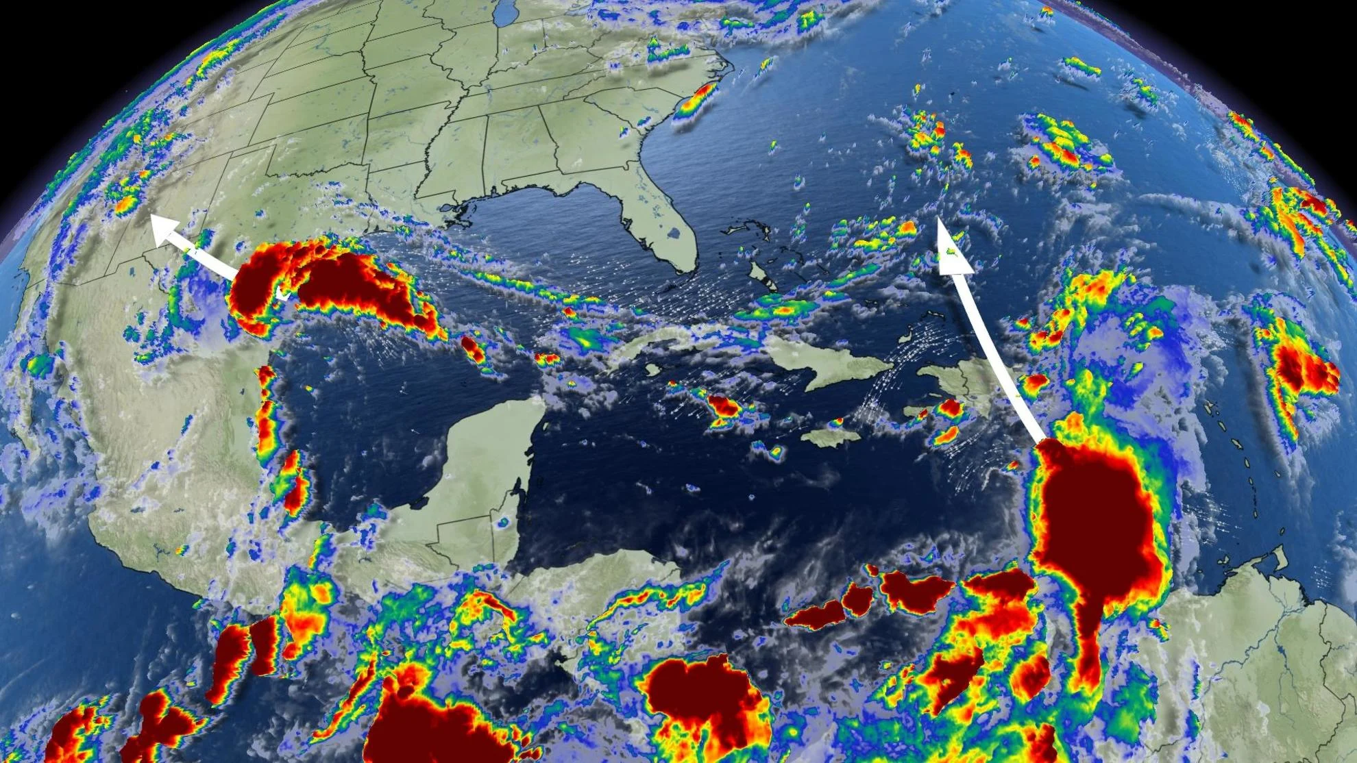
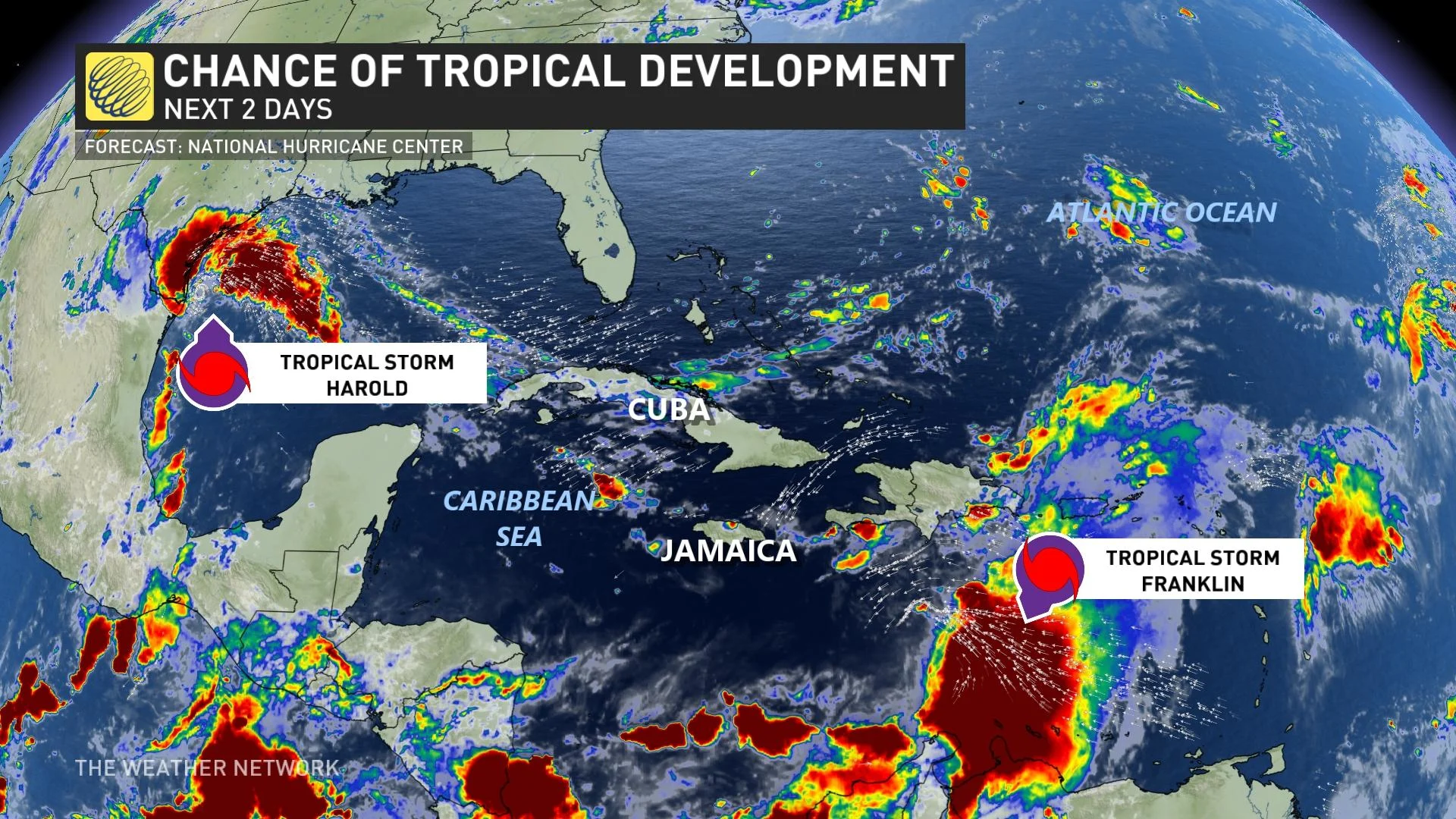
The Atlantic hurricane season just kicked into high gear, as three tropical storms developed over the weekend. That's only the third time in history that three Atlantic tropical cyclones formed over just 24 short hours.
While two of the three storms have dissipated or weakened, Tropical Storm Franklin has maintained its strength, with impacts to Haiti and the Dominican Republic expected this week. The Canadian Hurricane Centre (CHC) is also closely monitoring Franklin's progression, with the potential to track north of Canada's East Coast.
RELATED: Tropical Storm Hilary releases fury on Southern California
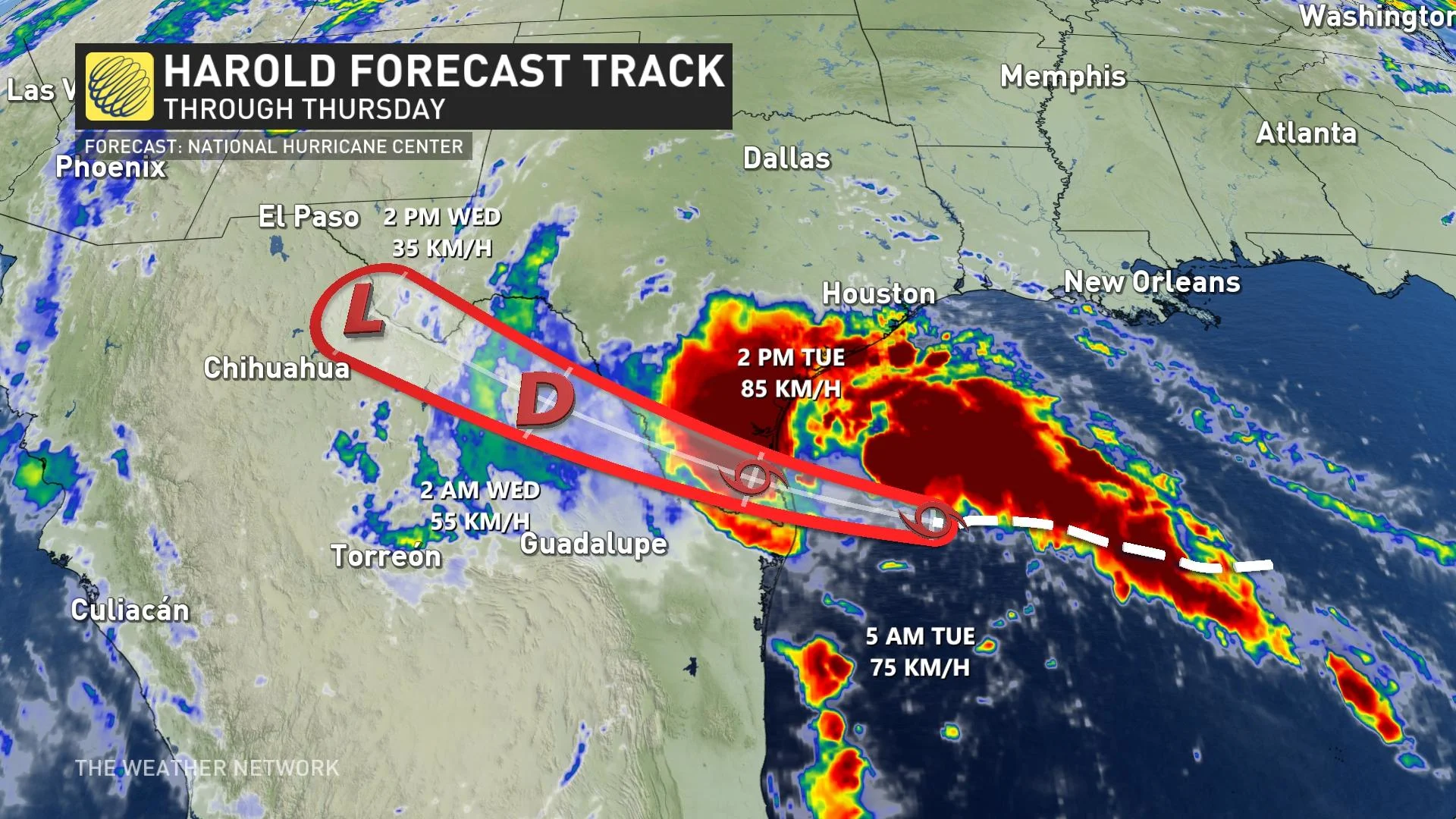
Tropical Storm Harold became the fourth named storm in just days, moving over the south Texas coast through Wednesday, with the threat for heavy rain and strong winds prompting warnings there.
Franklin
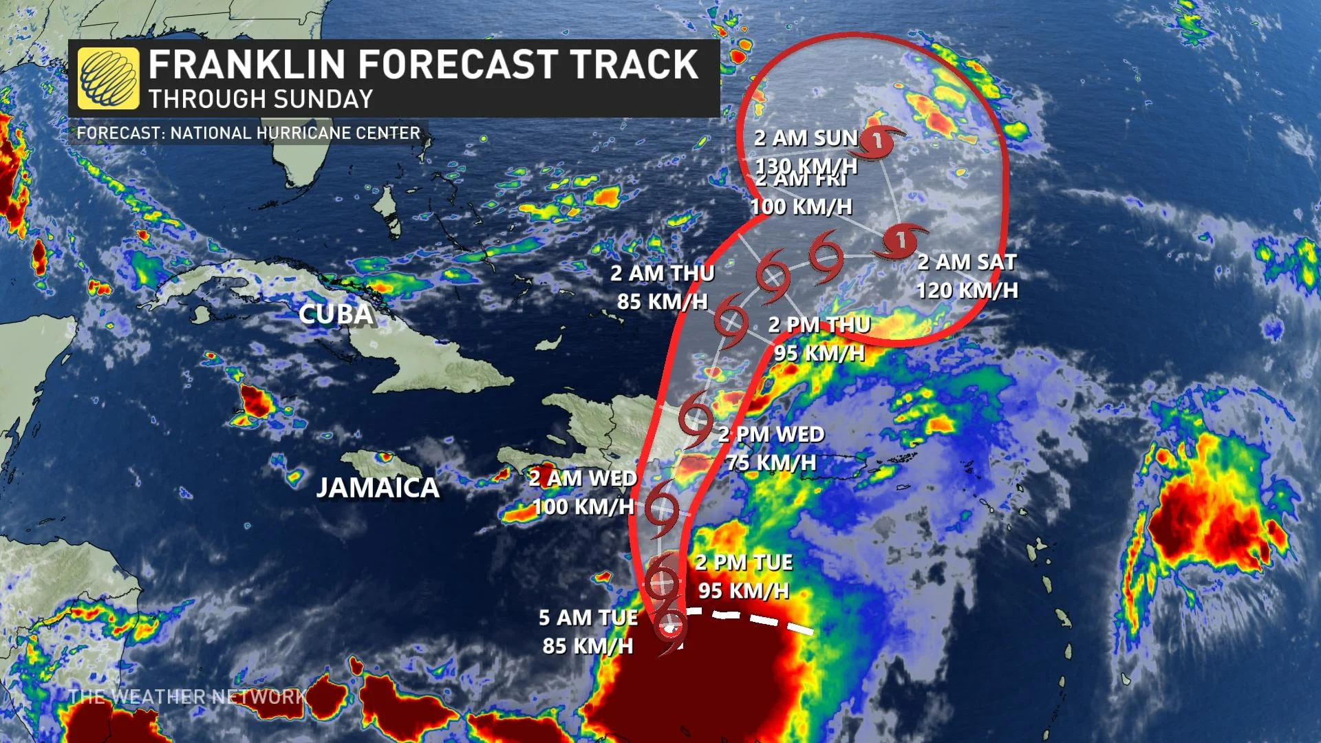
Franklin formed as a tropical storm at 5 p.m. on Sunday, still drifting slowly with little to no change in its intensity. As of Monday morning, it was located about 415 km south of Santo Domingo of the Dominican Republic, with maximum sustained winds of 85 km/h.
On the forecast track, the centre of Franklin is forecast to reach the southern coast of Hispaniola on Wednesday, traverse the island and move off of the northern coast on Thursday.
Franklin is expected to produce rainfall amounts of 50 to 100 mm, with isolated higher amounts of 150 mm across Puerto Rico and Vieques into Thursday. Across portions of Hispaniola, rainfall amounts of 125 to 250 mm are forecast, with isolated higher amounts upwards of 350 mm expected through Wednesday.
A storm surge will also raise water levels by as much as 1 to 3 feet above ground level along the immediate coast near and to the east of where the centre makes landfall in Hispaniola, the U.S. National Hurricane Centre (NHC) warns.
RELATED: Four tropical cyclones form as the peak of the Atlantic hurricane season hits
Canadian impacts?
While still far too early to have confidence in any specifics, Franklin could have some impact on the East Coast of the U.S. or Canada over the coming days. The storm’s progress is being monitored closely by the CHC for impacts.
Harold
Tropical Storm Harold made landfall on Padre Island, Texas on Tuesday morning, with warnings in place across the region. Harold is moving toward the west-northwest near 33 km/h, and this motion is expected to continue, taking the system inland over southern Texas and northern Mexico into Wednesday.
Harold is expected to produce rainfall amounts of 50 to 100+ mm, with isolated higher amounts of 175 mm, across South Texas through early Wednesday.
WEATHER HISTORY: The 2020 Atlantic hurricane season broke an 1893 record with 4 simultaneous storms
Across Mexico, rainfall amounts of 100 to 150 mm are forecast, with local amounts of 250 mm possible across portions of northern Coahuila and northern Nuevo Leon.
In both regions, scattered instances of flash flooding will be possible.
"The combination of a storm surge and the tide will cause normally dry areas near the coast to be flooded by rising waters moving inland from the shoreline," the NHC warns.
Large swells will affect portions of southern Texas through Tuesday as well.
"These swells are likely to cause life-threatening surf and rip current conditions," says the NHC.
Steady weakening is forecast, and Harold is expected to become a tropical depression later Tuesday.
MUST SEE: Heat, hurricanes, haboobs—deserts are a hotbed of extreme weather
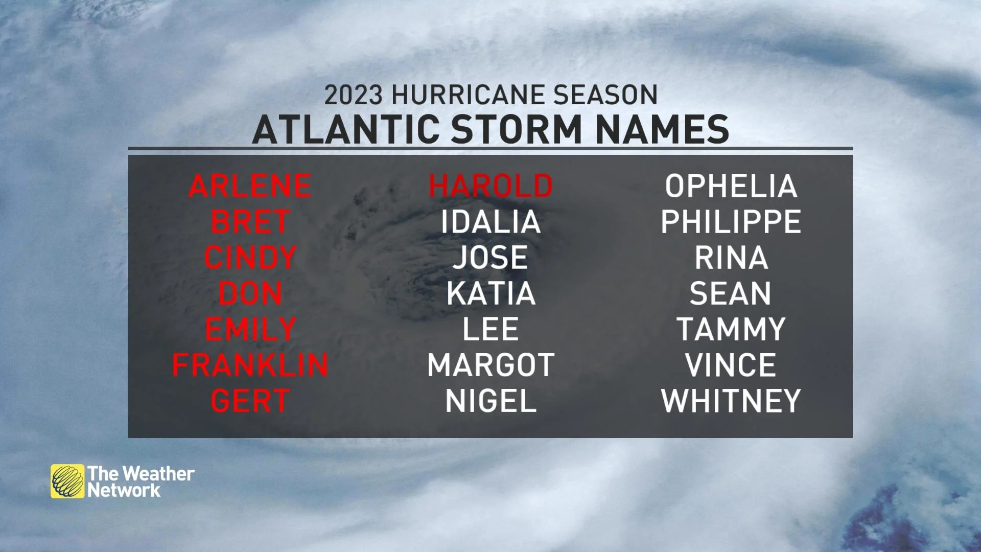
These latest developments come less than two weeks after the National Oceanic and Atmospheric Administration's (NOAA) Climate Prediction Center raised its prediction for the 2023 season from a near-normal level of activity to above normal.


