Vancouver sets all-time dew point record, heat nearing its end in B.C.
British Columbia’s South Coast isn’t supposed to feel as soupy as Florida, but the recent heat wave cranked up the mugginess to unprecedented levels.
Vancouver didn’t move to Florida, but you’d be forgiven for thinking that you’re in a tropical destination after stepping outside along British Columbia’s South Coast over the past few days. A brutally long stretch of high heat and humidity is finally coming to an end after bringing historic feels-like values and an impressive streak of excessively high daytime temperatures.
DON’T MISS: The heat is on across Canada, but will it persist through August?
Steamy Vancouver sets all-time dew point record
The humidity in Vancouver is no joke these days.
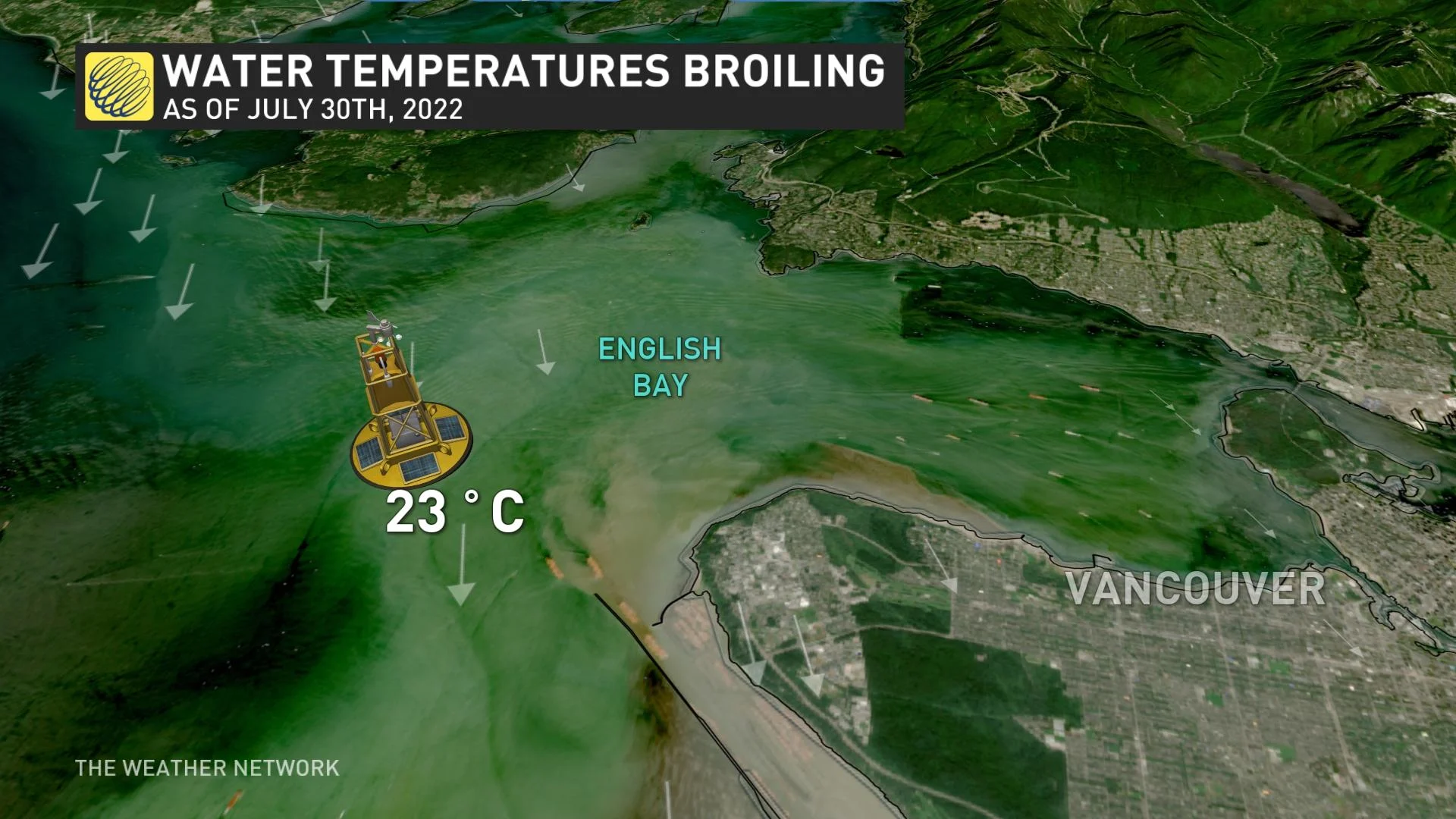
The city recorded a dew point temperature of 23°C on Friday, which set an all-time record for mugginess in this typically temperate city.
Higher dew points indicate higher moisture levels in the air. Dew points below 10°C are generally dry and comfortable, while things start feeling sticky when the dew point climbs above 15°C.
Anything higher than 20°C is pretty humid, and Vancouver’s dew point of 23°C is typical of what you’d expect in a place like Texas or Alabama this time of year.
In fact, Friday’s dew point in Vancouver came in higher than the city’s seasonal high temperature of 22°C for the date—an especially rare feat.
Warmer-than-usual waters are contributing to the elevated humidity levels across the South Coast. Water temperatures off Vancouver have come in at 23°C over the past couple of days, with northwesterly winds helping to blow that warmth and humidity inland.
Communities across southern B.C. stew in long-duration heat
Historically high humidity isn’t the only strange happening in B.C.’s latest heat wave.
The sheer duration of the heat is impressive by all accounts. While the unprecedented heat event in 2021 broke all-time records, this year’s heat event will be remembered for its unrelenting, day-after-day grip on the province.
MUST SEE: ‘Epic’ disaster: an inside look at this week’s catastrophic floods
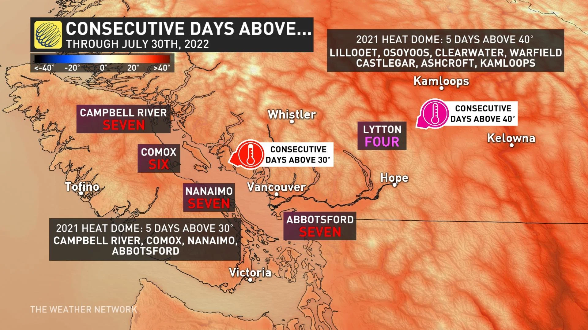
Many communities along the South Coast have seen at least six consecutive days of high temperatures at 30°C or warmer as of July 30, 2022. The heat is worse farther inland, where Lytton has seen four consecutive days of highs at 40°C or warmer. That’s a brutal stretch even for folks acclimated to such extreme temperatures.
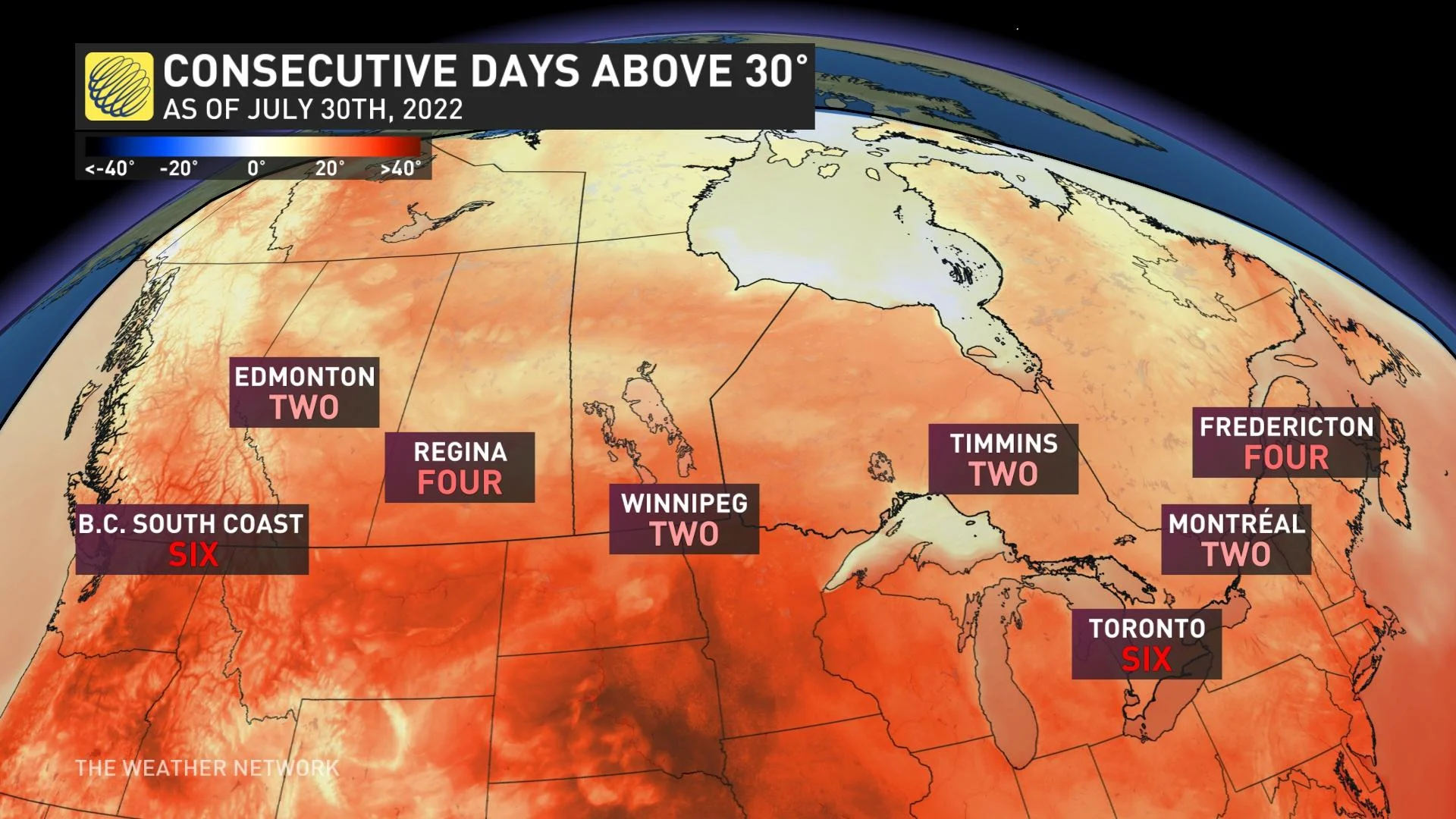
British Columbia’s long-duration heat wave stands out even more compared to other parts of Canada. Six consecutive days of temperatures 30°C or warmer is a longer streak than Regina or Montreal, and on par with Toronto as of July 30th.
Heat breaks Monday
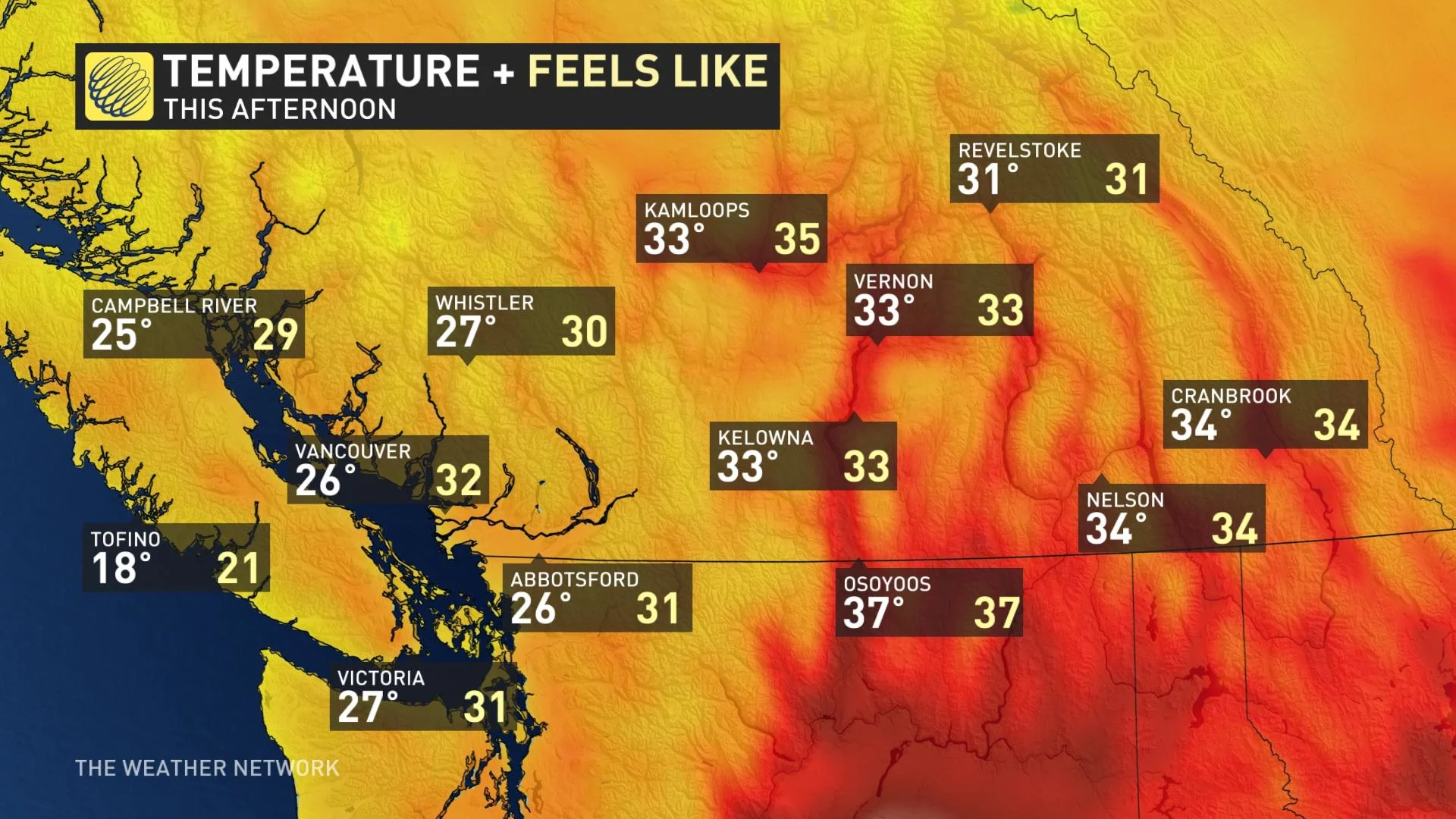
Heat warnings will continue to slowly drop off as the heat dome slides out of B.C., putting an end to the prolonged heat event. Monday will feature much more comfortable temperatures for Vancouver Island and the Metro Vancouver area.
As well, although much of the thunderstorm activity will be focused across Alberta Monday, parts of central and northwestern B.C. may also pick up some active weather. There is the risk of hail and locally heavy downpours within the storms.
A trough of cooler air will settle in across the region early this week, bringing the chance of on-and-off showers.
Stay tuned to The Weather Network for the latest conditions across British Columbia.


