Winds turn on the lake-effect machine in Ontario after storm's departure
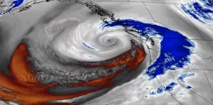
After a powerful winter storm brought blizzard-like conditions and thundersnow to Ontario, lingering winds will turn on the lake-effect machine to bring even more of the white stuff to the province this weekend
The rare thundersnow forecast verified Friday evening across southern Ontario. Lightning was reported in Windsor, London, Brantford, Burlington, Hamilton, and downtown Toronto.
What a show it was. The storm was quite disruptive, making for treacherous travel and cutting power to thousands. Flight delays and cancellations were reported at Toronto-area airports. Localized wind damage also occurred. Lightning was even seen striking the CN Tower in downtown Toronto.
MUST-SEE PHOTOS: Thundersnow, blizzard-like conditions hit Ontario
Through 7 a.m. Saturday morning, this is how much snowfall was reported across some select cities: London saw 7 cm, Hamilton received 4.4 cm, Toronto accumulated 5.2 cm, Owen Sound observed 12 cm and Ottawa documented 15 cm.

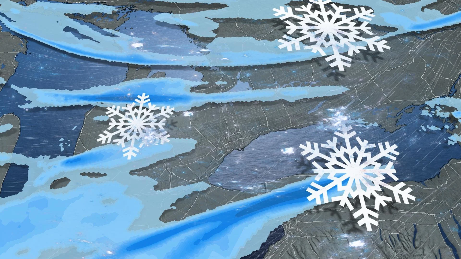
While the storm eases as Saturday morning progresses, we're not done with the snow in Ontario. For many, this will be the second act of the performance as strong winds will favour a multi-day, lake-effect setup in the snowbelt regions –– adding to the snow accumulations and dangerous travel already experienced.
RELATED: How Pearson Airport navigates tough winter weather
Arctic air switches on the lake-effect snow
As the low-pressure system lifts north, the concern shifts to the lake-effect snow, blowing snow, reduced visibility and damaging winds.
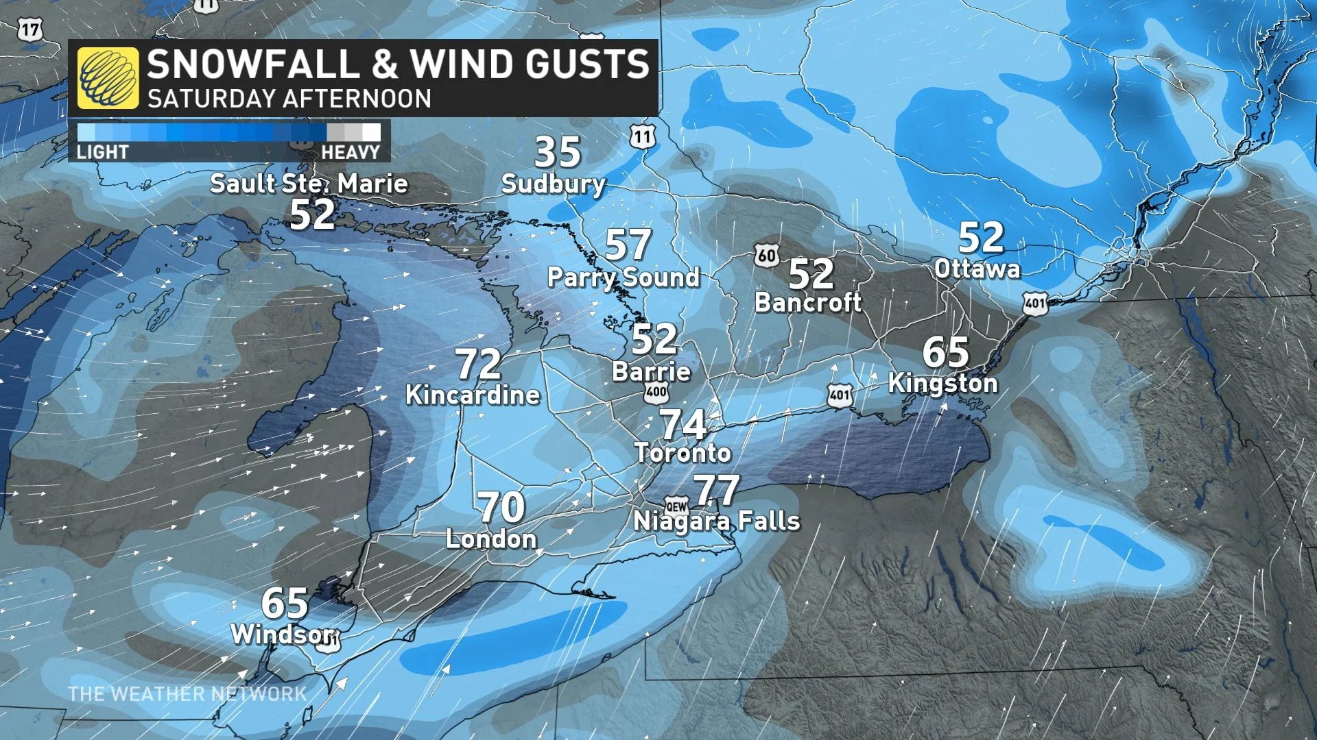
As the bursts of snow continue to move through southern Ontario, strong wind gusts of 60-90 km/h will create whiteout conditions. These bursts of snow can appear very quickly so it is best to be extra vigilant on the road.
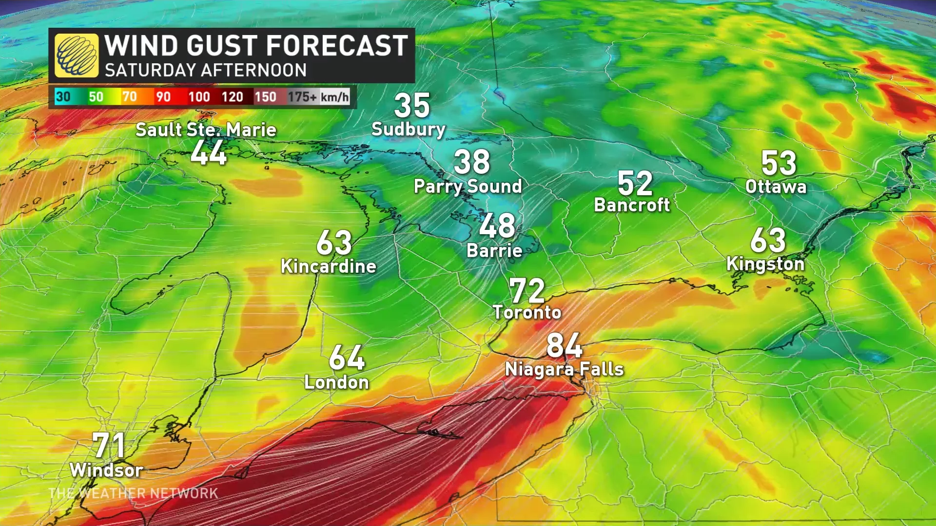
Along the Lake Huron, Lake Erie, Lake Ontario, and Georgian Bay lake shores, it is possible for wind gusts to be 90-100+ km/h.
STAY SAFE: Be aware of your heart while shovelling heavy snow
There will be some improvements for southwestern Ontario and the Greater Toronto Area (GTA) as it’ll just be bursts of snow to move through the region, but closer to the typical snowbelts, very poor conditions will continue through Saturday and for the coming days.
WATCH: More snow targets southern Ontario with lake-effect bands
The strongest wind gusts are forecast along the shores of Lake Erie, as a favourable wind direction parallels the lake, creating wind gusts over 100 km/h. Whiteouts and blizzard conditions are likely, so travel is strongly discouraged if you’re on the northern shoreline of Lake Erie.
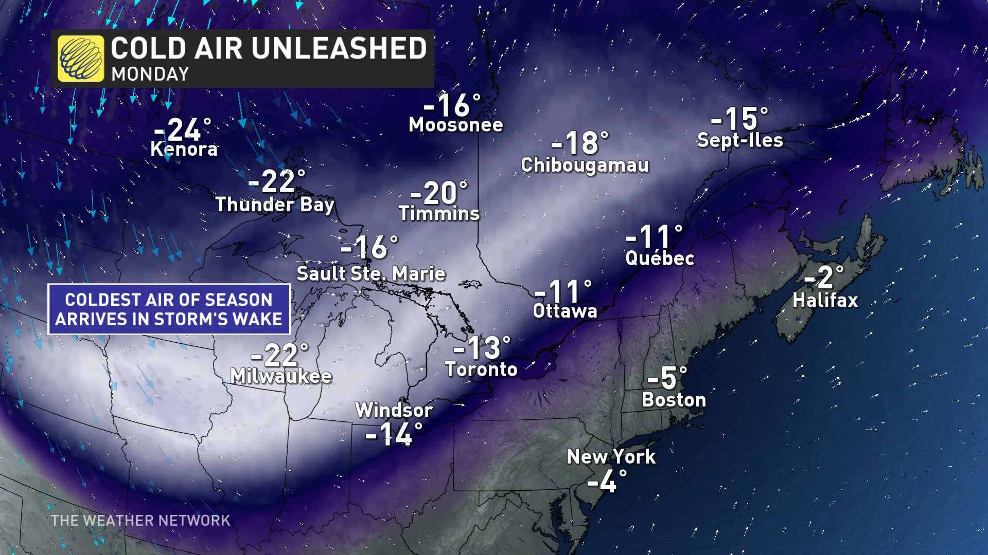
Colder air will flood into the region and set up a multi-day, lake-effect setup for the typical snowbelts.
Northwesterly winds late Saturday will develop lake-effect bands for the Saugeen Shores, Wasaga Beach, Barrie and surrounding areas.
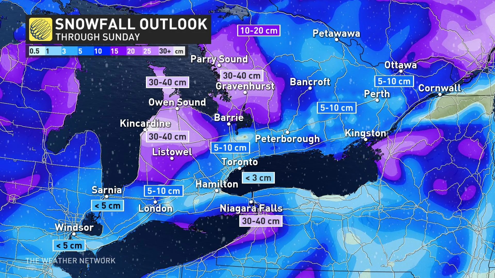
Into Sunday and Monday, westerly winds will cause lake-effect snow to pile up for the Bruce Peninsula and areas east of Georgian Bay like Parry Sound, Huntsville, Bracebridge, and Gravenhurst.
The multi-day snowfall total will vary, but the highest snowfall totals could approach 40 cm.
The aforementioned lake-effect off of Lake Erie lifts northward out of the U.S. overnight into Sunday morning, greeting and impacting the Niagara Peninsula. We can expect over 20 cm of snowfall across this band.
Stay with The Weather Network for the latest on this high-impact storm across Ontario.


