El Niño is a distant memory; will Canada feel winter's wrath?
El Niño is now a distant memory, which will allow for a more 'traditional' winter to show up this year. Here's what to expect for the 2024-25 winter season across Canada.
Last winter featured the warmest winter on record for Canada, with warmer-than-normal temperatures from coast to coast. Given the trend towards milder winters, it would be easy to assume that Canada will get off easy again this winter.
However, there are critical differences in the current global pattern compared to last year, and that will have a significant impact on the upcoming winter for at least parts of Canada.
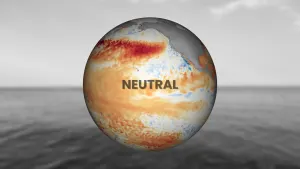
This time last year we were in the midst of one of the strongest El Niño events on record.
Strong El Niño events are notorious for bringing mild winters to Canada, and that was a critical contributor to our record-breaking lack of winter weather last year.
El Niño is now a distant memory, and that will allow winter to show up this year, and we think that winter will attempt to redeem its reputation.
SEE ALSO: Meteorological winter starts on December 1. Why? Because it's science!
National overview
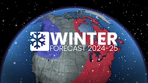
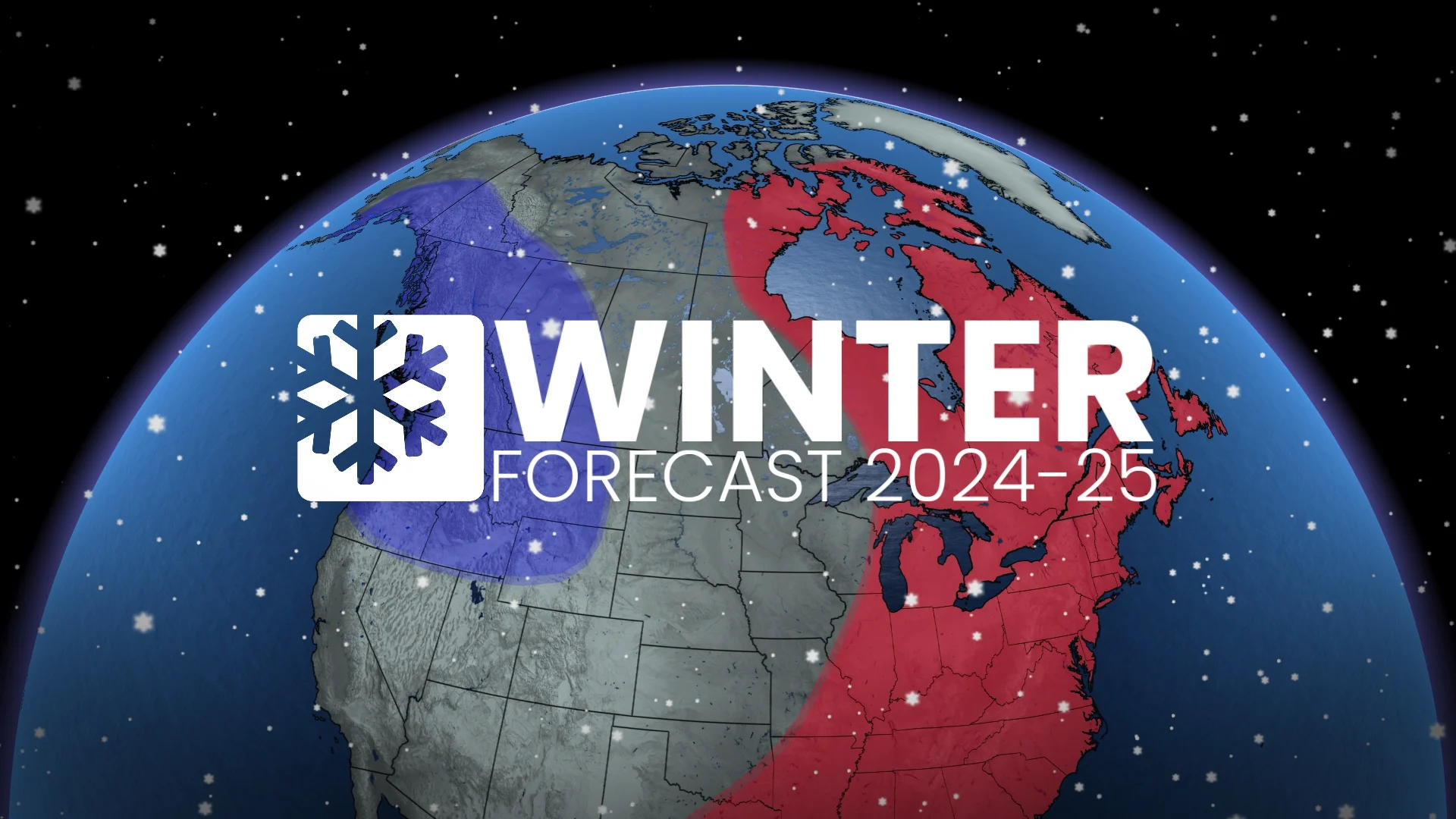
The focus of winter's fury will be in western Canada, where near-normal and colder-than-normal temperatures are expected to dominate this upcoming season.
Meanwhile, eastern Canada will also have periods of cold weather, particularly in December; however, periods of milder weather are expected in January and February, resulting in above-normal temperatures for the season overall, although not as warm as last winter.

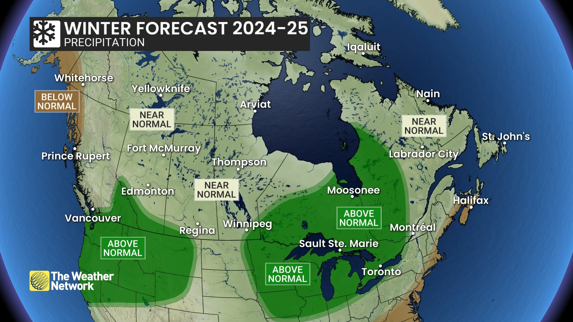
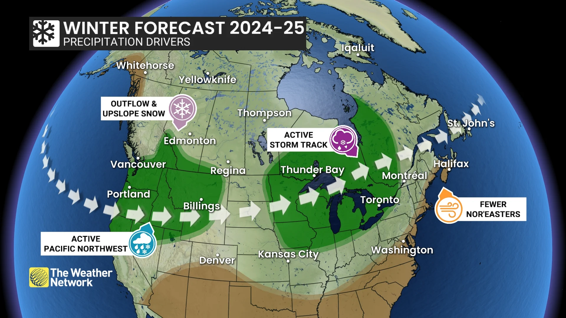
We also expect a more active pattern this winter with near-normal or above-normal precipitation across most of Canada.
The two exceptions are the north coast of B.C. and also southern parts of the Maritimes. Both of these regions will still experience numerous winter storms, but not quite as many as what we see in a typical winter.
DON'T MISS: What exactly makes for a 'white Christmas'?
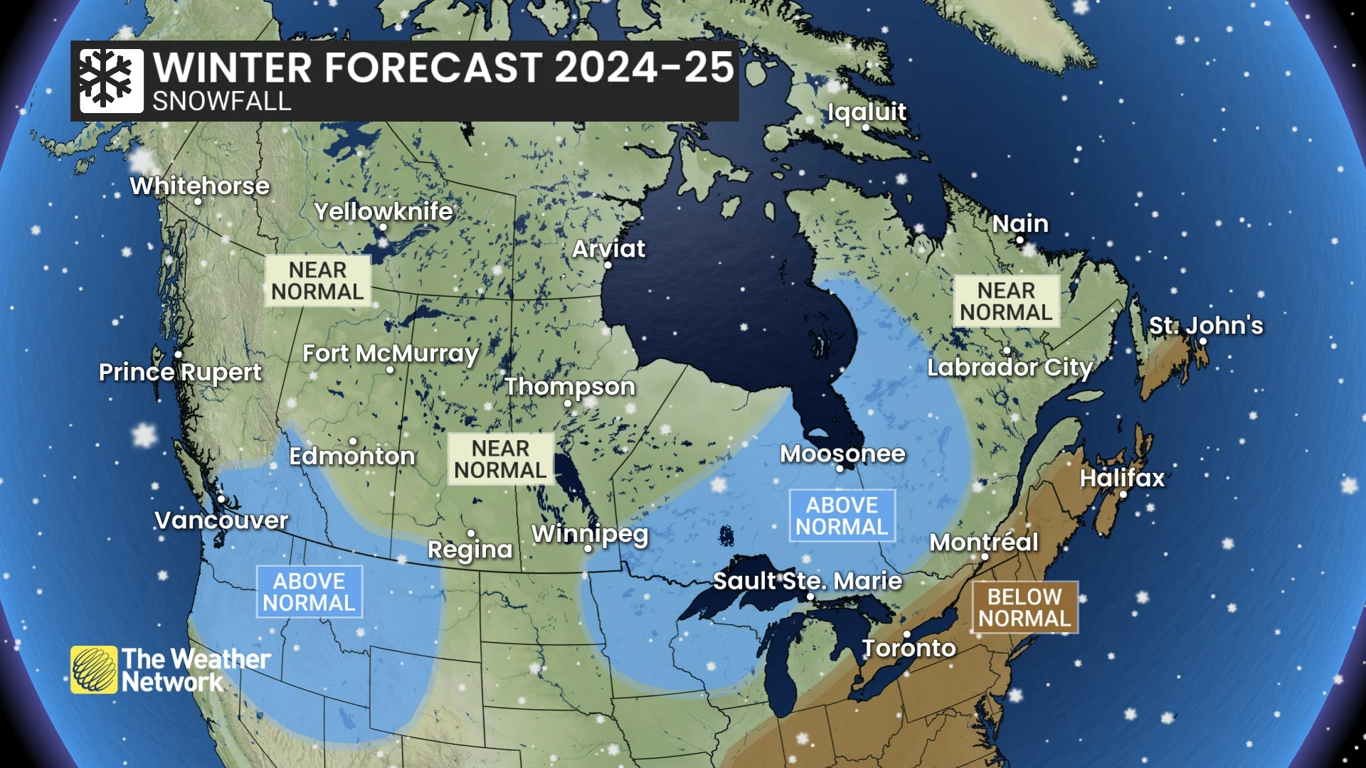
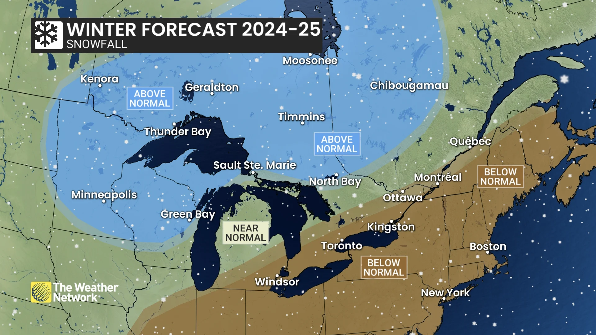
Our winter snowfall forecast resembles our precipitation forecast, but there are critical differences.
Across southern Ontario, southern Quebec, and much of Atlantic Canada, milder temperatures will increase the threat for rain and ice at times rather than pure snow events. This should result in below-normal snow totals despite the active pattern.
SEE ALSO: What’s the snowiest month in your corner of Canada?
However, the close proximity of above-normal vs. below-normal snowfall highlights a major bust potential to the forecast in this region. If the storm track shifts further south than expected, that would completely change how this season is remembered. Much of this region can still be milder than normal and yet just cold enough for heavy snow during the heart of the winter season.
Below is a more detailed look at what we can expect across the country during the upcoming winter season.
British Columbia
A cold winter is expected across the province, with a heightened risk for periods of severe cold for the B.C. Peace region and arctic outflow events for the south coast region. However, the frigid pattern will relax at times, especially during December.
An active storm track should also bring above-normal snowfall to southern parts of the province, including Vancouver, Victoria, and Kelowna. Much of the south and central coast should see near-normal rain totals with a lower than normal risk for Pineapple Express events. Below-normal precipitation is expected for the north coast region.
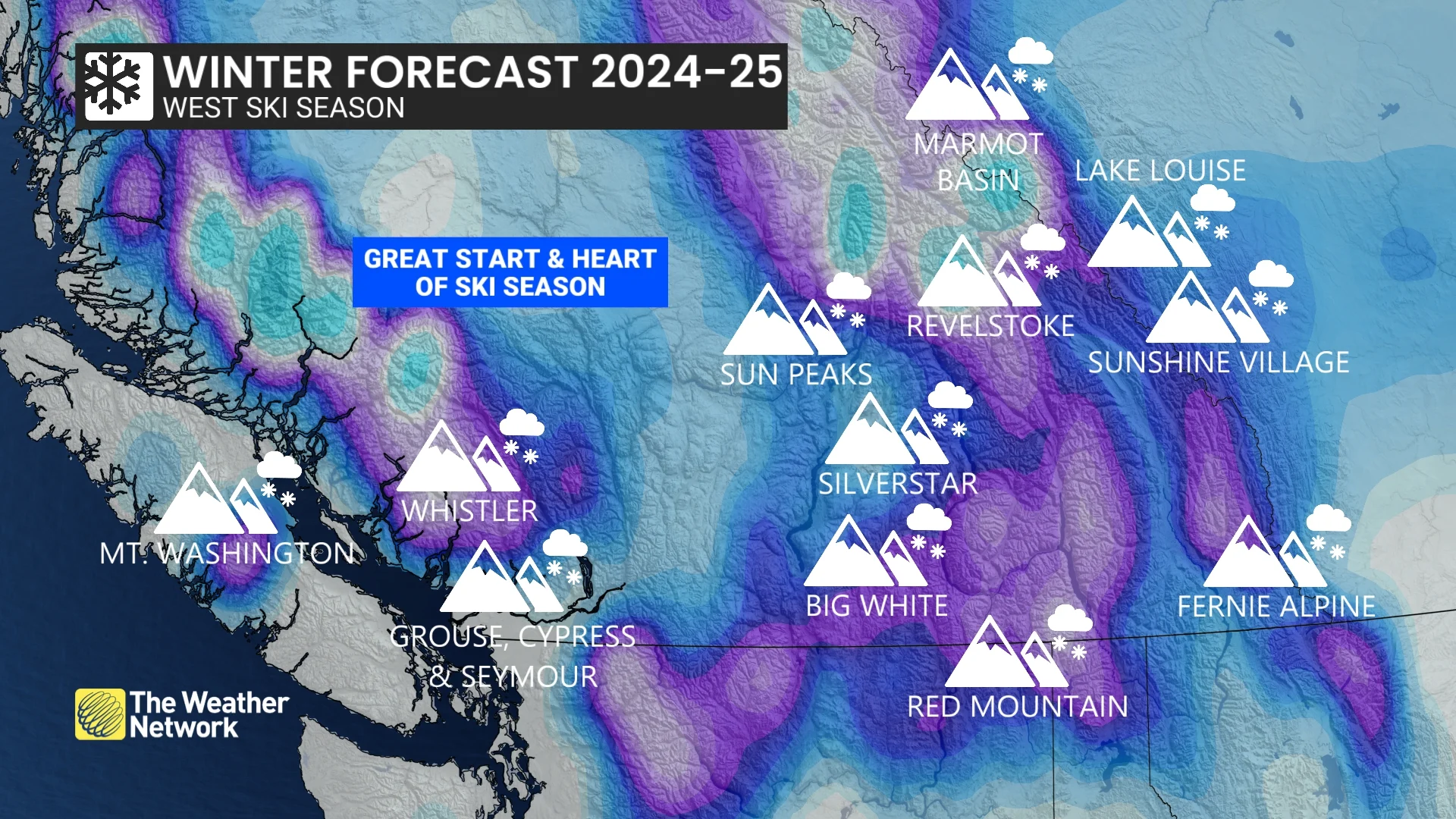
However, above-normal snow totals are expected to extend into some areas with near-normal precipitation totals. The colder temperatures should result in less rain and more pure snow events, even across lower elevations.
A solid ski season is expected, including a strong start to the season, especially compared to last year. Snow totals in the alpine regions are not expected to be exceptional, but fewer rain events in the alpine regions should help to preserve the snow that does fall across the region, and colder temperatures will allow for more snowmaking opportunities.
WATCH: B.C.'s ski season should look very different this year
Alberta
A colder winter is expected across the province, including Edmonton and Calgary. Near-normal or colder-than-normal temperatures are expected to dominate most of the season with a heightened risk for periods of severe cold.
Near-normal snowfall is expected across most of the region, but above-normal snow totals are expected across parts of southern Alberta. This should bring a much more widespread white Christmas compared to last year when many places had a very rare brown Christmas. However, travel will be a bigger concern this winter compared to last year with the typical risk for blizzard conditions at times.
Above-average snowfall is also expected in the southern Rockies and foothills, with a strong ski season expected.
WATCH: Arctic air could bring some serious snow to the Prairies
Saskatchewan and Manitoba
A much colder winter is expected across the region compared to last year. Near-normal temperatures are forecast for the season as a whole across the region, including Saskatoon, Regina, Brandon, and Winnipeg. This will include the typical risk for periods of severe cold, but the cold pattern will relax at times.
Near-normal snowfall is expected across most of the region, but above-normal snow totals are expected across southeastern Manitoba. Travel will be a bigger concern this winter compared to last year with a heightened risk for blizzard conditions at times.
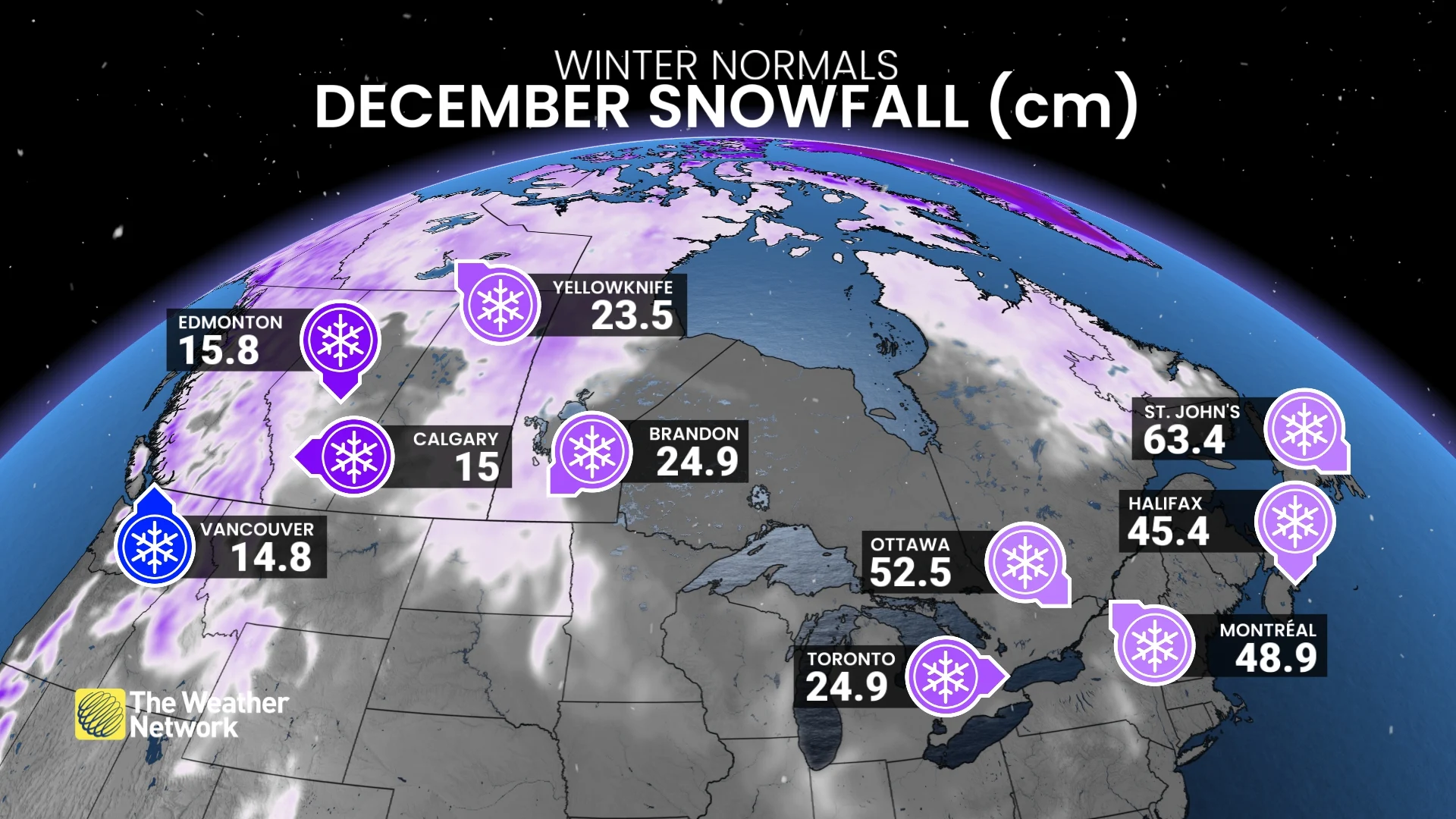
Typically, residents of this region are almost guaranteed a white Christmas, but many places had minimal snow on the ground for Christmas last year. This year should bring a return to typically very high odds for a white Christmas.
Ontario
After a very mild fall, December will feature an abrupt transition to colder weather with much more wintry conditions leading up to the holidays than we have seen in recent years. This will allow for a much better start to the ski season due to lake effect snow and more opportunities to make snow.
However, as we get deeper into the winter season, we expect more of a come-and-go winter pattern during January and February with periods of mild weather outduelling the periods of colder weather.
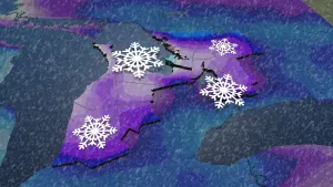
A snowy winter is expected across northern Ontario, including Timmins and Thunder Bay, due to an active storm track into the Great Lakes region, but southern areas, including London, Toronto, and Ottawa, will often see messy storms with a changeover to ice and rain and the potential for extended thaws. As a result, we expect below-normal snow totals across southern Ontario.
RELATED: Why the Great Lakes produce some of the world’s heaviest snow
However, that does not rule out the potential for a major snowstorm, and we should see significantly more snow than last winter (that won’t be hard to do). Also, if the storm track ends up being just slightly further south than expected, that would completely change how this season is remembered across southern parts of the province with much higher snow totals.
WATCH: Potential for big snow events in Ontario
Quebec
A come-and-go winter is expected with periods of mild weather outduelling the periods of colder weather, especially during January and February.
However, December will bring an abrupt transition to colder weather, and we expect more wintry weather leading up to the holidays than we have seen in recent years. This will allow ski areas, which are currently running behind schedule, to see substantial improvements during the first few weeks of December.
A snowy winter is expected across western Quebec and into central Quebec, and near-normal snow totals are expected for eastern Quebec. However, southern parts of the province, including Montreal, will often see messy storms with a changeover to ice and rain at times. As a result, we expect below-normal snow totals for areas near and south of the St. Lawrence.
However, high-impact snowstorms are still probable across this region, and if the storm track verifies further south than expected, that would completely change how this season is remembered with much higher snow totals.
WATCH: Mild temperatures won't stop the snow in Quebec
Nova Scotia, New Brunswick & P.E.I.
A changeable winter season is expected across the region, including Halifax, Fredericton, and Charlottetown. Traditional winter weather will show up at times, but stretches of milder weather are expected to outduel the colder periods, especially during January and February.
Below-normal snowfall is expected with fewer than normal nor’easters. This region will still experience its share of high-impact winter storms, but the dominant storm track is expected to be further north than what we typically see. This will allow very mild air from the Atlantic to surge north into the region at times.
Therefore, the Maritimes will see fewer pure snowstorms. Many storms bring a messy mix of snow, ice, and rain, especially across Nova Scotia and near the Bay of Fundy. Many areas will struggle to maintain consistent snow cover due to the periods of milder temperatures and rain.
WATCH: Is winter cancelled for the East?
Newfoundland & Labrador
A relatively mild winter is expected across the province, including St. John’s, Gander, and Corner Brook. Traditional winter weather will show up at times, but stretches of milder weather are expected to outduel the colder periods, especially during January and February.
Below-normal snowfall is expected across central and southern parts of the province with fewer than normal nor’easters. Newfoundland and Labrador will still experience their share of high-impact winter storms, but the dominant storm track is expected to be further north than what we typically see. This will allow mild air from the Atlantic to surge north into the region at times.
As a result, fewer pure snowstorms are expected. Many storms bring a messy mix of snow, ice, and rain, and southern areas will struggle to maintain consistent snow cover due to occasional rain and periods of milder temperatures.
Northern Canada
Milder-than-normal temperatures are expected across eastern parts of the region, including Iqaluit. Meanwhile, colder-than-normal temperatures are expected for southern parts of the Yukon, including Whitehorse. In between, near-normal temperatures are expected for much of the NWT (including Yellowknife), northern Yukon, and western Nunavut. Near-normal snowfall is expected across most of the region.


