Autumn can still produce intense hurricanes across the Atlantic
Leaves are changing and the air is getting cooler, but don’t let your guard down yet if you live near the coast
It’s easy to forget about hurricanes when crisp air and pumpkin spice take over our world with fall’s arrival. But it’s far too early to let your guard down if you live near the coast.
Autumn has generated some of the Atlantic Ocean’s most intense and destructive hurricanes on record. The basin’s hurricane season runs through November 30, and we’ve seen powerful storms develop long after Canada’s Thanksgiving holiday.
DON’T MISS: A hurricane can explode in size after shedding its own eye
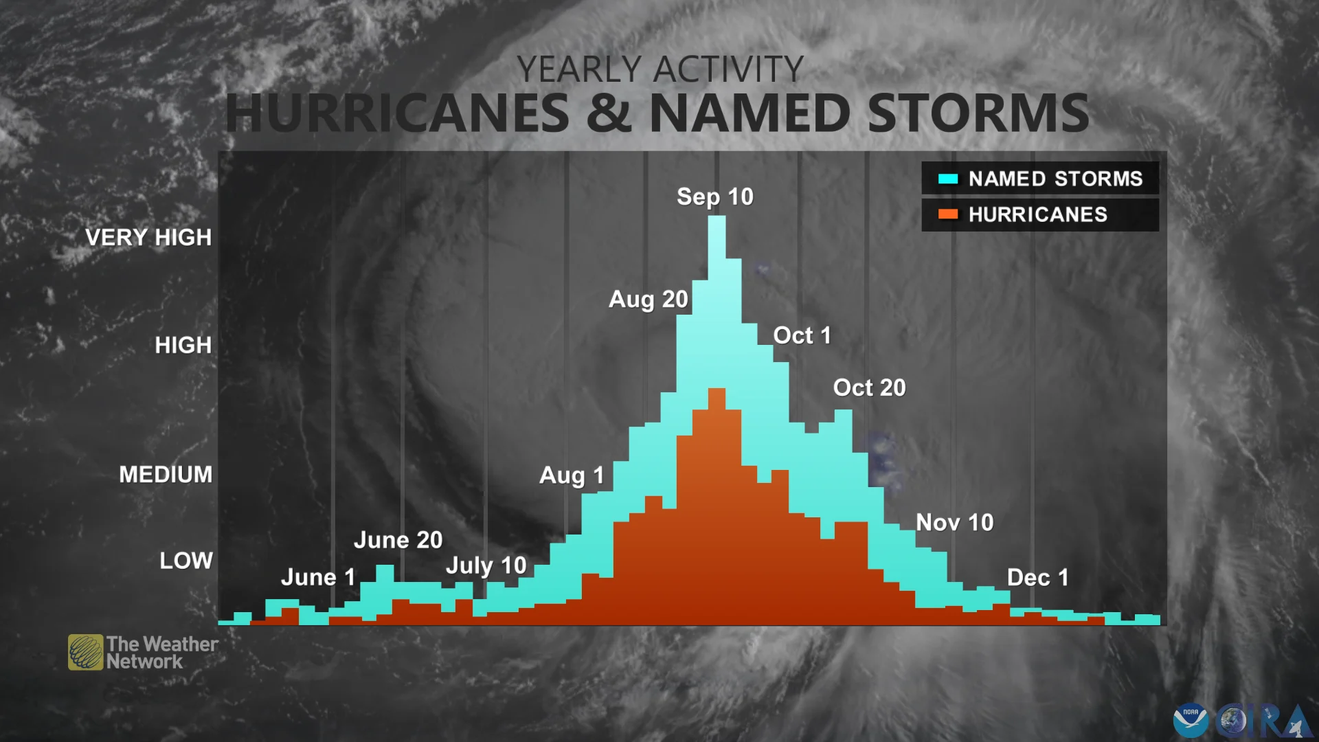
Hurricane season peaked on September 10
Even though we’re in the grips of a seasonal change here on land, the tropical Atlantic still feels and looks like summer. Hurricane season only peaked on September 10, and the heart of the season extends into the middle of October.
A key reason hurricane season pushes deep into the fall months is that water easily holds onto its heat. Sea surface temperatures remain toasty even as the air above cools off with the arrival of autumn.

One of the major changes in hurricane activity between the summer and fall is where hurricanes tend to form.
Summer storms usually originate with thunderstorms rolling off sub-Saharan Africa. We can watch these classic systems move across the Atlantic for as long as a week and a half before they threaten the U.S. or Canada.
Fall storms, on the other hand, tend to form much farther to the west. The decaying remnants of cold fronts are a frequent seed that spawn the development of tropical systems heading into October and November. These storms can intensify very quickly, and their proximity to land reduces the lead time for residents who need to prepare and get out of harm’s way.
Dozens of major storms have roared in autumn
Some of the worst hurricanes in recent memory occurred during the month of October.
Parts of Florida are still dealing with the devastation wrought by Hurricane Michael when it swirled ashore in the middle of October 2018. The storm reached Category 5 intensity before hitting the state’s Panhandle region with winds of 260 km/h.

MUST SEE: How a mammoth hurricane rapidly intensifies in mere hours
Hurricane Sandy grew into one of the largest storms ever recorded when it roared into the U.S. East Coast in late October 2012. The storm evolved into something of a supercharged nor’easter as it made landfall. More than 100 people died as a result of Sandy’s flooding and winds, and the storm left behind tens of billions of dollars in damages.
The most intense hurricane ever observed in the Atlantic unfolded in the middle of October during the historic 2005 hurricane season. Hurricane Wilma intensified into a scale-topping Category 5 storm on October 19, registering a historic minimum central pressure of 882 mb.
Fall is especially dangerous in Central America
Fall hurricanes are especially dangerous for vacationers looking south to get away from the cool temperatures descending on Canada.

Some of the most devastating hurricanes to hit the Caribbean and Central America occurred in October and November. This list includes Hurricane Eta and Hurricane Iota, which both made landfall on nearly the same stretch of coast in Nicaragua within two weeks of one another in November 2020.
Hurricane Otto struck near the border between Nicaragua and Costa Rica in late-November 2016, bringing extensive wind and flood damage to the region.
The second-deadliest hurricane ever witnessed in the Atlantic basin was Hurricane Mitch, a strong storm that moved very slowly near landfall in Honduras around Halloween 1998. The storm and its destructive floods killed more than 11,000 people throughout Central America.
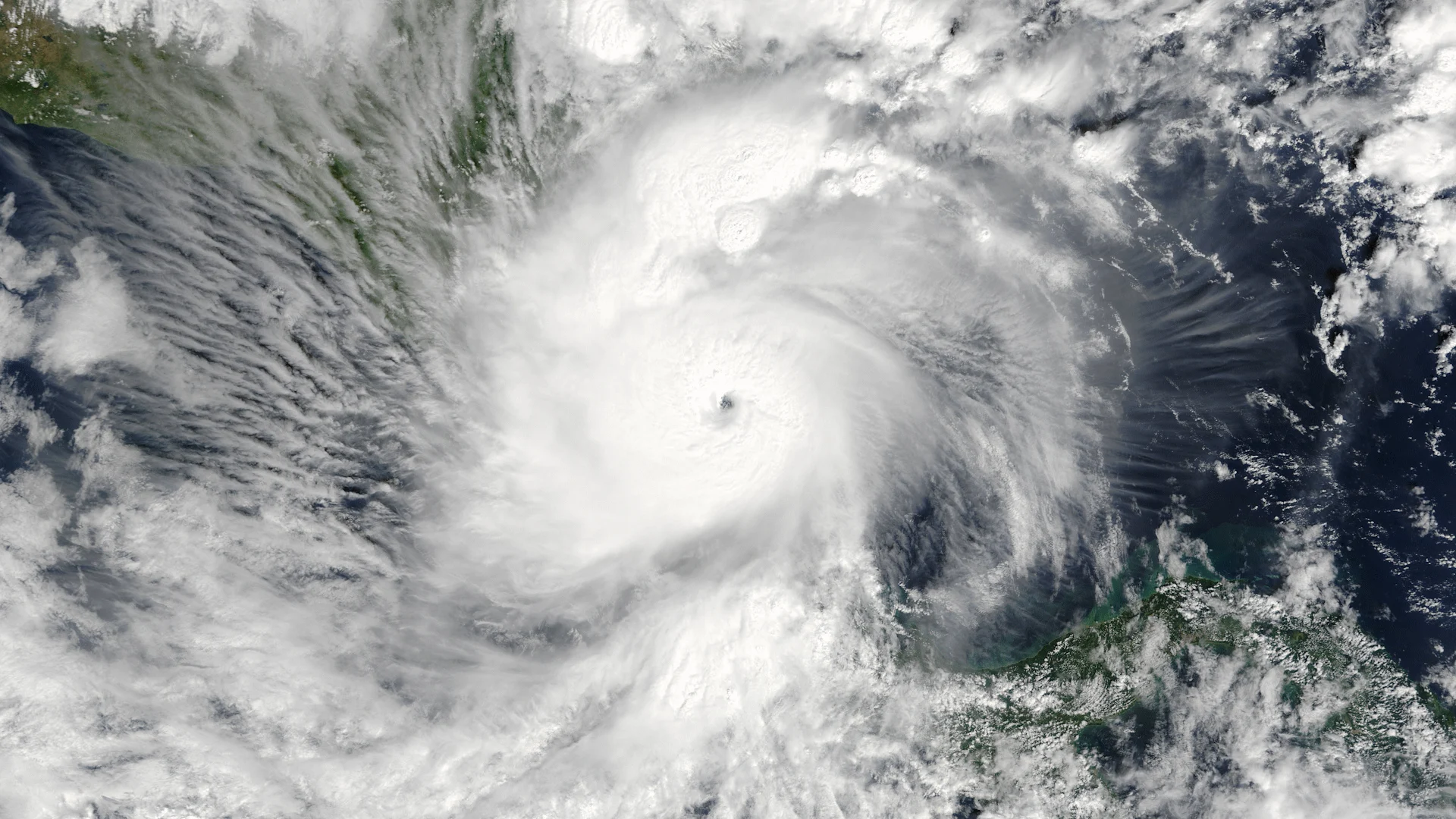
Header image of 2016's Hurricane Otto courtesy of NOAA.


