Will winter redeem its reputation? A sneak peek at winter 2024-25

After a historically mild winter last year, here's what we can potentially expect for this upcoming winter season in Canada
Canada got off exceptionally easy last winter with much warmer than normal temperatures across the country. Can we expect a repeat this winter?
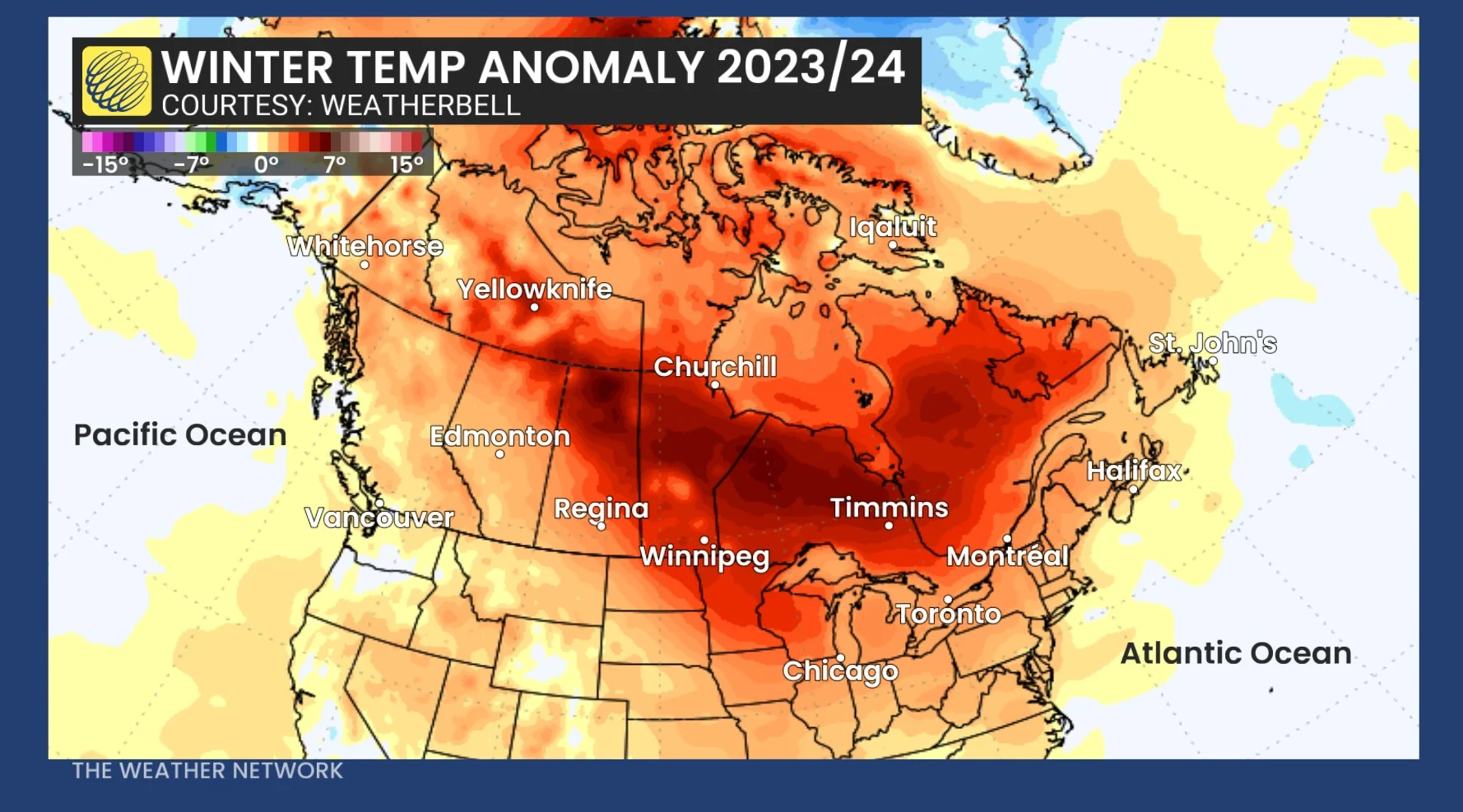
Just to refresh our memories before we tackle that question, last winter was the warmest winter on record for many towns and cities and also for the country as a whole!
The various shades of orange and red on the map below highlight the warmer than normal temperatures that were so widespread across North America during the three-month period of December, January, and February.
SEE ALSO: When should you switch to winter tires? Provincial breakdown, here
Given the tendency towards milder winters, it would be easy to assume that the upcoming winter will continue to follow that trend.
However, there are some critical differences in the global pattern compared to last year. This will likely have a significant impact on the upcoming winter for at least parts of Canada.
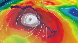
Each winter, one of the key influences on the dominant jet stream pattern for the season is ocean water temperatures in the tropical Pacific. This time last year we were heading into one of the strongest El Niño events on record. This is highlighted by the warmer than normal ocean water temperatures in the black rectangle to the west of South America on the map below.
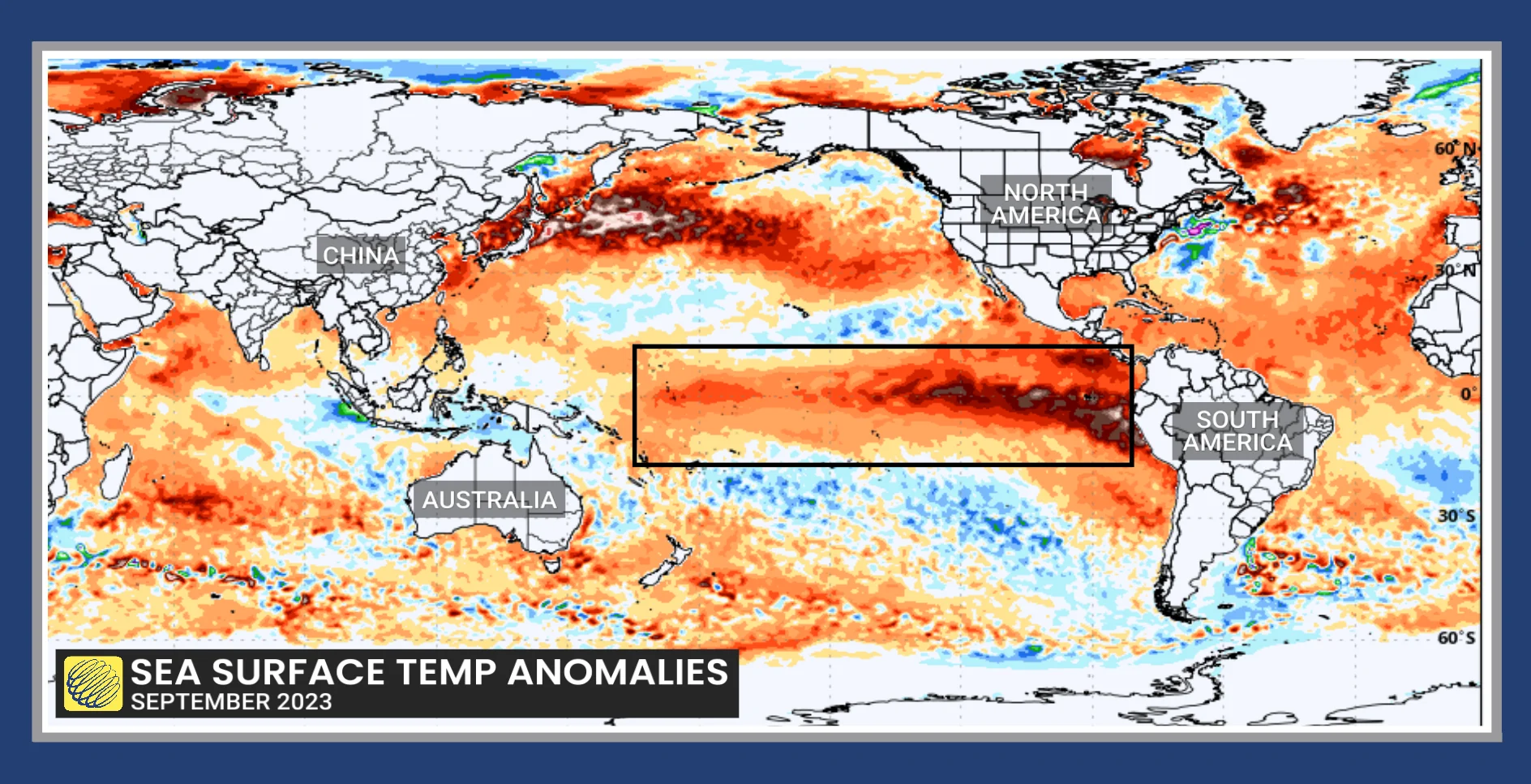
Sea surface temperature anomalies for September 2023.
Winters that feature a strong El Niño event are notorious for bringing very mild temperatures to most of Canada. So, while last winter was exceptional, it was also expected due to the El Niño event.
DON'T MISS: The Weather Network's El Niño and La Niña hub
However, when we look at current conditions, we can readily see that ocean water temperatures are now cooler than normal in that same region. This is the signature of a developing La Niña (which is the opposite of El Niño).
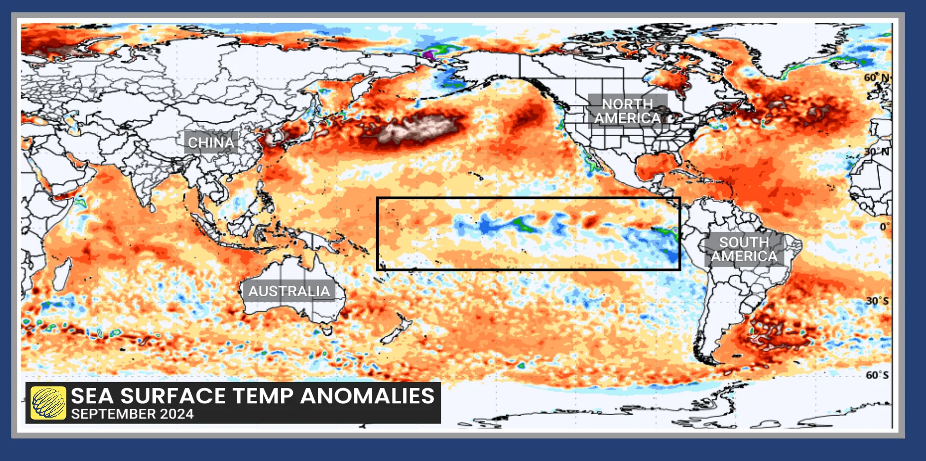
Sea surface temperature anomalies for September 2024.
So, what does that mean for the upcoming winter?
While there is consistency to how a strong El Niño event typically impacts Canadian winters, the effects of La Niña are a lot more variable.
Recently, we had three consecutive La Niña winters during 2020-21, 2021-22, and 2022-23. Each year, winter showed up in a big way for at least part of the season. However, the location and duration of the coldest weather were highly variable from year to year.
Currently, the La Niña conditions are still rather weak. When we look back in history at years that had similar (weak La Niña) conditions, there is actually a surprising consistency to how winter started during those years.
In most cases, winter got off to a strong start during the month of December, and in some of those years, colder than normal temperatures started as early as November.
This is a look at how winter has typically started during weak La Niña events:
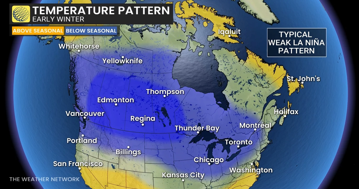
So, is that our forecast for how winter will start this year? Given that cold Decembers have become rather rare during recent decades, we think that it is unlikely that a cold pattern will be as widespread as the above map shows. Also, the focus of the coldest weather could be displaced further east (or west) from what the map shows.
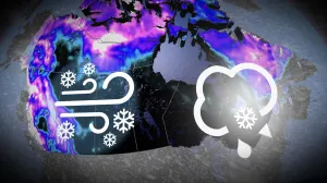
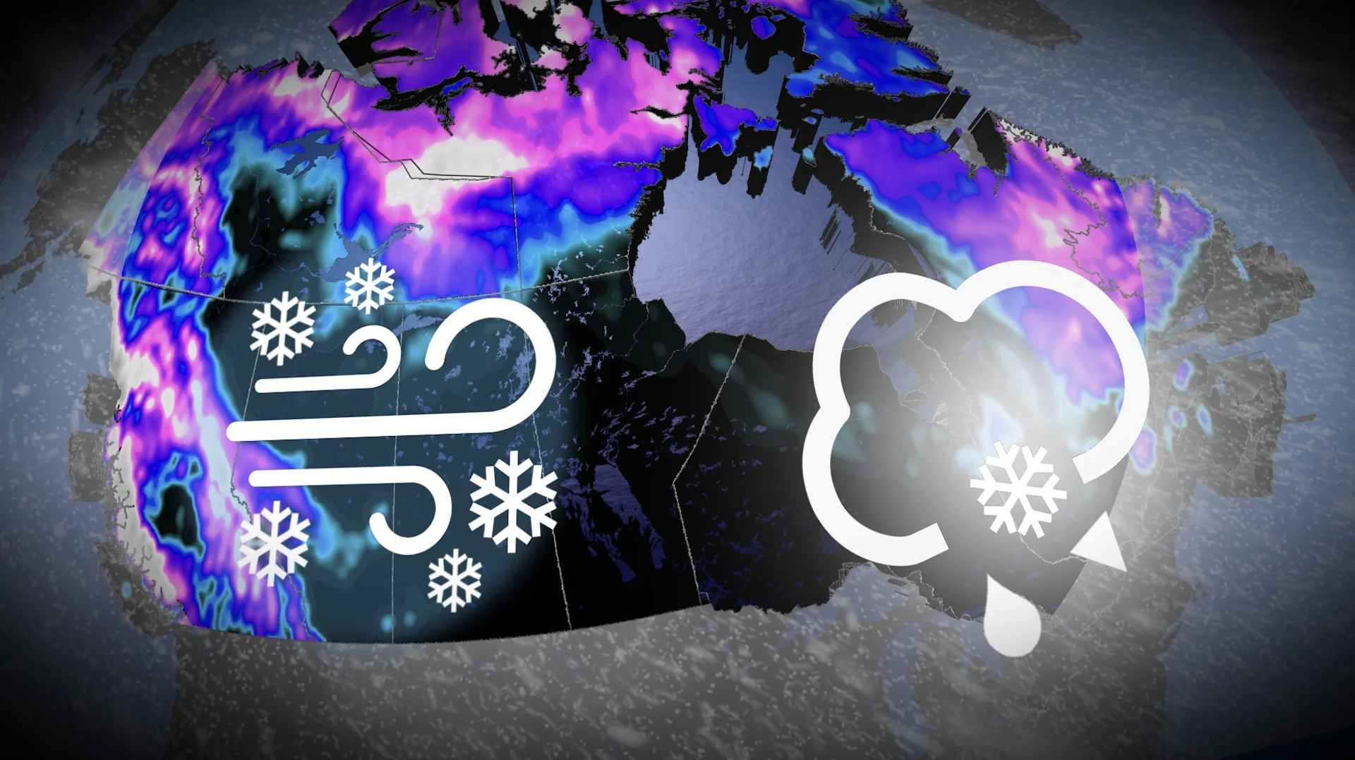
However, we do think that winter really will show up for December this year. While it is much too early to predict who will see a white Christmas, the weeks leading up to Christmas and New Years should be much more wintry than last year and more wintry than many other Decembers in recent memory. That would be great news for ski areas across Canada.
WATCH: A deeper dive into the winter sneak peek
Will this pattern continue to hold for the rest of the winter?
As we look back at the winters that had weak La Niña conditions, there is a dramatic contrast in how those winters continued to evolve during January and February.
During many of those winters, a much milder pattern developed across central and eastern Canada, with above-seasonal temperatures dominating during the rest of the winter. Only western Canada continued to see colder than normal temperatures. That is one possible scenario for this winter.
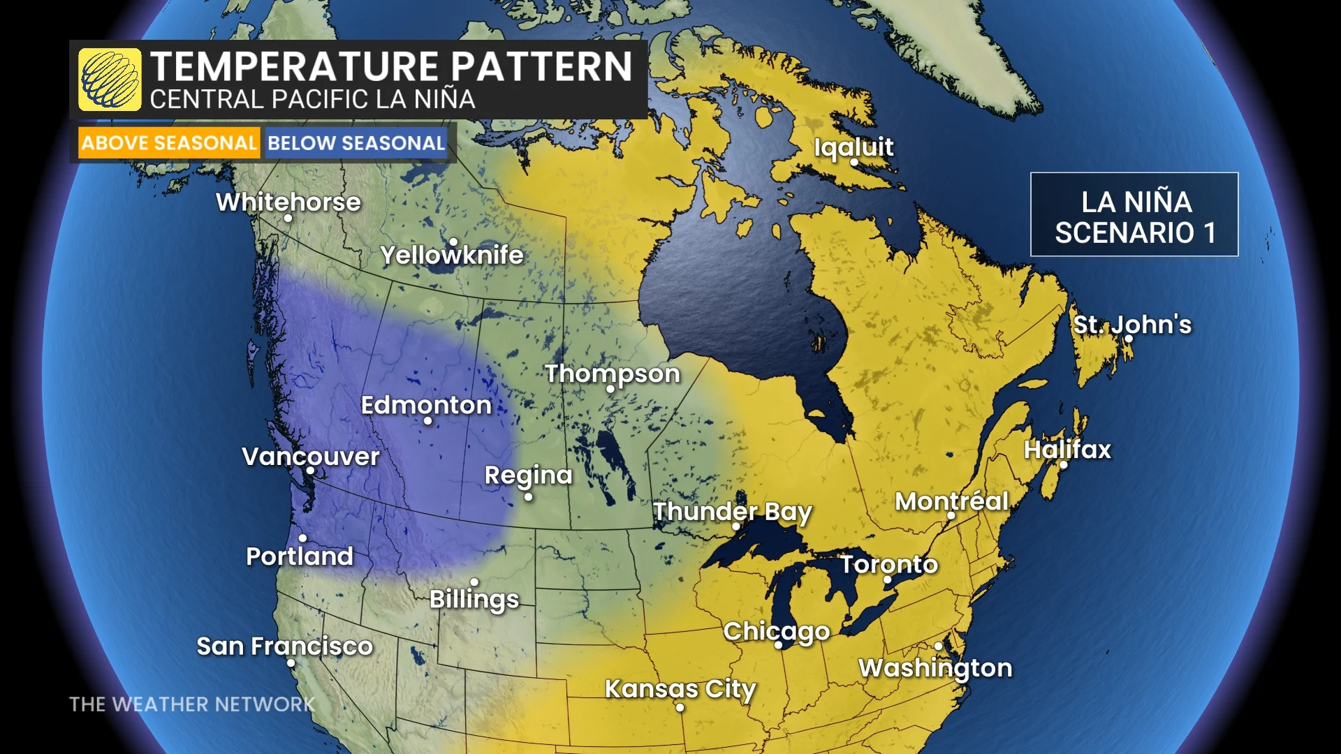
This is one possible scenario for January and February.
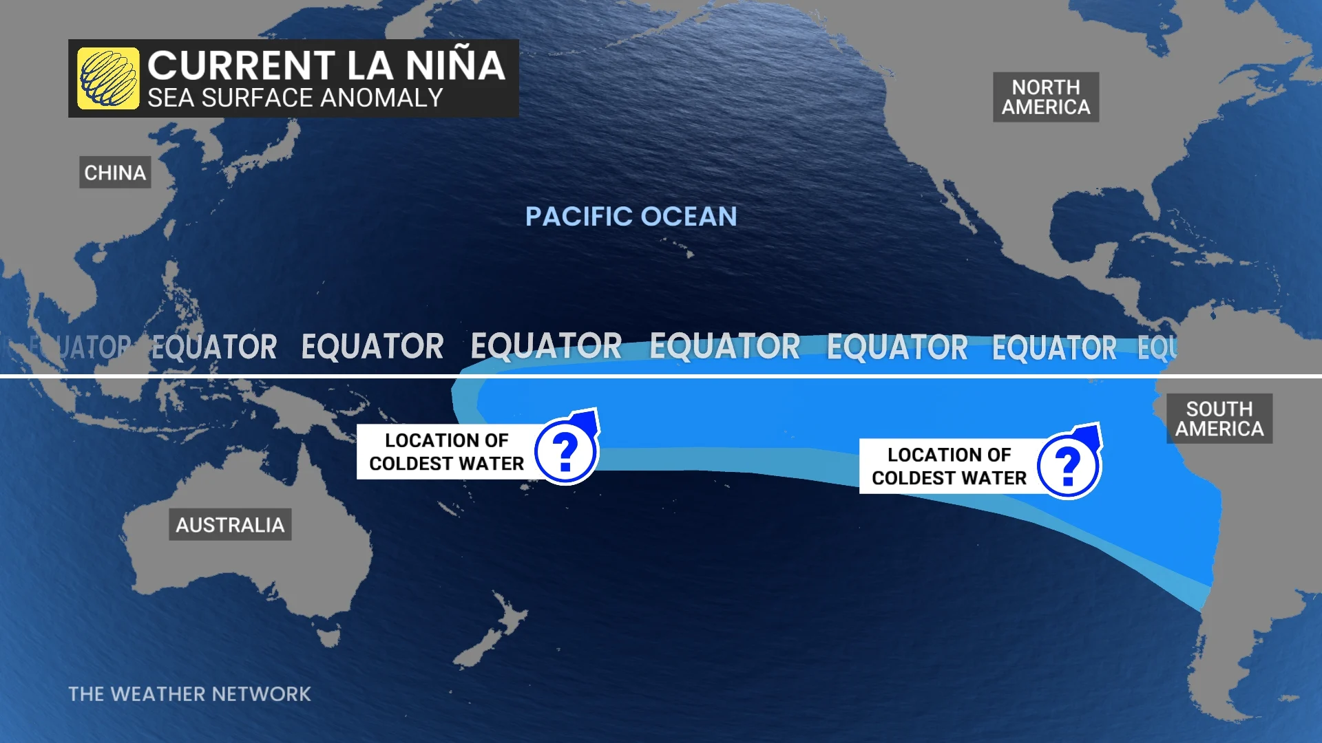
During these winters, the coolest ocean water temperatures associated with La Niña were found across the central Pacific (towards the International Dateline).
However, when we look at winters in which the coolest water associated with the developing La Niña was found in the eastern part of the tropical Pacific (this is the area just to the west of South America), we ended up with a very different pattern. Typically near-normal temperatures or colder than normal temperatures continued to dominate through February across most of Canada.
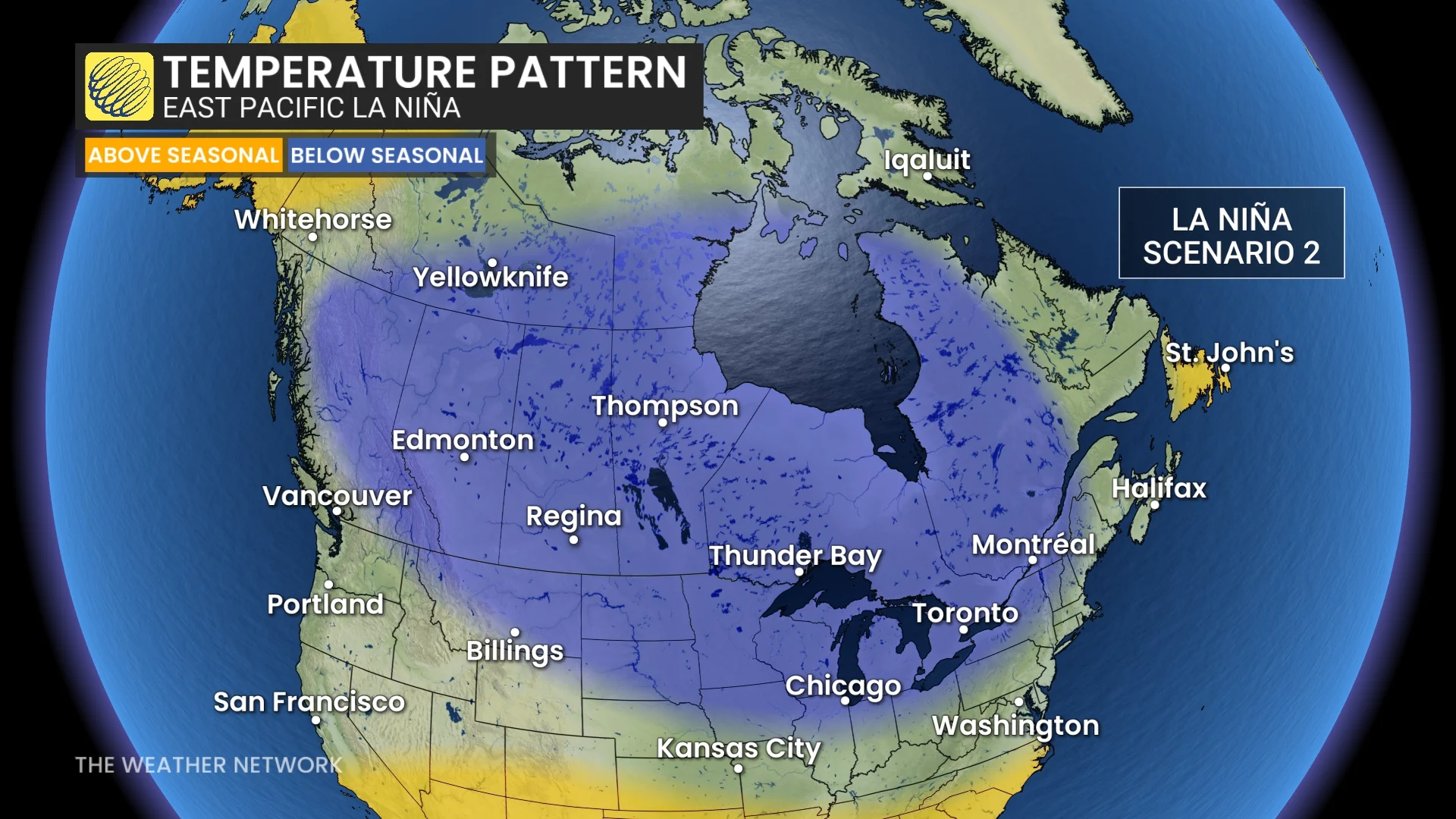
This is another possible scenario for January and February.
So, the key consideration as we finalize our official 2024-25 winter forecast, set to be released on November 27, will be figuring out whether this winter will feature a central Pacific-based La Niña or an eastern Pacific-based La Niña.
At this point there is evidence that the upcoming season could be a hybrid event—not fully a central Pacific-based La Niña event, but not a true eastern Pacific La Niña event either. Therefore, we could see alternating periods that resemble both scenarios.
While it is possible the upcoming winter will resemble last winter in your community, we do not expect that Canada as a whole will rival last winter for the warmest winter on record. For at least parts of Canada, winter will show up and attempt to salvage its reputation.
Please check back on theweathernetwork.com on November 27th for the release of our official 2024-25 Winter Forecast!