Why fall storms fascinate forecasters and storm chasers
Fall storms are fascinating as they epitomize the classic 'temperate cyclone' that meteorologists love to forecast and storm chasers love to capture.
What I love about Ontario is that we get everything thrown at us (weather-wise). In the summer it’s tornadoes; in the spring it’s ice storms and thunderstorms; in the winter it’s blizzards and snow squalls. And, in the fall,... well, fall storms. Not the most imaginative term, but it works. But why would that excite the storm chaser in me?
Fall storms are fascinating to me as they epitomize the classic “temperate cyclone” that meteorologists love to forecast. It’s kind of at the heart of our forecasting training, and they can involve all forms of weather found on the continent: thunderstorms, tornadoes, ice storms, and blizzards. And, as an added bonus, hurricane-force winds near the heart of the storm.
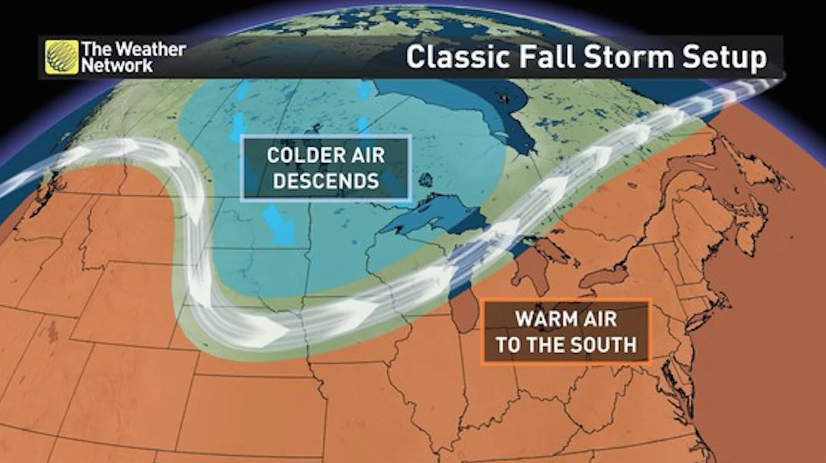
Natural forces attempting to balance heat across the planet generate weather. In fall storms, that imbalance is especially strong near the centre of North America. As the planet wobbles on its axis, the amount of direct sunlight on North America changes; more direct sunlight, higher temperatures = summer. Less sunlight, more indirect sunlight = winter. In fall (and spring), the continent is undergoing a shift from one extreme season (winter and summer) to the other.
RELATED: What does a classic fall storm look like in your part of Canada?
Things get complicated at this point, but to simplify, a temperate cyclone acts to pull cold air down from the north part of the continent (i.e. Canada) and pull warm, moist air up from the south. It’s this clash of two air masses that generates the energy that the storm feeds on. The greater the difference in air mass temperatures, the greater the energy generated. So, in the fall, with very cold air able to move far south clashing with very warm air moving north, the storms that are generated are supplied with a lot of energy.
Add in the significant moisture that can be drawn up from the Gulf of Mexico with the forming cyclone and the stage is set for what can sometimes be major precipitation events. This precip can come in all forms. In the north, as the warm, water-laden air feeds into the storm, the cold air can transform the rain into snow, sometimes dumping 30-40 cm across wide swaths of the US and Canada in one shot. Further south, the warm air fuels thunderstorms and even tornadoes, often right along the Gulf coast. At the changeover line of 0 degrees Celsius, freezing rain can develop and if there is enough moisture, massively damaging events can occur.

These storms are among the largest impact systems on the continent, hitting the Gulf Coast with thunderstorms while simultaneously hitting northern Ontario with a barrage of snow. And deep in the heart of them, the winds wrapping around the centre of the low can generate huge waves on the Great Lakes. They are the sort of system that I can chase in a lot of different ways and every storm I learn just a little more about how the atmosphere works.
And I get to see how fast the wind gets before I fall over.


