Australia’s all-time heat record in jeopardy as temperatures soar
Australia is no stranger to extreme heat—so it’s noteworthy when the country’s all-time high temperature record is at risk of falling
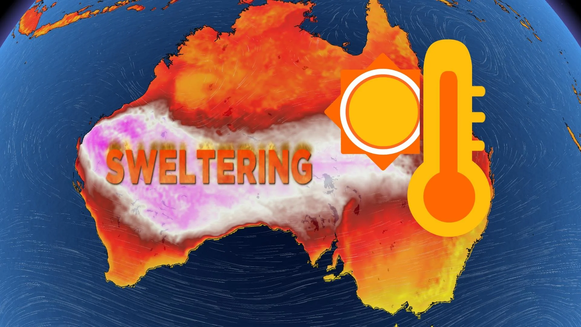
A brutal heat wave building over Australia could come perilously close to toppling the country’s all-time high temperature record—no small feat when the nation routinely broils beneath the hot summer sun.
The heat doesn’t get to stand alone. There’s also a stubborn tropical system lurking hundreds of kilometres inland, thriving on the warm, moist soils of northern Australia as if the land were the ocean itself.
DON’T MISS: After 2023's astounding new global heat record, 2024 may be even worse
Australia is no stranger to extreme weather
Australia’s rough and tumble reputation extends beyond its venomous spiders and carnivorous sea sponges.
The country’s immense size and position leaves it exposed to the entire spectrum of calamities—including terrible wildfires, powerful cyclones, and even Prairie-like severe thunderstorms.
This vast size can be hard to grasp given the country’s relative isolation. Australia stretches from the tropics to the mid-latitudes, a 3,600+ km north-south extent that’s roughly equal to the distance from Toronto to San Jose, Costa Rica.
SEE ALSO: Heat, hurricanes, haboobs—deserts are a hotbed of extreme weather
A flight from the western city of Perth to the eastern city of Brisbane is about the same distance covered by the five-hour flight from Vancouver to Atlanta, Georgia. Again: it’s huge.
And since much of the country lies beneath a strip of atmosphere where sinking air dominates, a solid majority of the country is covered by the rust-tinged desert sands of the Outback—the perfect environment to foster extreme heat.
Heat ridge sends temperatures soaring into the 40s
It’s the middle of summer in the southern hemisphere and the skies over Australia are bringing the heat. Making matters worse is a strong El Niño continuing in the eastern Pacific Ocean, which tends to foster hot summers on the other side of the ocean.

RELATED: Why extreme heat is one of the world’s deadliest weather disasters
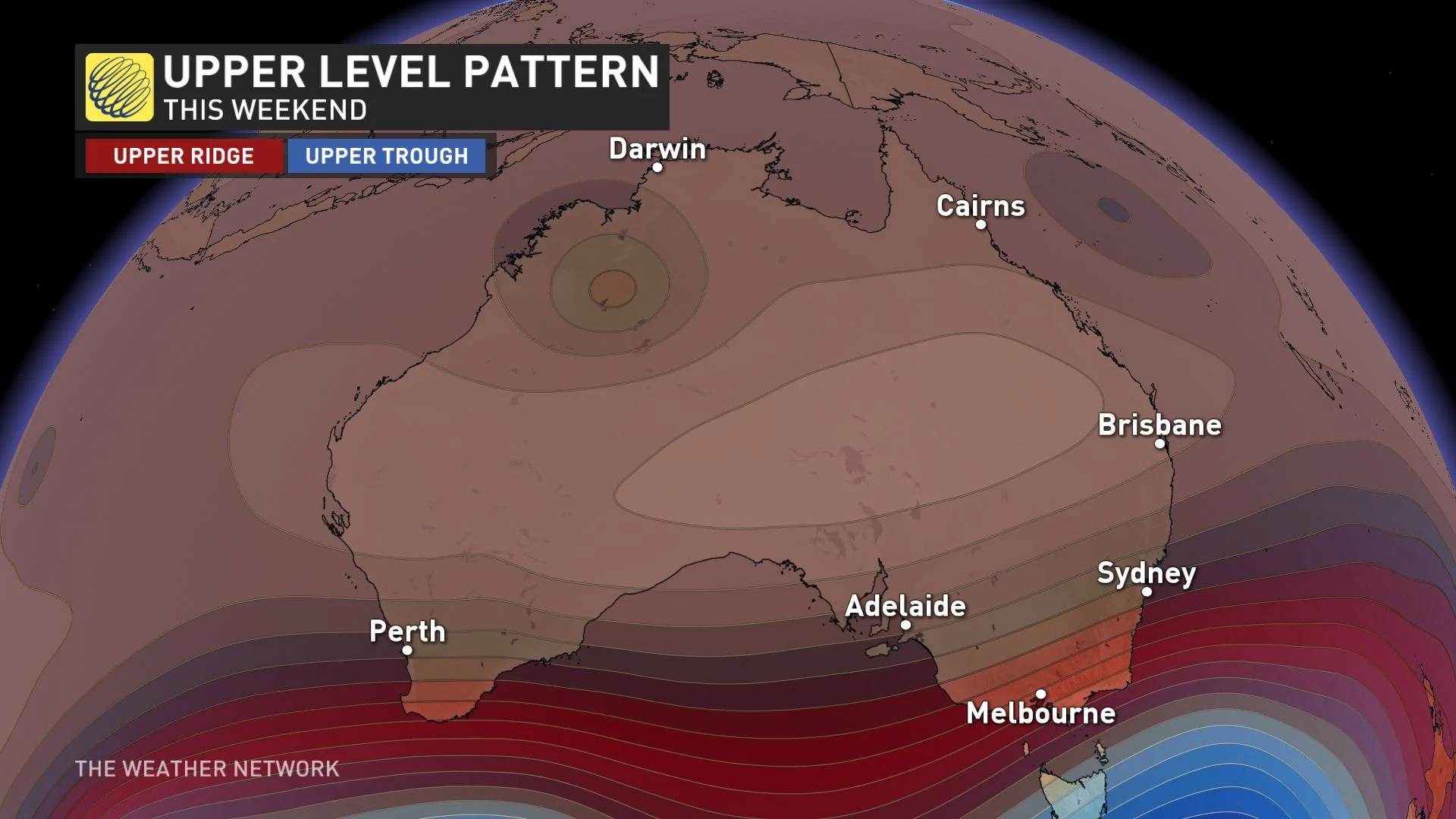
A powerful ridge rising in the atmosphere over the centre of Australia will force heat to build in abundance over the next week. This significant heat wave will send temperatures soaring into the 40s for hundreds of thousands of square kilometres of land.
This will be a long-duration heat event, to boot, with up to a week of 40-degree daytime highs possible for communities away from the ocean.

The highest temperatures are expected across the deserts of Western Australia, where temperatures could easily crack 45°C through the middle of next week.
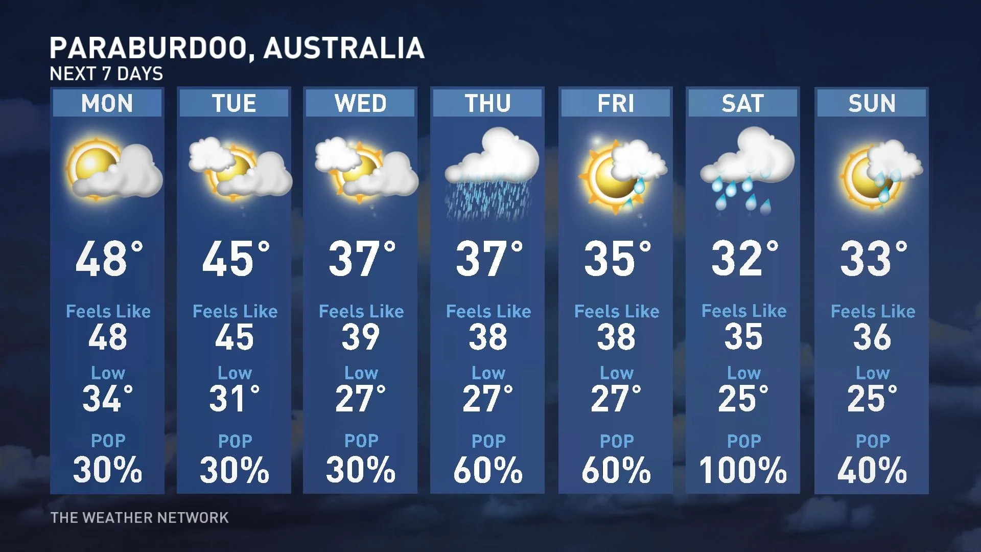
Folks in the rural town of Paraburdoo should see a high of 48°C on Monday, with nearby communities possibly coming awfully close to the 50-degree mark. Even though it’s mostly a dry heat, actual air temperatures that hot can lead to heat-related illnesses in short order.

If anyone closes in on 50°C, it could imperil Australia’s all-time high temperature of 50.7°C measured in the town of Onslow on January 22, 2022. Only one day back in 1960 saw a confirmed reading match that sizzling high-mercury mark.
Not only does a 50.7°C reading stand as Australia’s hottest-ever temperature, but it’s also the highest confirmed reading ever observed in the southern hemisphere.
A lively tropical disturbance adds to the curiosity
If a scale-topping heat wave isn’t enough excitement for one week, there are also a couple of tropical systems swirling around Australian waters.
A developing tropical cyclone could grow quite powerful in the days ahead as it swirls off the northeastern shores of Queensland.

MUST SEE: How hot water fuels the world’s most powerful hurricanes
There’s also a strange feature lurking around the edge of the building heat wave—which may bring a touch of heat relief to spots like Paraburdoo.
A feisty tropical disturbance over north-central Australia is thriving even though it’s far inland from the coast.
The unnamed disturbance has a distinct swirl on satellite imagery, complete with robust and persistent thunderstorm activity clustered around the centre of the storm.
Our system here is the equivalent of a tropical storm even though it’s been over land for days and it’ll remain over land for days to come. It’s likely a phenomenal example of the “brown ocean effect,” which occurs when warm, moist soils feed a tropical system its energy much the same way they’d draw power from warm ocean waters.


