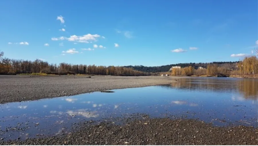
B.C. drought fears surge as rivers dry up

Image: The Nechako River in Prince George, showing the effects of drought. (Andrew Kurjata/CBC)
Extreme hot dry weather has left streams and rivers across the province running low and that's creating drought conditions more commonly seen in late July.
On June 12, temperature records for many places in B.C. were broken — with highs not seen in some spots in a century. Provincial drought monitors say this kind of weather is leaving many waterways at record-low flows, fuelling fears over everything from fire risks to salmon survival.
David Campbell who heads the River Forecast Centre for the province says seeing drought ratings this high in June raises obvious concerns for July and August.
'KIND OF SHOCKED'
"If this kind of weather persists, we are going to be in challenging situations as we get into the later part of the summer," said Campbell who urges people to start conserving now, especially in places that rely on local streams or rivers.
"That water is going to be gone later in the summer," he said.
In an average year, Campbell says the drought map of B.C. would be the colour green, the code for normal. But most of the province is a bright yellow, the code for dry. The northeast corner of the province or Fort Nelson zone and Vancouver Island is shaded ochre or orange for very dry. Only three zones remain green: Lower and Upper Columbia and the West Kootenay.

Image: The map of drought levels in B.C. already shows 3 zones as very dry (orange): East Vancouver Island, West Vancouver Island and Fort Nelson. Most of the rest of the province is colour-coded yellow, the rating for dry. (Province of BC)
Campbell says this is the fifth year of a pattern of drought that used to be something seen every 10 or 20 years.
RIVERS 'EXTREMELY LOW'
"I tend to be kind of shocked," he said. "All of the rivers across the province are extremely low for this time of year. We are coming into conditions that we haven't really seen at all — or certainly not that often."
Campbell says the statistics are being tallied again Thursday and the map will soon change, but he's not forecasting any more green for normal. He predicts it will be worse.
That's elevated concerns about already vulnerable salmon that need the tributaries to get into the rivers to spawn in late summer, when the drought is expected to be at its worst.
Chinook salmon returns to Duncan-area streams and rivers are watched closely by anglers and provincial officials. Federal fishing closures were introduced earlier this year to protect salmon, including a catch-and-release rule until mid-July on many parts of Vancouver Island.

Image: Volunteer Carsten Hunter rescues salmon fry from a pool of water left behind as Vancouver Island's Robertson River dries up. (Megan Thomas/CBC)
The Cowichan River and Lake Stewardship Society has already started a rescue operation for fry stranded in fast-desiccating rivers and creeks in the Cowichan watershed on Vancouver island.
On the wildfire front, tinder-dry crisp forest floors are already a hazard, and now with a potential lack of water, fire officials say homeowners are edgy.
"We are certainly worried about it and we are watching real close," said Doug Knott the fire chief in Lake Cowichan in an interview with CBC on forest fire risks.
He says he has noticed people now call fire officials at the first whiff of smoke.