B.C. bomb cyclone to create the world’s largest wave pool
The swells generated by the next B.C. storm will propagate thousands of kilometres, reaching as far as Hawaii and the western beaches of Mexico’s Baja Peninsula. Talk about impact.
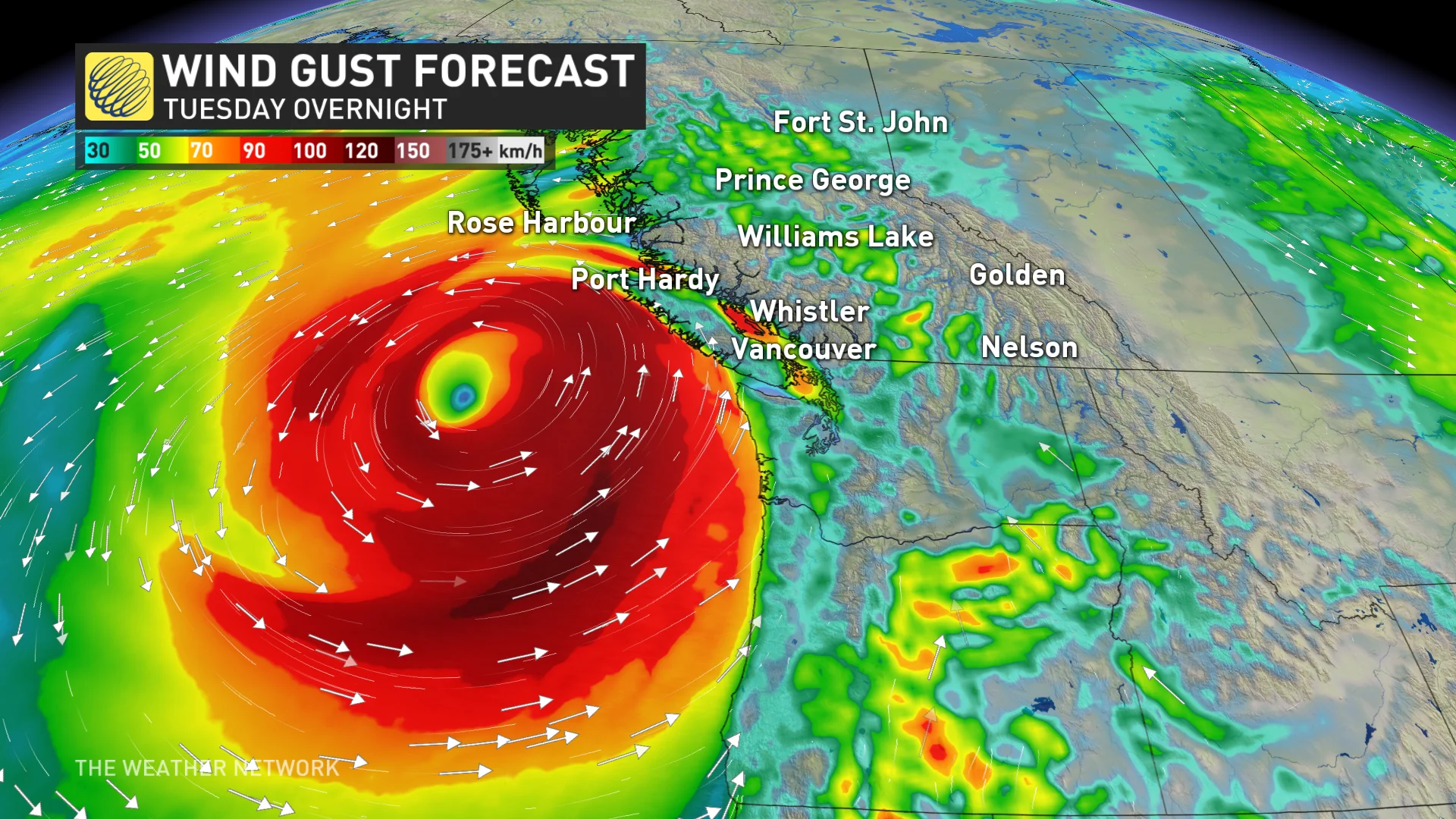
Some of the biggest swells and waves in recent memory are about to roar ashore near the northwestern tip of Vancouver Island. This bomb cyclone, fuelled by rapid intensification, is set to generate an oceanic spectacle, creating massive seas and long-travelling swells.
RELATED: How a monster is born: Discover the fuse that lights a bomb cyclone
How far will the storm swell travel?
The swells generated by this storm will propagate thousands of kilometres, reaching as far as Hawaii and the western beaches of Mexico’s Baja Peninsula. Talk about impact.
Swells are distinct from choppy, wind-driven waves. They are smoother, longer-period waves that can travel vast distances from their origin, carrying the storm’s energy far and wide.
What about the wave heights near the deep, low-pressure centre?
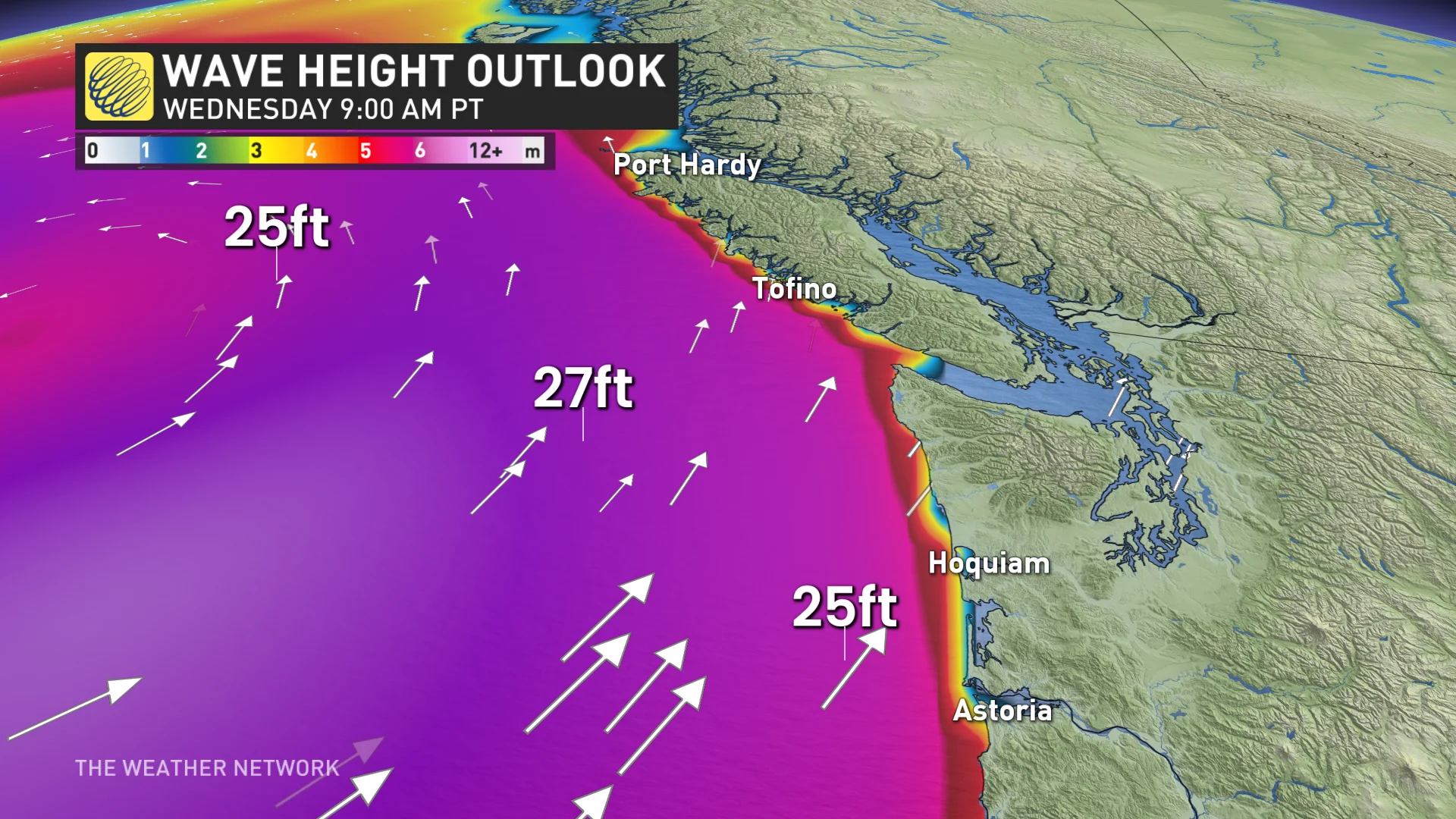
This is where wind-driven waves and swells coalesce to produce truly massive seas.
Close to the heart of the storm, where wind-driven waves meet long-travelling swells, the seas will reach incredible heights.
Significant wave height: This metric represents the average height of the highest one-third of waves at sea and provides a snapshot of the wave energy in the area.
Just a couple of hundred kilometres off the coast of Vancouver Island, models predict significant wave heights of more than 10 metres (35 feet).
These wave heights imply that the theoretical, maximum wave height, the tallest wave the storm could generate, might reach 20 metres (70 feet).
For perspective, that’s equivalent to a six-storey building, four adult giraffes stacked tall, one-fifth the height of the Statue of Liberty, 10 African elephants and three T. Rex dinosaurs.
Impactful waves along the coast
Closer to shore, the waves will still pack a punch.
West coast of Vancouver Island: Expect waves between six to eight metres (20-26 feet), with a potential maximum of 12 metres (40 feet).
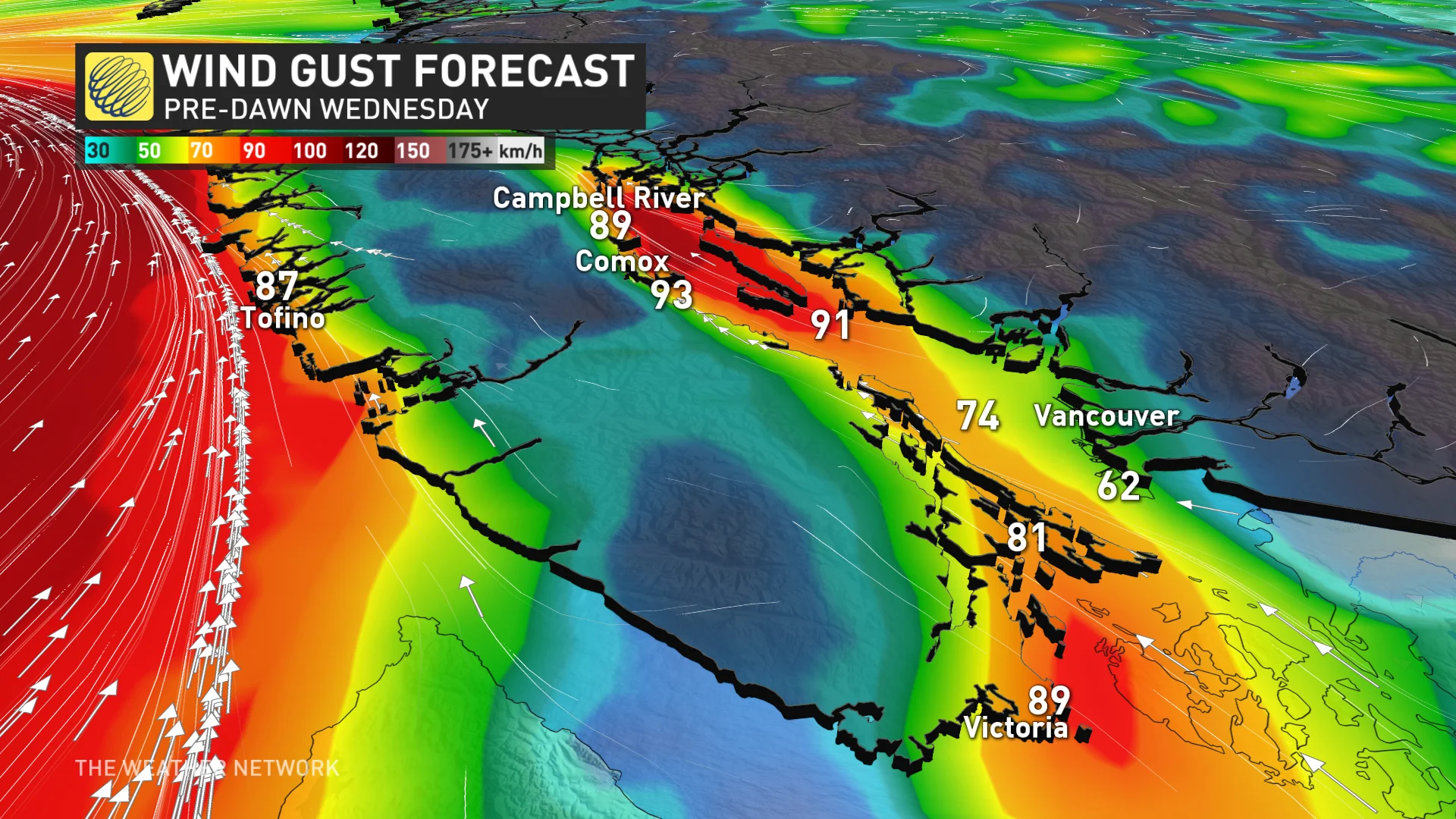
Georgia Strait: Wave heights will reach three to four metres (10-13 feet), with northern sections potentially seeing a maximum wave of up to five metres (16 feet). Those waves could cause significant coastal impacts, especially with the tidal cycle amplifying their effects.
The dangers
Mariners: The wide-open seas near the low will be highly hazardous, with massive, chaotic waves making navigation extremely dangerous for those at sea.
Coastal erosion: The powerful waves could erode beaches and cliffs along exposed coastlines, potentially leading to property damage.
Sneaker waves: These unpredictable waves can surge inland unexpectedly, posing risks to those near the shore. These happen when multiple wave patterns align, called wave interference, magnifying wave heights.

(Getty Images)
The timing of high tide adds another layer of risk, with residual effects from the recent king tide cycle:
Campbell River: 4.33 metres (9:15 a.m. PST Wednesday)
Comox: 4.96 metres (9:59 a.m. PST Wednesday)
Victoria: 2.79 metres/2.9 metres (9:15 a.m. PST and 2 p.m. PST Wednesday)
Those planning to visit the coast for storm watching should exercise extreme caution and stay well back from the water.
Thumbnail imagery is a generic wave in the Pacific Ocean, unrelated to the specific B.C. story. It is courtesy of Getty Images/Joshua McDonough:892523910-170667a.


