El Niño turns strong and still growing as winter fast approaches
Forecasters issued an El Niño advisory on Thursday as all indicators point toward influential warmth in the Pacific heading into the winter months
The Pacific Ocean continues running a fever as the northern hemisphere heads into the winter months, and forecasters see the chance for this El Niño pattern to grow even stronger in the weeks to come.
NOAA’s Climate Prediction Center (CPC) issued an El Niño advisory in its monthly update on Thursday, a formality that makes official what we’ve long known—El Niño is here, it’s strong, and it could affect our winter weather.
MUST SEE: El Niño's impact on Canada's winter: What to expect?
El Niño is officially here and growing stronger
We’re on the lookout for potential shifts in winter weather patterns across North America in the weeks ahead as El Niño strengthens in the eastern half of the Pacific Ocean.
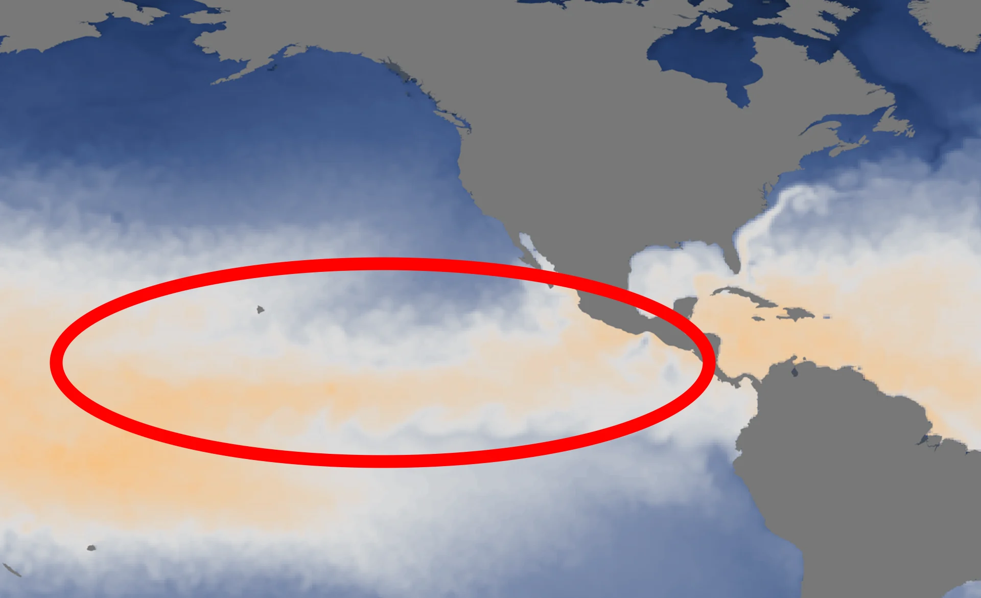
Water temperatures in the equatorial Pacific Ocean west of South America have been consistently warmer than normal since the early spring, with a period of steady warming through the summer.

A spell of abnormally warm waters is considered an El Niño when sea surface temperatures are consistently 0.5°C above normal for about seven consecutive months. Anomalies of 1.0°C represent a moderate El Niño, while a strong event features temperatures at least 1.5°C above normal.
Average sea surface temperatures across a critical section of the Pacific are coming in around 1.7°C above average, the CPC said this week, which meets the criteria for a strong El Niño.
Given that this pattern started in the late spring, October's warmth satisfied the time duration required to graduate from a "likely" El Niño to a full-blown event that's ongoing as we move into winter.
This warmth extends more than a hundred metres below the surface, as well, which reinforces the staying power of this event into the first half of 2024.
Experts see continuing odds of a “historically strong” El Niño this season
Greater temperature anomalies signify a stronger El Niño, which may have greater and farther-reaching impacts on global weather patterns.
RELATED: A ‘historically strong’ El Niño is possible heading into winter
Forecasters with the CPC give a 35 percent chance of this El Niño growing “historically strong,” with average temperature anomalies of 2.0°C or warmer. This change represents a slight uptick in the odds of a high-end El Niño compared to the agency’s update in October.

Since 1950, only three winters have seen average temperatures in this part of the Pacific rise more than two degrees above normal: 1982-83; 1997-98; and 2015-16. All three of those seasons saw highly impactful shifts in weather patterns around the world.
What could this mean for folks across Canada?
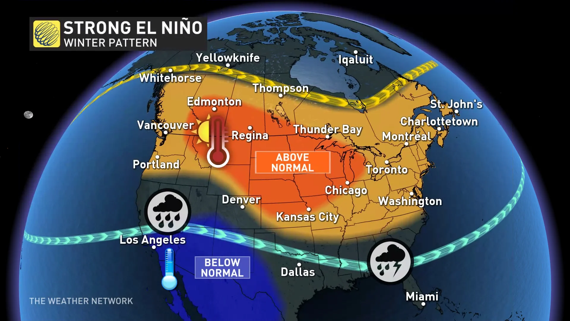
“Past data indicates that El Niño winters tend to be relatively mild across the country, particularly during strong El Niño events like the one anticipated for this winter,” wrote Dr. Doug Gillham in The Weather Network’s look-ahead to what El Niño could portend for our upcoming winter.

Not all El Niño winters are the same. While many of them follow the same patterns, each one has its own personality of sorts.
Some complicating factors will likely make this winter unique, including a far-reaching warmth across the Pacific, as well as the exceptional warmth that remains present throughout much of the Atlantic Ocean.
Dr. Gillham noted that we’ve still seen impactful winter storms even during those milder El Niño winters: “Even mild winters have a risk for impactful winter weather, as demonstrated by the destructive ice storm that struck southern Quebec and eastern Ontario during the powerful El Niño of 1997-98.”
Stay tuned for The Weather Network’s official winter outlook coming out on Wednesday, November 29, and check back frequently throughout the month as forecasters monitor how these pattern changes will affect conditions in your community.
Header image courtesy of NOAA.


