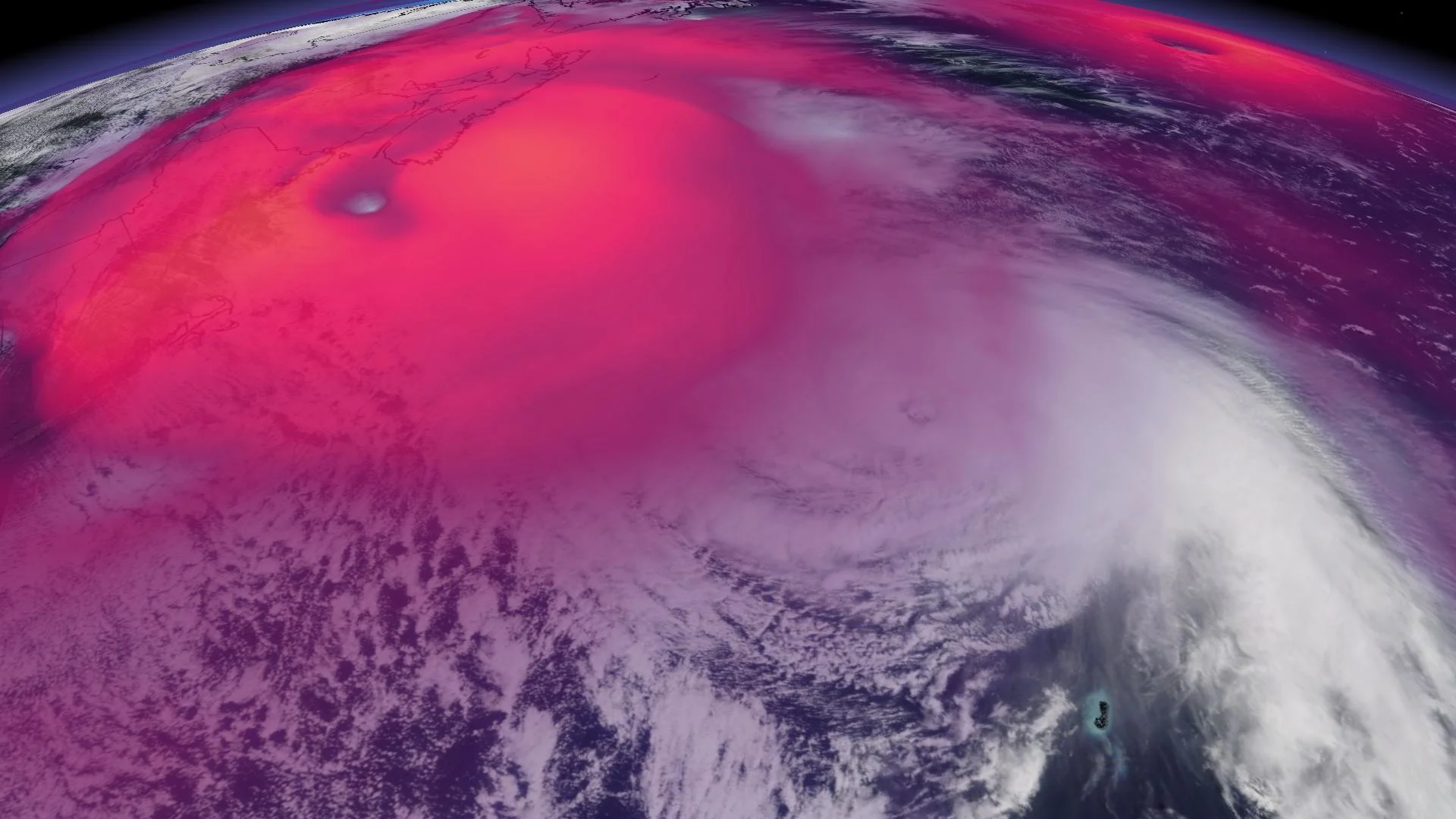
Fiona versus Lee: How powerful but different these hurricanes are
With Lee knocking on the East Coast's doorsteps, and the one-year anniversary of the destructive Fiona coming at the end of this month, we take a look at the two storms and do a side-by-side comparison
All eyes are on hurricane Lee this week and where it will ultimately end up, including one scenario that would see it bring some impacts to Atlantic Canada.
Visit The Weather Network's hurricane hub to keep up with the latest on hurricane Lee and all other tropical developments around the world
With Lee knocking on the East Coast's doorsteps, and the one-year anniversary of the destructive Fiona coming at the end of the month, we take a look at the two storms and do a side-by-side comparison.
Residents will need to prepare for Lee, but it is an entirely different storm than Fiona and isn't expected to be nearly as strong or destructive, so folks can breathe a sigh of relief.
Fiona's historic impact on Atlantic Canada
Hurricane Fiona lashed Atlantic Canada in September 2022 as an intense post-tropical cyclone, making landfall on Nova Scotia’s Cape Breton with the characteristics of both a hurricane and a nor’easter.
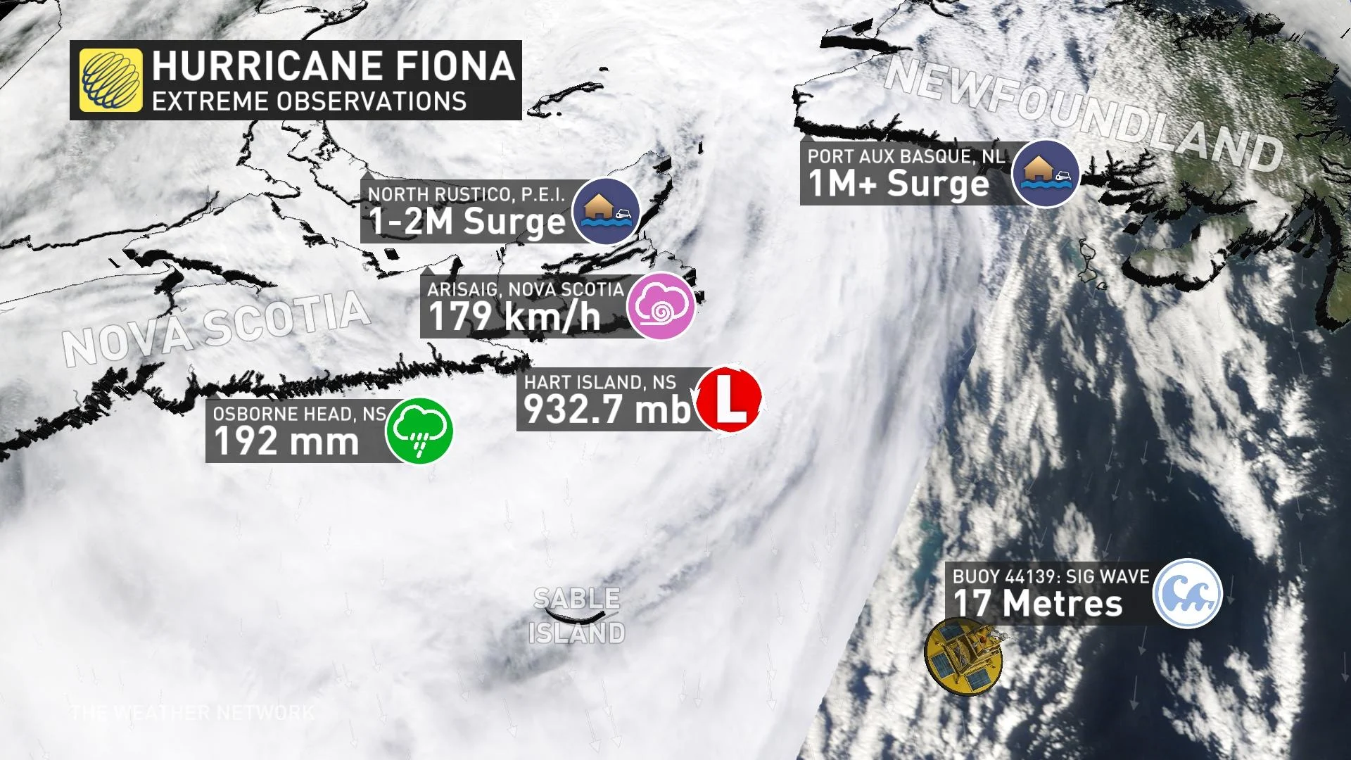
Fiona’s evolution from a tropical cyclone to a post-tropical cyclone dramatically expanded the storm’s size and reach, allowing it to produce widespread, damaging winds and flooding across the East Coast.
The storm cemented its place in history as the costliest storm ever recorded in Atlantic Canada, and Canada’s 10th-most expensive disaster on record. Coastal erosion from waves and storm surge took a harsh toll on southwestern Newfoundland, where more than 100 homes along the coast washed into the sea.
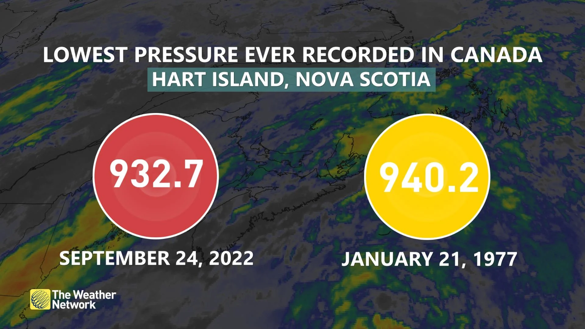
As a result of the damage it caused, Fiona was officially retired earlier this year, and will never be utilized again as a named tropical storm or hurricane in the Atlantic basin.
Comparing Fiona and Lee
Pressure
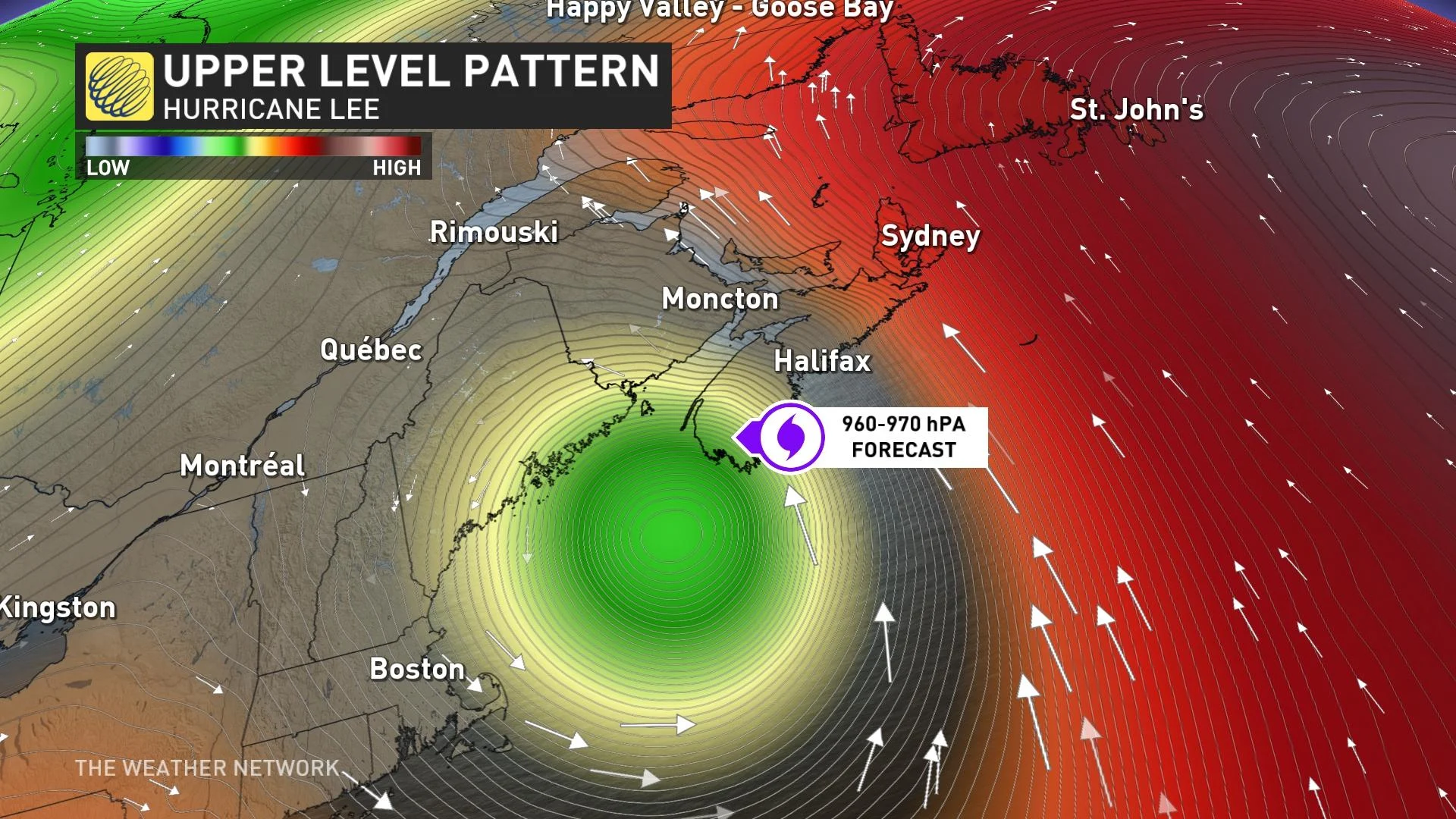
The lowest pressure of Fiona was around 932 millibars at landfall whereas Lee will be around 960-970 millibars.
Wind
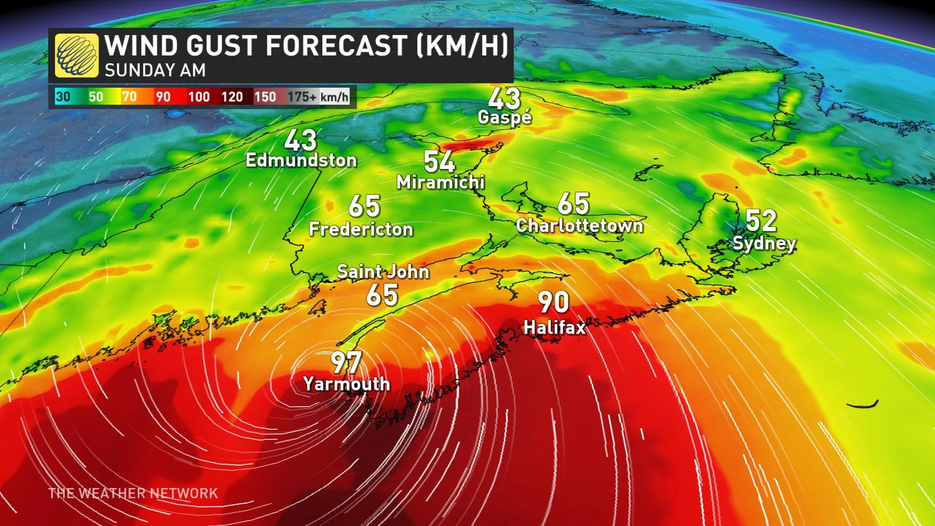
Fiona brought wind gusts of 125 km/h in Halifax, N.S., and peak wind gusts of 179 km/h in Arisaig, N.S.

Lee is expected to bring wind gusts lower than that, with the strongest model going as high as 125 km/h. However, the model consensus is really closer to 100-110 km/h for coastal sections.
Waves
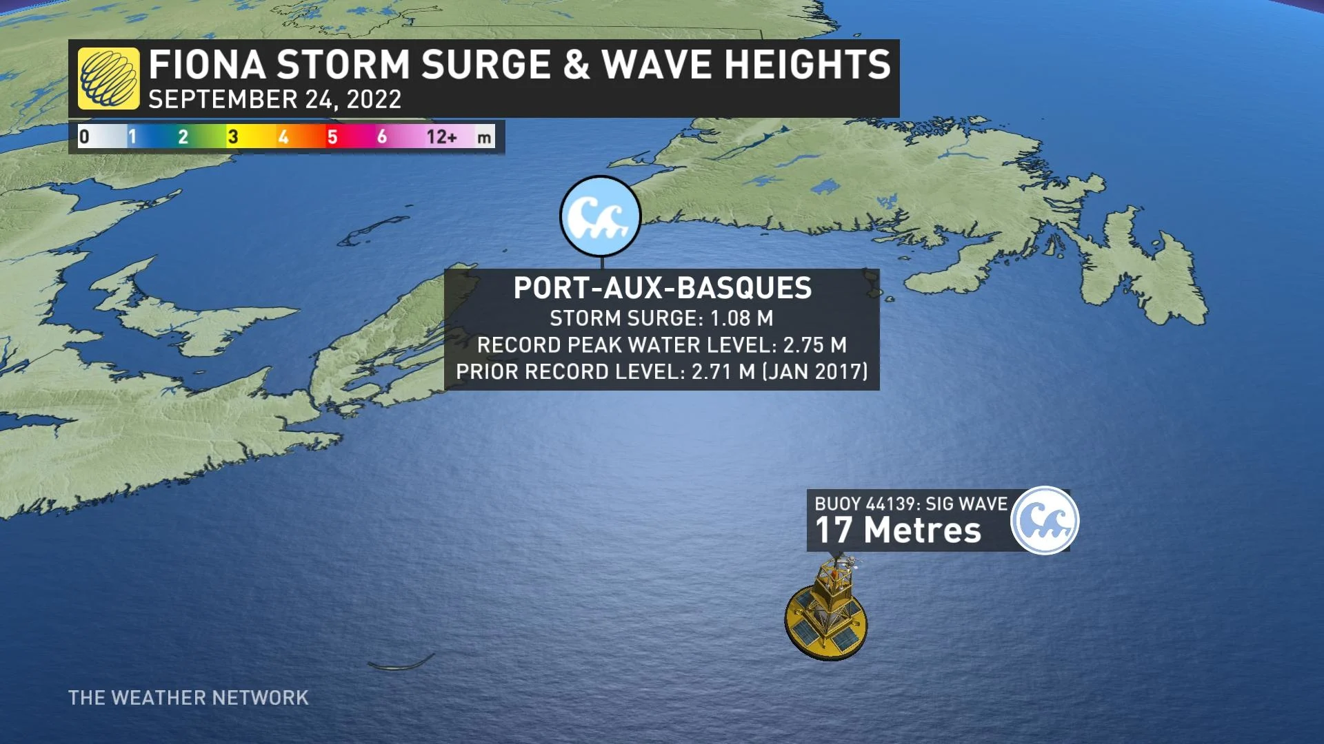
Fiona had high-wave heights, with an offshore buoy measuring a wave as high as 17 metres.
Lee won't see wave heights that extreme, but will still be high. Current forecast calls for heights up to seven metres.
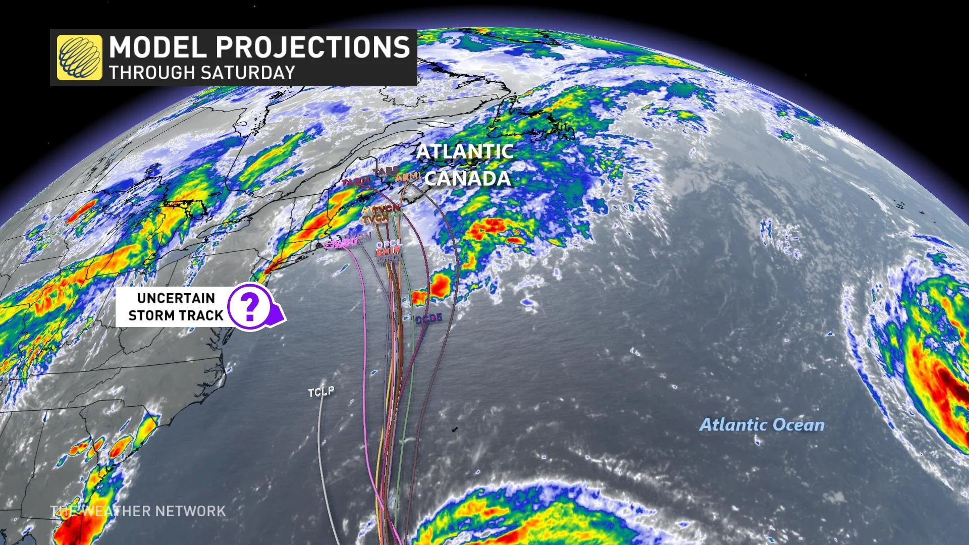
Several scenarios are still on the table right now in terms of Lee's ultimate path and what regions will be impacted most.
Scenario 1: Lee turns into New England
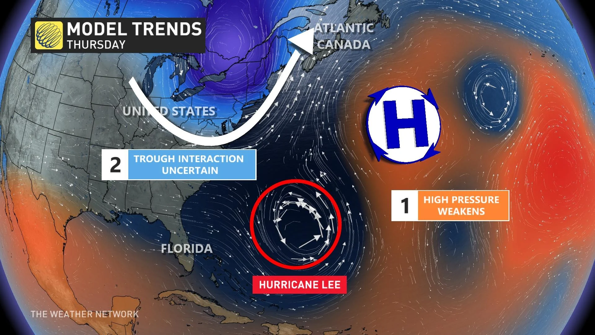
One scenario that’s possible is that the trough over the Great Lakes is a little bit weaker than expected. That would allow a ridge of high pressure to set up near the Maritimes, potentially forcing Lee to turn west and head into New England.
MUST SEE: How a mammoth hurricane rapidly intensifies in mere hours
The scenario would bring hazardous conditions to the bustling Interstate 95 corridor throughout New England -— a heavily travelled corridor by Canadians visiting the United States —- while potentially bringing some wind, rain, large costal waves and erosion to southern sections of the Maritimes.
Scenario 2: Lee tracks into Atlantic Canada
Another scenario consistently showing up in weather models is that prevailing winds will keep hurricane Lee on a northward trajectory, bringing the storm directly into the Maritimes by next weekend.
This would be a high-impact event for the region, with heavy rain, high winds, and coastal flooding possible across Nova Scotia, New Brunswick, and Prince Edward Island.
Folks across the region are understandably weary about tropical systems after the impacts of Dorian in 2019 and Fiona in 2022. It’s likely that hurricane Lee would not be as strong as either of those two systems if it were to hit the region.
However, residents would have to stay on high alert for flooding, power outages, tree damage, and coastal flooding.
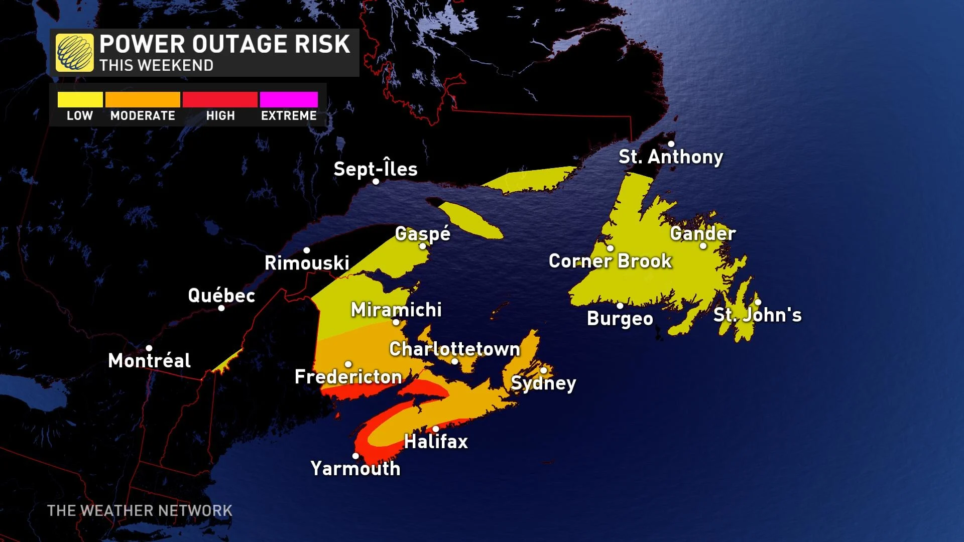
Scenario 3: Lee turns toward sea, possibly affecting Newfoundland
It’s still possible that Lee could turn a bit east and follow a track that heads farther out to sea. That is a similar situation to the one we saw with hurricane Franklin last month -- the storm looked like it might’ve hit Atlantic Canada, but conditions allowed it to turn out to sea. That solution has the lowest probability of verifying compared to the previous two.
If Lee was to turn out to sea, we’d still have to closely monitor potential impacts to Newfoundland, and especially the Avalon Peninsula, by the end of this weekend or early next week.
WATCH: Shocking Fiona before & after photos show the fallout of the storm
With files from Dennis Mersereau, a digital journalist at The Weather Network.


