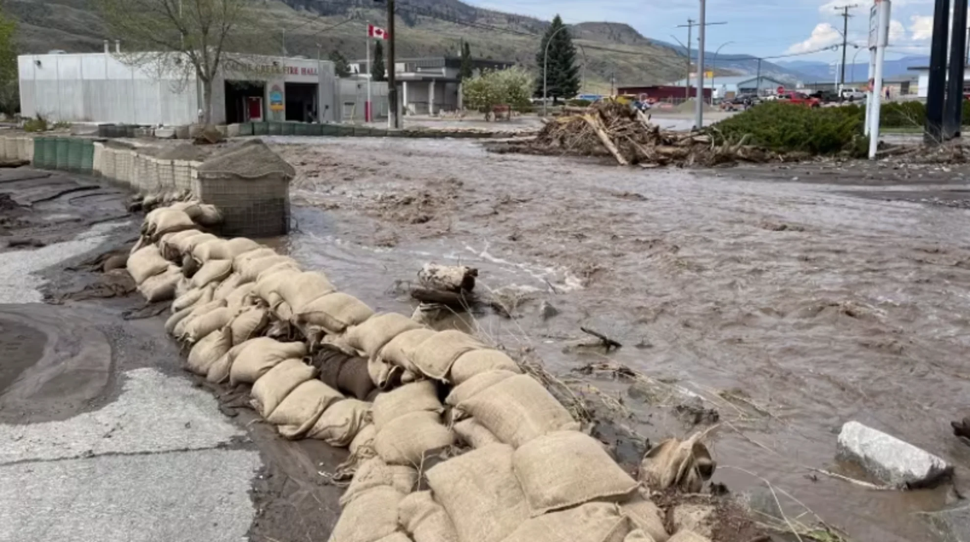
Flooding situation likely to deteriorate in B.C. Interior, province forecasts
Much of B.C.'s Interior is under a flood watch, flood warning or a high streamflow advisory Wednesday, with the province forecasting flooding conditions to deteriorate over the next few days.
Communities throughout the Interior — including Cache Creek in the Thompson region and Parker Cove in the north Okanagan on Okanagan Indian Band territory — have seen evacuation orders due to floods over the past few days.
MUST SEE: 1 home destroyed as flood risk prompts more evacuation orders in Cache Creek
On Wednesday night, evacuation alerts and orders have been issued for multiple properties in Grand Forks, near the Canada-U.S. border in the Kootenay region. As of 8 p.m. PT, residents of 10 properties have been told to leave their homes.
The warnings, orders and alert come as rivers have been rising quickly due to rapid snowmelt after a hot snap that is expected to continue, according to the province.
In a statement, B.C.'s emergency management ministry says it is expecting hot weather with accelerating snowmelt anticipated through Friday followed by heavy rainfall and thundershowers through Saturday
"Based on forecasts from the River Forecast Centre, conditions in areas that are currently flooding, including Cache Creek and Okanagan Indian Band territory, are expected to deteriorate over the coming days," the statement said.
RELATED: From thunderstorms to snow, spring snaps back into reality across B.C.

The River Forecast Centre has issued a flood warning for the Thompson region that encompasses communities including Cache Creek, Lytton and Merritt. (Marcella Bernardo/CBC)
The province went on to say that moderate flooding is expected in Grand Forks starting Friday, and "significant flood hazard" is anticipated in smaller watersheds throughout the Central and Southern Interior.
The public is being asked to stay away from fast-flowing rivers and riverbanks and avoid recreational activities in or near rivers and streams.

"The regional emergency operations centre is issuing these alerts as weather models are showing that rivers will continue to rise," said Mark Stephens, the EOC director at the Regional District of Kootenay Boundary, in a statement.
Sandbag centres activated
The province said in its statement that it had already sent more than 200,000 sandbags to communities to deal with flooding so far this year.
It said it is sending watershed experts to areas of concern and is in contact with communities to assist with preparedness and emergency plans.

The floodwaters from the overflowing Whiteman's Creek in Parker Cove, near Vernon in the north Okanagan, left a trail of damage in its wake Wednesday, tearing away a normally quiet neighbourhood street. (Brady Strachan/CBC)
The B.C. River Forecast Centre has issued a flood warning for the Thompson region that encompasses communities including Cache Creek, Lytton and Merritt.
A flood warning was also in effect for Whiteman Creek as it flows into Okanagan Lake, in the Parker Cove community.
Lower-level flood watches covered the Okanagan, Boundary and Kootenay regions along with areas surrounding the Salmon River between Salmon Arm and Vernon. A flood watch was also in effect for the middle Fraser River plateau, including areas around Quesnel and Williams Lake.

Much of B.C.'s Interior is under a flood watch, warning or high streamflow advisory as of May 3, 2023. Regions in yellow are under a streamflow advisory, with regions in orange under a flood watch and regions in red under a flood warning. (B.C. River Forecast Centre)
In the north, high streamflow advisories were in effect for the Williston region as well as areas surrounding Prince George.
In the centre's three-tiered warning system, a flood watch means river levels are rising and flooding might occur. It is preceded by a high streamflow advisory — the lowest of the three levels issued by the River Forecast Centre — that indicates minor flooding in low-lying areas is possible.
RELATED: Evacuation order issued due to a landslide near Nelson, B.C.
The province says the Interior is expecting sunny skies and warm temperatures through the week, with highs in the range of 30 C. It says there is also potential for up to 60 millimetres of rain later in the week.
Anyone who is subject to an evacuation alert or order is asked to keep a go bag with important documents ready.
WATCH: Active transport methods at risk from warming climate
This articles was originally published for CBC News. It contains files from The Canadian Press


