Record warmth melts Great Lakes ice to historic February lows
Warm weather across the Great Lakes pushed ice coverage to record lows for the month of February
It’s the middle of February and there’s hardly any ice on the Great Lakes. Satellites only detected 2.99 percent of ice coverage across the lakes on February 11, which is the lowest value ever measured during the month of February.
If this season were progressing as normal, we would see about one-third of the Great Lakes crusted over with ice by the middle of February as we close in on the historical peak of coverage around the end of the month.
The near-complete lack of ice on the Great Lakes so far this year is another jarring exclamation point on an astoundingly warm winter across North America, and another sombre reminder of our changing climate.

DON’T MISS: After 2023's astounding new global heat record, 2024 may be even worse
Ice coverage at historic lows
Ice is a way of life across the Great Lakes.
Autumn bears witness to rampant lake-effect snow squalls as the first puffs of winter’s frigid breath blow over the warm waters. A rhythmic pattern of cold fronts gradually chill the lakes enough that they start to freeze as true winter sets in.
Snow squalls gradually taper off as the ice thickens and its extent grows from the shorelines off beyond the horizon, creeping across the five lakes like winter’s white kudzu.

A typical winter would see ice coverage across the Great Lakes peak a little above 40 percent before spring’s encroaching warmth rapidly chips away at the frozen crust.
This is no typical winter.
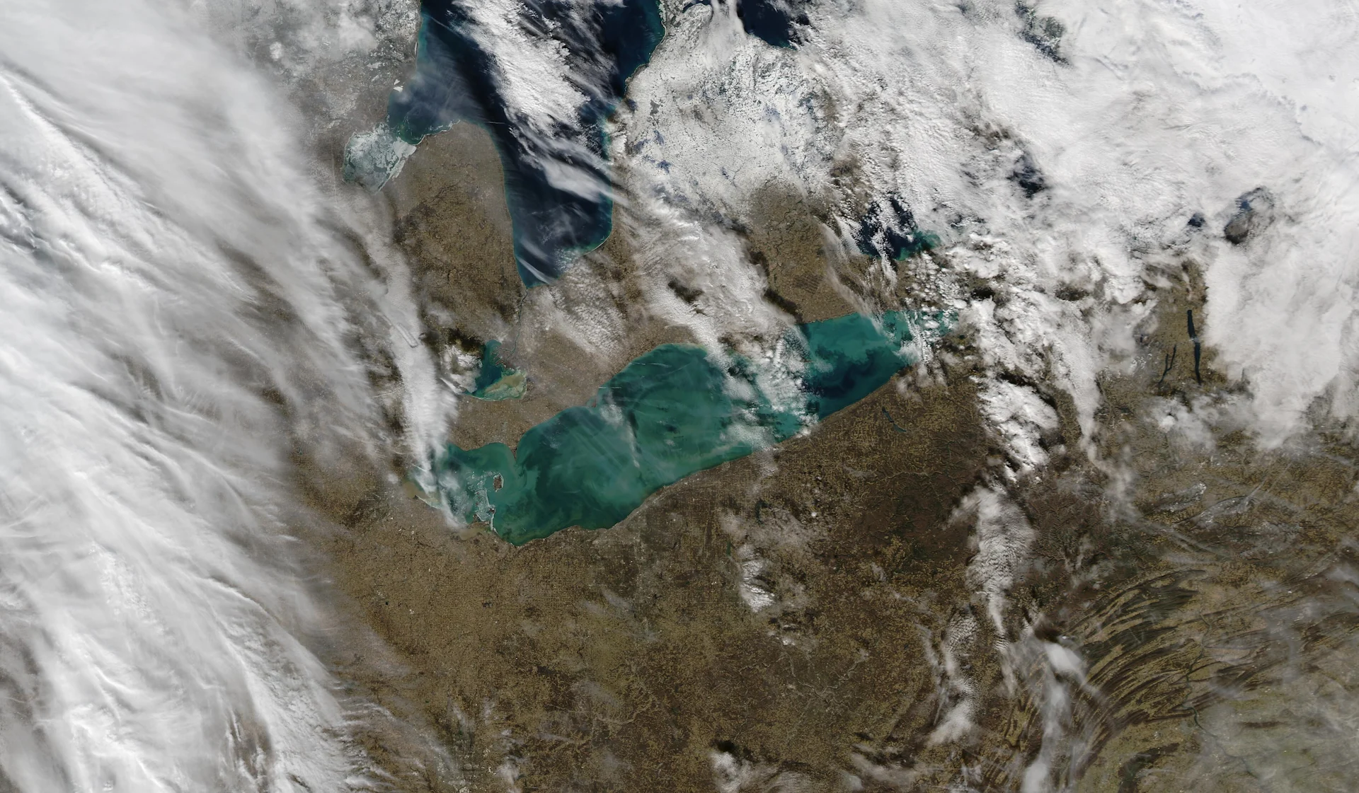
February 11 saw just 2.99 percent of the Great Lakes covered in ice. Scant amounts of broken ice covered a negligible fraction of Lake Erie and Lake Ontario, with most of the region’s ice concentrated in the shallow waters of Lake Huron’s North Channel and Saginaw Bay.
Since the beginning of routine satellite monitoring of lake ice back in 1973, we had never seen ice coverage on the Great Lakes fall below 4.5 percent until this year. The previous all-time February low occurred in 2012 when ice extent across the five lakes failed to crack 10 percent all month.
The driving force behind this historically low February ice extent is the warm temperatures we’ve been able to enjoy for much of the season.
Toronto measured its fifth-warmest February day on record last week when the temperature climbed up to 15.7°C at Pearson Airport. The mean temperature in Toronto for the first ten days of February clocked in at 2.0°C, the warmest start to the month on record.

RELATED: No ice on Lake Erie this winter fuels fear for the future
Temperatures ran more than ten degrees above seasonal across almost the entire province heading into the second weekend of the month, with above-freezing temperatures allowing rain to fall as far north as Moosonee on James Bay.
It’s been a similar story for much of this winter. Exceptional warmth and bouts of tropical humidity have kept temperatures far above seasonal this season despite occasional intrusions of Arctic air.
The brutal cold snap that hit the Prairies in the first half of January briefly seeped into the Great Lakes region, allowing lake ice coverage to grow to a maximum of 16.02 percent on January 22. Just over one-third of Lake Erie’s surface hosted some ice that day, with nearly one-quarter of Huron covered in a frozen cap.
Temperatures rapidly climbed back above-seasonal after the cold spell, forcing most of that ice to vanish in a matter of days.

MUST SEE: Why extreme cold still happens in a warming world
A stretch of cooler temperatures moving into the Great Lakes over the next week will help bring temperatures closer to seasonal, which should help increase the extent of lake ice heading through the middle of the month. It’s unlikely that we’ll come anywhere close to seeing near-normal ice coverage in the short-term, though.
El Niño and climate change play starring roles in lack of ice
This year’s dearth of ice on the Great Lakes is courtesy of persistent stretches of above-seasonal temperatures covering much of North America this season. Much of the blame for these abnormal patterns lies with El Niño in the eastern Pacific, which heavily affects North American winters.
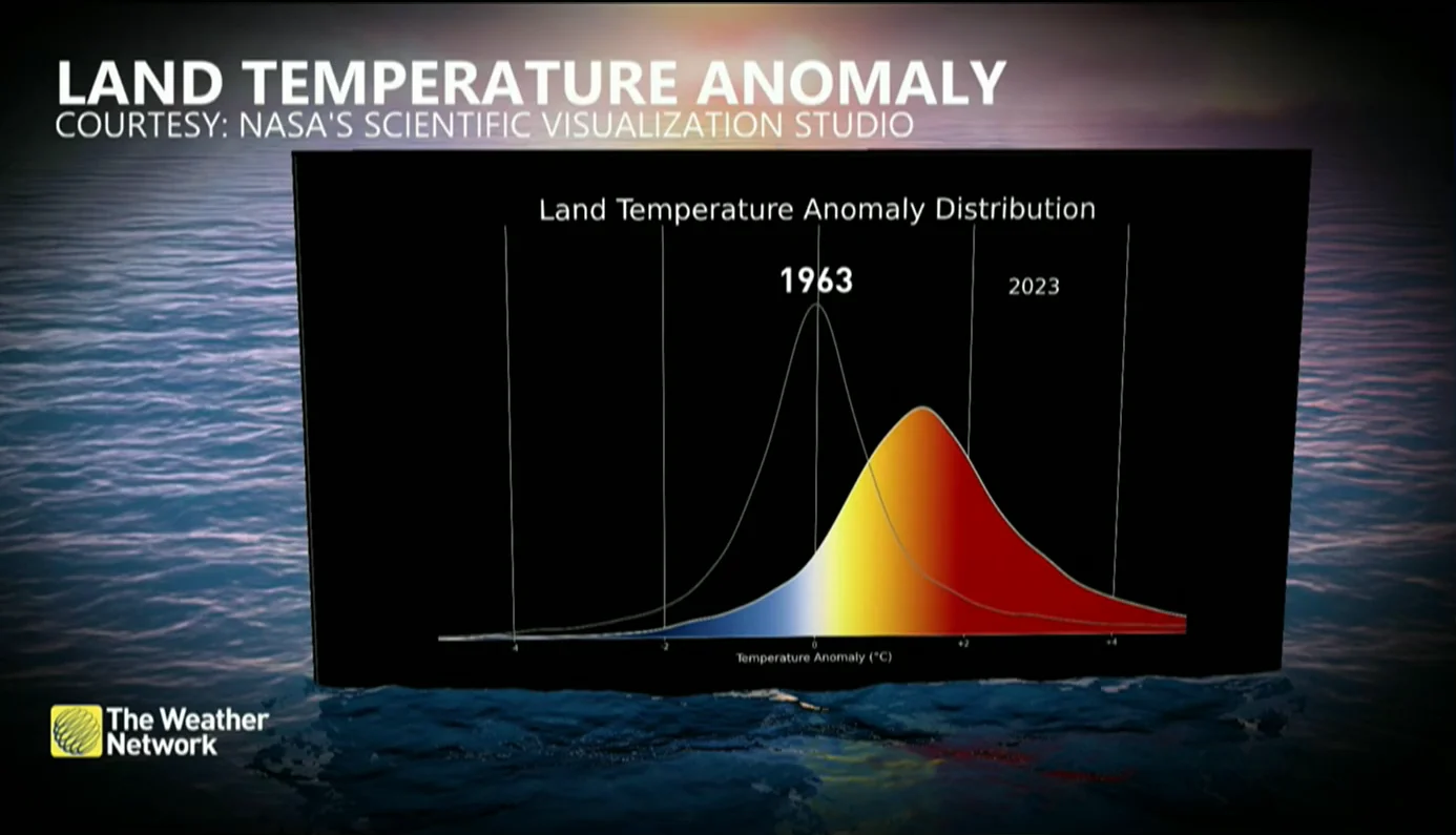
Frequent record warmth is also occurring against the backdrop of climate change. Higher baseline temperatures make warm extremes more common, which has a detrimental effect on lake ice and sea ice in the Arctic.

Record-setting heat like we’ve experienced this season—and so often in recent years—is expected amid a warming climate. A warmer climate can even influence cold snaps.
The Great Lakes are acutely feeling the effects of climate change. Researchers have found that water levels on the lakes are likely to lurch between too-low and too-high as North America experiences weather extremes.
A relative lack of ice on the lakes can negatively affect the region’s rich ecosystem and cause worsening coastal erosion for communities throughout the region. Longer periods of ice-free coverage can also increase the risk for lake-effect snowstorms, which can lead to car accidents and significant disruption to lives and livelihoods.
Header image of the Great Lakes on February 7, 2024, courtesy of NASA’s MODIS Aqua.


