How Hurricane Helene produced 700+ mm of rain in three days
The destructive, high-end hurricane will secure a spot in history for the catastrophic flooding left in its wake
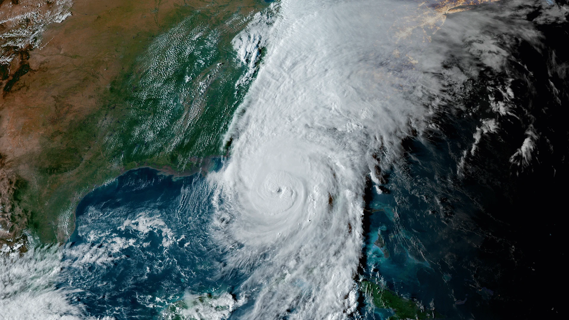
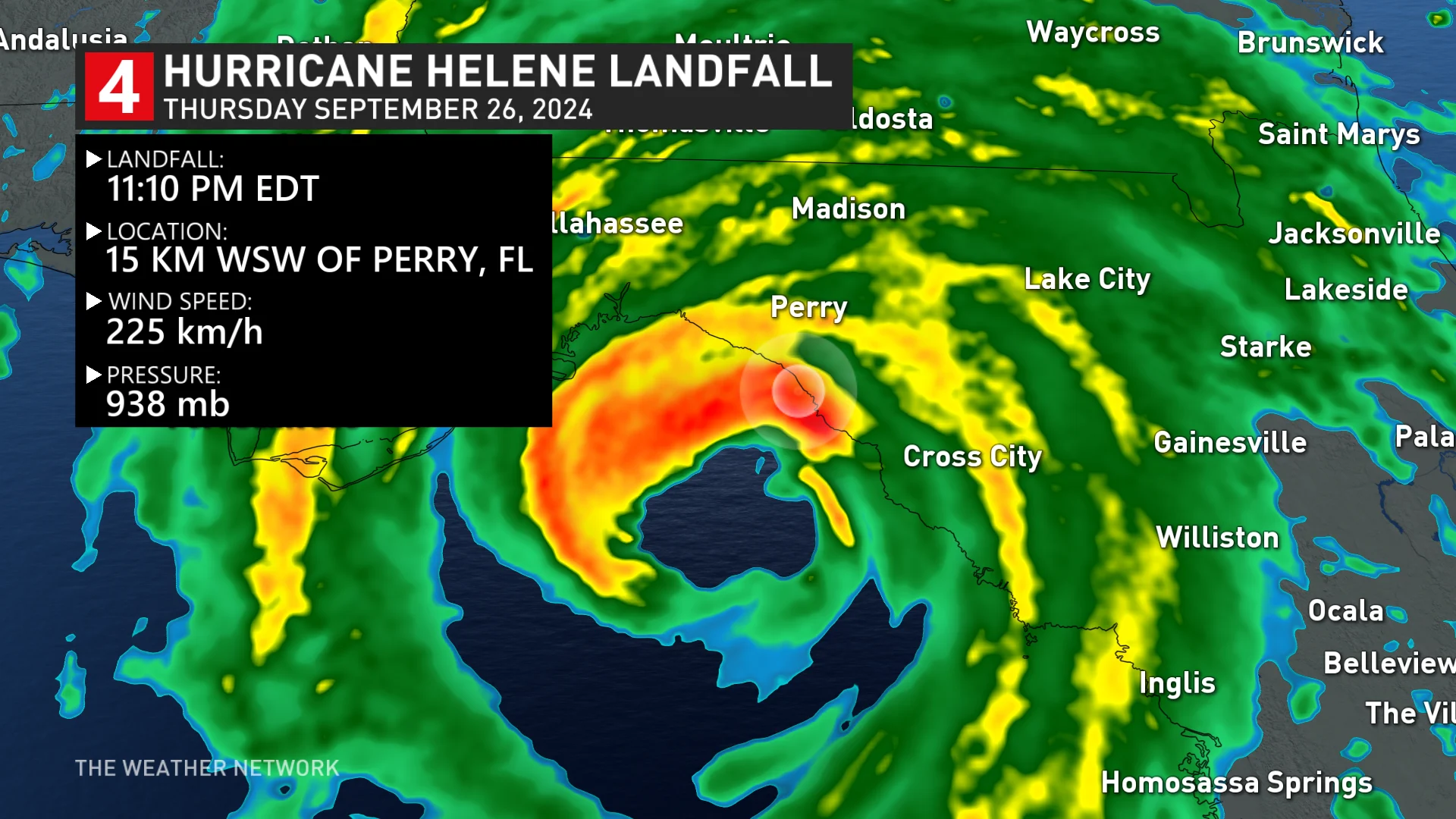
Hurricane Helene will live in history as one of the strongest storms to ever make landfall in the United States. The hurricane roared into Florida on Sept. 26 with maximum winds of 225 km/h.
For all the destruction the storm wrought along the Florida coast, one of Hurricane Helene’s biggest legacies will be the catastrophic flooding that unfolded across the southeastern United States before and during the storm.
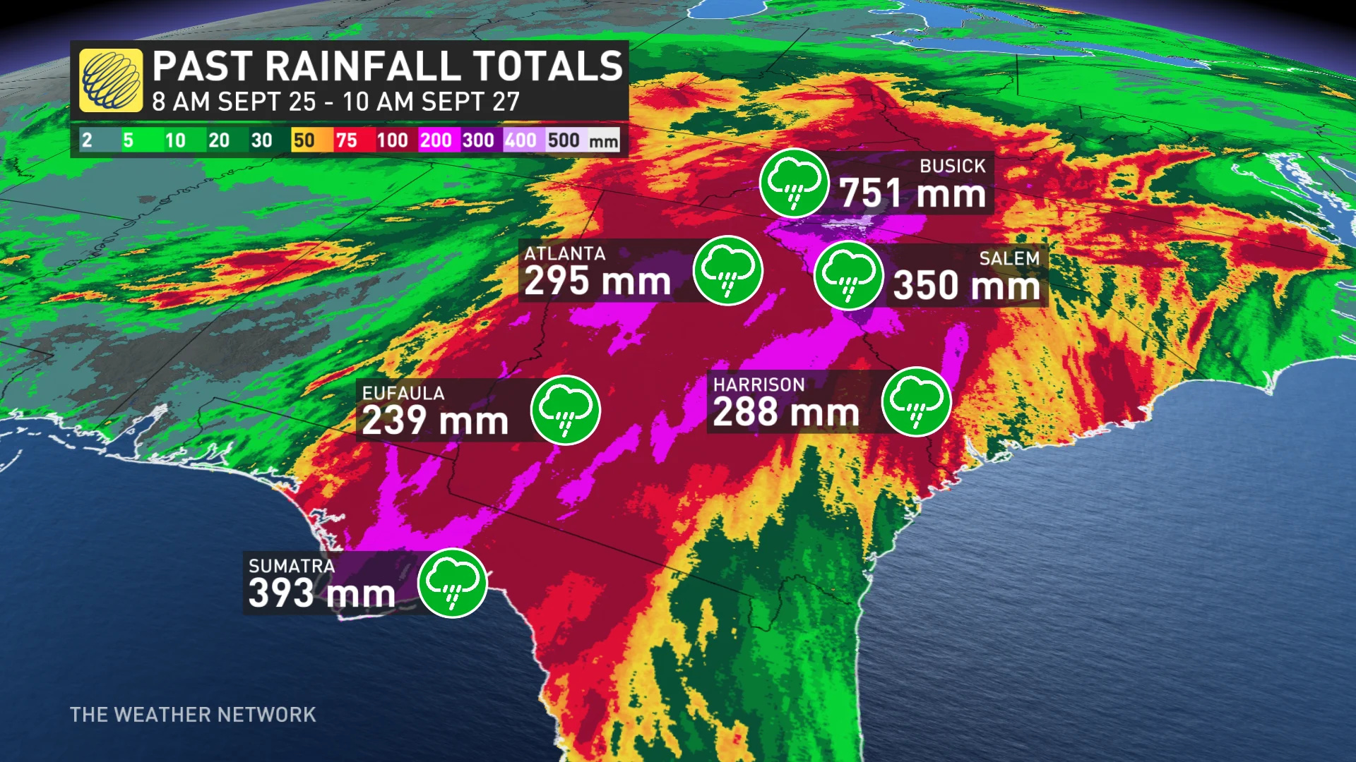
Some areas saw more than 700 mm of rain by the end of the storm, which left entire communities submerged beneath fast-rising waters. Here’s a look at how Hurricane Helene unleashed such devastating floods long before it ever made landfall.
DON'T MISS: Powerful Helene cuts deadly path through Florida, southeastern U.S.
Helene quickly grew into a high-end hurricane
Following in the footsteps of so many recent hurricanes before it, Helene rapidly intensified into a major Category 4 storm as it sped toward landfall on Thursday, Sept. 26.

The enormous storm, which measured more than 700 km across at its largest, slammed into the Florida Panhandle at maximum strength with winds as high as 225 km/h.
Major wind damage and a destructive storm surge accompanied the storm as it pushed ashore, reducing entire neighbourhoods to rubble as seawater inundation reached as much as 4.5 metres above ground level.
But the storm’s prolific and drenching rains will put Hurricane Helene in history for more than just its pure fury along the coast.
Half a metre of rain hits the Carolinas
Tropical downpours started across the southeastern United States long before the hurricane ever approached landfall.

MUST SEE: Autumn can still produce intense hurricanes across the Atlantic
This was a classic example of a phenomenon known as a predecessor rain event (PRE). A PRE occurs when a large batch of sustained heavy rain forms ahead of a tropical system’s arrival. These shields of rain typically develop in a long line stretching south to north.
Helene entered a complex environment that saw a strong upper-level trough lingering over the southern United States.
That trough helped wring out abundant tropical moisture streaming over the eastern U.S. ahead of Helene’s arrival, generating a large and sustained batch of heavy rain that parked over the Carolinas and Georgia while the hurricane itself was still developing over the Gulf of Mexico.

Some communities in western North Carolina saw 200-300 mm of rain in the days leading up to Helene’s landfall. Then the core of the storm traversed the area, dropping just as much rain in an even shorter period of time.
Busick, N.C., reported 751.3 mm (29.58 in.) of rain between 8:00 a.m. on Sept. 25 and 10:00 a.m. on Sept. 27. At least 330 mm of rain fell in the college town of Boone, N.C., which is home to Appalachian State University. Even the Atlanta metropolitan area saw 300-350 mm of rain from the event.
Devastating floods
The end result was chaos. “All roads in western N.C. should be considered closed,” the North Carolina Department of Transportation said during the storm on Friday morning. Historic flooding plagued the region as the immense runoff quickly overwhelmed creeks, rivers, and drainage systems.
The Swannanoa River at Biltmore, N.C., was one of numerous locations that saw an all-time record river crest in the wake of the drenching rain. The river crested at 26.10 ft (7.96 m), exceeding flood stage by 16.10 ft (4.91 m) and blowing past the previous record-high crest of 20.70 ft (6.31 m) set back in July 1916.

SEE ALSO: Hurricane remnants can bring dangerous weather deep into Canada
Mass rescues were required at the Unicoi County Hospital in Erwin, Tenn., after floodwaters completely inundated the building.
“As of 12:27 pm, 54 people were relocated to the roof of the building, and seven remain in rescue boats. The hospital has been engulfed by extremely dangerous and rapidly moving water,” the hospital’s parent company reported on X on Friday.
Predecessor rain events like the one that occurred with Helene are responsible for some of the worst flooding seen before and during a landfalling tropical system.
One particularly intense PRE occurred ahead of Hurricane Joaquin in 2015, dousing parts of coastal South Carolina with more than 600 mm of rain—and that hurricane never actually made landfall in the U.S.
Header image courtesy of CSU/CIRA & NOAA.


