How impactful was B.C.'s latest atmospheric river? Details pour in
We break down the numbers, provide context and unravel the most significant rainfall event in B.C. since November 2021
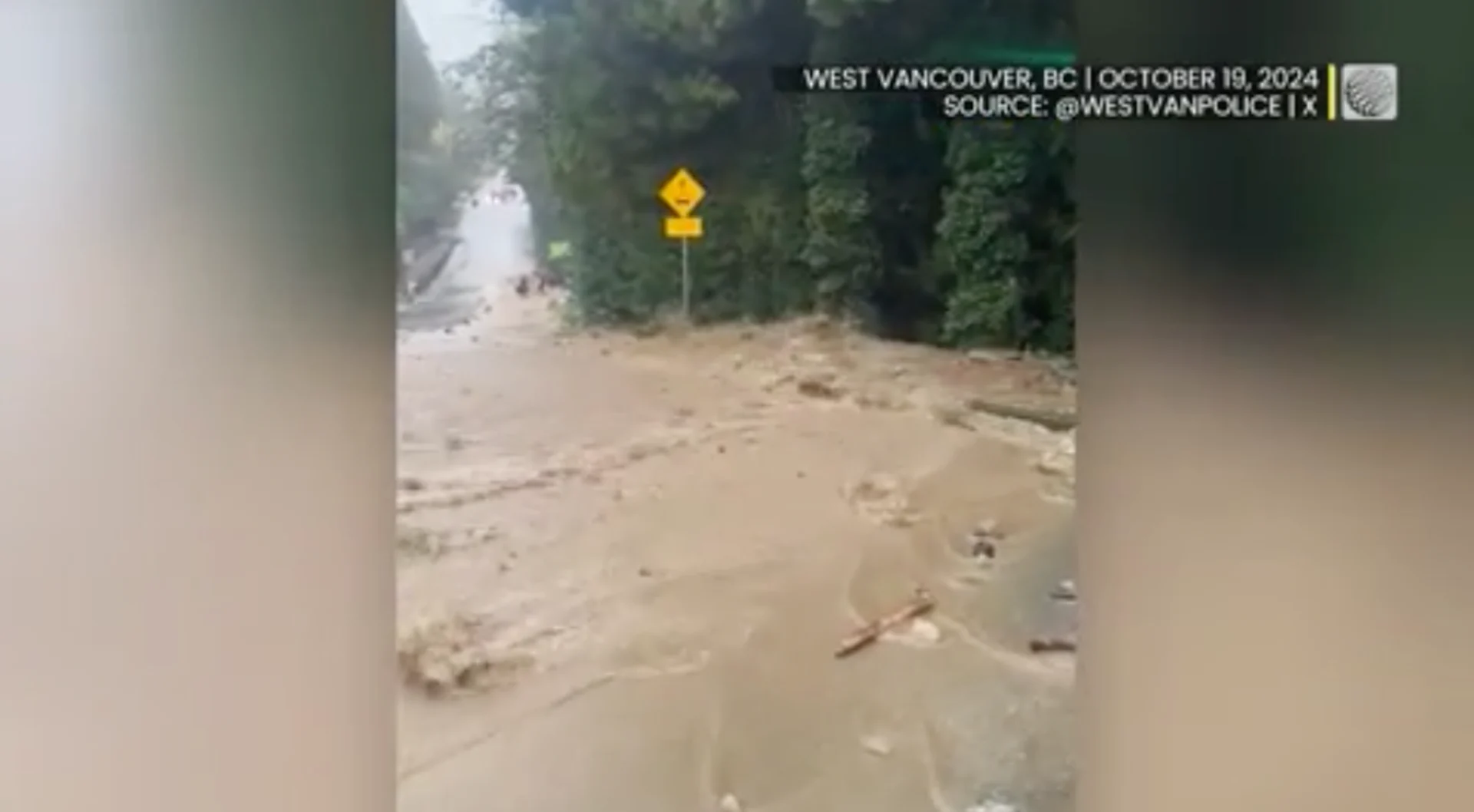
A major atmospheric river brought extreme rainfall totals to portions of Vancouver Island and the Lower Mainland this weekend, leading to road washouts and significant flooding.
We’ll break down the numbers here, provide context, and unravel the most significant rainfall event since November 2021.
RELATED: PHOTOS: Potent atmospheric river brings widespread flooding to B.C.
Storm totals from Friday to noon Sunday
Effingham forestry station on Vancouver Island recorded over 300 mm of rainfall since Friday, underscoring the extreme maximums from this powerful atmospheric river. Several locations saw a month’s worth of rain in just 48 hours.
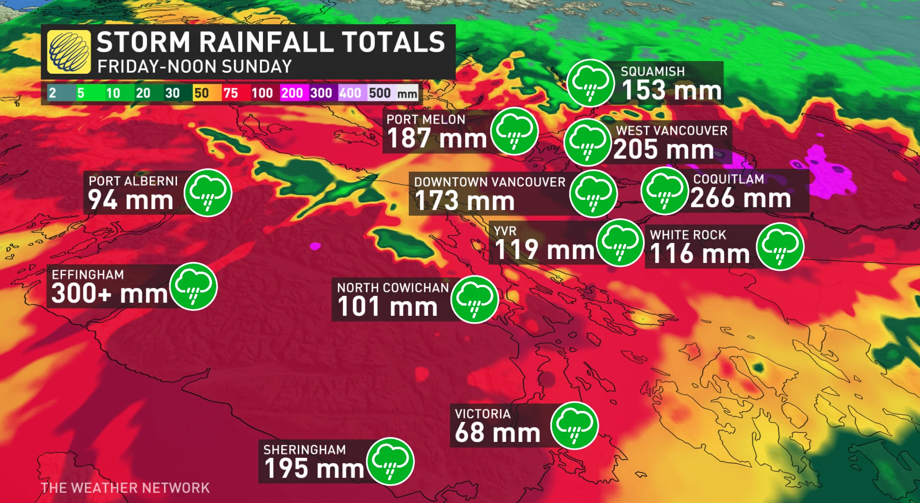
Here are some of the notable totals:
Coquitlam (Burke Mountain): 266 mm
Sheringham: 195 mm
West Vancouver: 205 mm
Port Melon (Howe Sound): 187 mm
Vancouver Harbour: 173 mm
Squamish: 153 mm
White Rock: 116 mm
Vancouver International Airport (YVR): 119 mm
North Cowichan: 101 mm
Port Alberni: 94 mm
Victoria (University): 68 mm
Comox: 60 mm
Daily totals: Oct. 19
Coquitlam (Burke Mountain): 197 mm (equivalent to the area’s monthly average)
West Vancouver: 135 mm
Vancouver Harbour: 116 mm
Port Melon: 93 mm
YVR: 67.1 mm
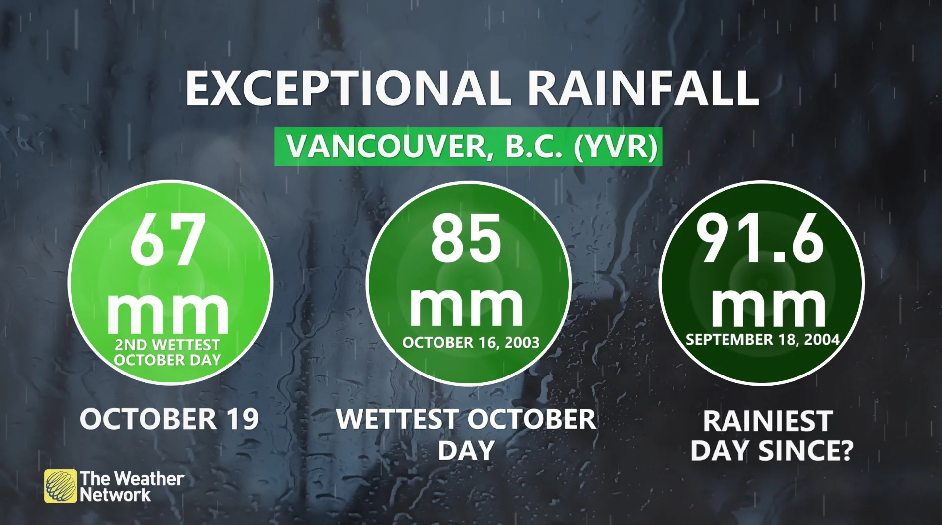
That marks the wettest day since Sept. 18, 2004 (91.6 mm), and the second-wettest October day on record (after Oct. 16, 2003, with 85 mm).
November 2021 comparison
For further context, let's compare this event to the record-breaking rainfall of November 2021.
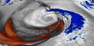
Most stations on the South Coast recorded higher rainfall during the November 2021 event, except for Burke Mountain and Vancouver Harbour, which saw more rain this time. Severe flooding occurred in areas including Coquitlam, West Vancouver, Surrey, and North Vancouver, with southwestern Vancouver Island also heavily impacted.
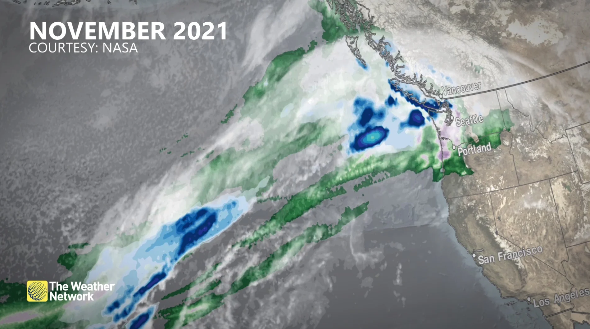
November 2021. (NASA)
This atmospheric river may have had a more significant impact on localized areas within Metro Vancouver. Vancouver International Airport (YVR) is likely to record rainfall amounts slightly higher than during the 2021 event. However, with much less snowmelt this time, as the event occurred later in the season, the flood risks were somewhat mitigated.
A Category 4 atmospheric river is rare for this part of the coast, but it still pales in comparison to the Category 5 event in November 2021. It pushed well into the Interior and up the Sea-to-Sky corridor.
Category 4 and 5 atmospheric rivers refer to the highest levels of moisture transport, often leading to extreme rainfall and flooding.
That event also saw much less of a rain-shadow effect on southern Vancouver Island and the Fraser Valley.
With files from Tyler Hamilton, a meteorologist at The Weather Network.


