More rain could worsen Toronto Island floods
Water levels could continue to rise throughout the week
With water levels on Lake Ontario already running high -- and more rain in the forecast for the coming week -- the international body that monitors the lake's water levels says they may exceed the levels reached in 2017.
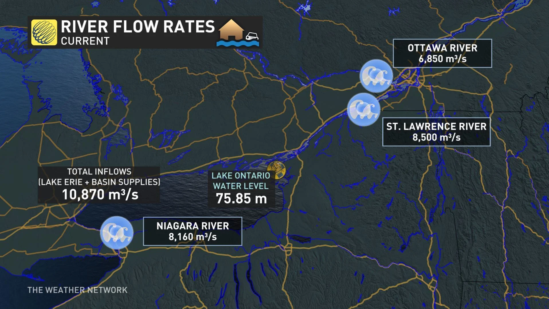
The International Lake Ontario-St. Lawrence River Board said Monday the lake's water level was at 75.85 m above sea level, and 'will likely reach or exceed' the 2017 record high, which the Toronto and Region Conservation Authority says was 75.93 m.

"Forecasts show that Lake Ontario levels are expected to crest within the next one to three weeks, mostly likely within a few centimeters (approximately 1 in.) of the record high, but potentially higher levels are possible should wet weather continue," the board said in its Monday bulletin.
The high, and still rising, lake water levels have had residents of low-lying areas scrambling.
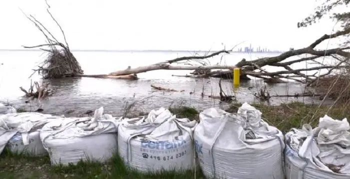
In Toronto, the city has deployed thousands of sandbags and 24 industrial sump pumps to help fend off the flooding on low-lying Toronto Island, but there've been setbacks in the form of ongoing rain, the still-rising water levels, and occasional winds causing waves that spill over flood barriers, as happened last week and over the weekend.
“The chances we catch winds from wrong direction – and at this point any direction is a bad direction – any time we get strong winds, that also kind of turns up the lake. You can end up with waves or with storm surge,” Rehana Rajabali, the senior manager of flood risk management for the Toronto and Region Conservation Authority, told the Globe and Mail.
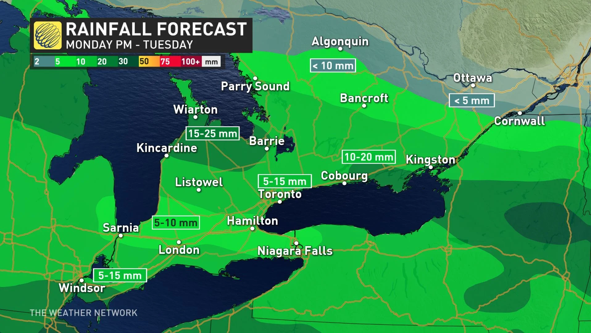
Making matters worse, there are a few more rounds of rain ahead this week, with the first lasting into Tuesday morning. Parts of the GTA and southwest are set for totals in 5-15 cm range, lower than initially feared, but areas further up the lake around Prince Edward County, where flooding has also been reported, may see higher amounts.


