Ontario’s exceptionally warm February landed in the records
A warm winter across Ontario ended with remarkable warmth that landed in the record books throughout the province
Toronto just lived through its warmest February on record—and it wasn’t even close.
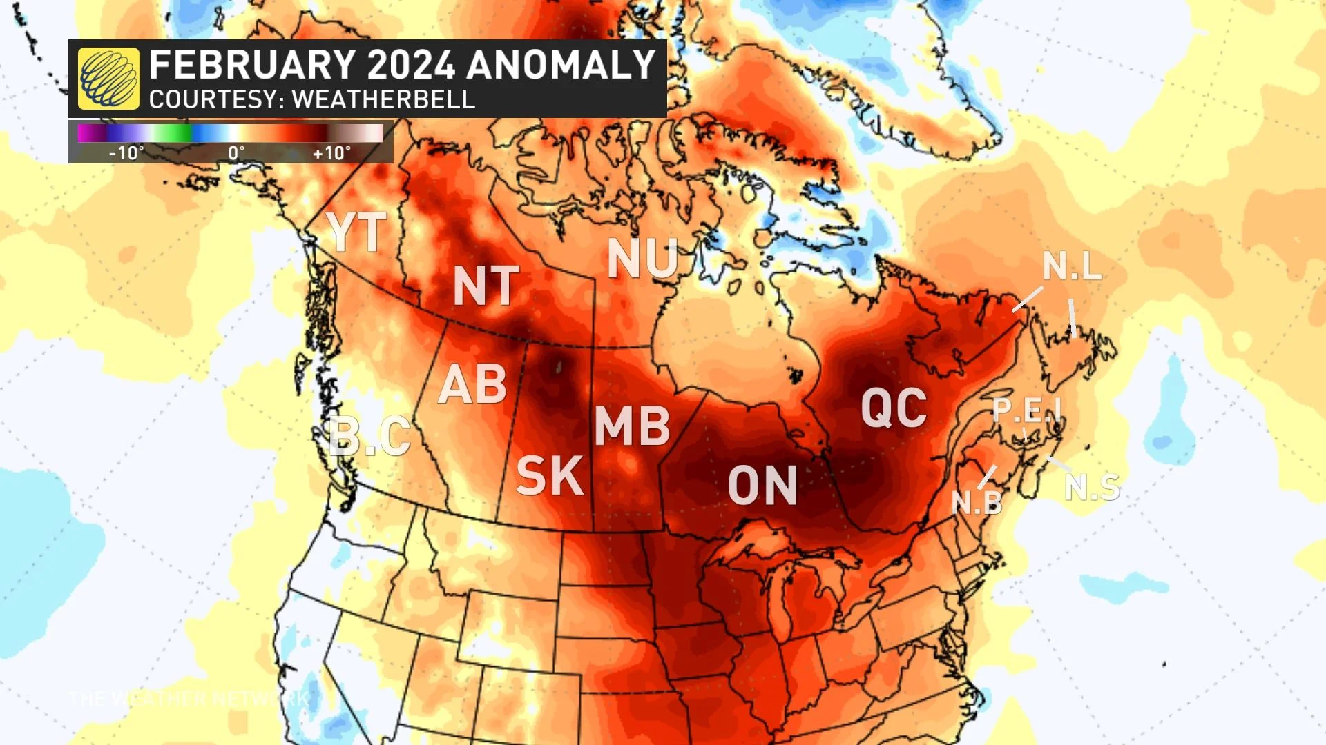
The final month of meteorological winter landed in the records across Ontario as consistent above-seasonal conditions blanketed the province. The pattern culminated in all-time warmth across the Greater Toronto and Hamilton Area (GTHA).
The above-seasonal temperatures we saw this past month finished near the top of the records for communities across Ontario, a testament to the intensity of this winter's unseasonable patterns.

SEE ALSO: Expect a turbulent March across Canada as the seasons duke it out
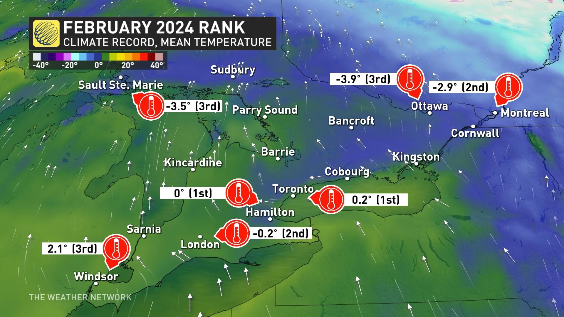
Toronto-Pearson International Airport finished February with an average temperature of 0.2°C. This value easily beat the previous all-time warmest average February temperature of -0.2°C back in 2017.
Average temperatures account for daytime highs and nighttime lows. A lack of seasonably cold nights contributed to the astounding warmth across the province, but spring-like daytime highs were a force to reckon with in their own right.

Toronto typically goes an entire February without notching a daytime high of 10°C or warmer. This year, though, Pearson Airport saw seven days with highs in the teens.
Feb. 28 landed as the airport's second-warmest February day ever recorded, with a comfortable afternoon reading of 16.5°C.
It’s a pattern that repeated throughout the province this past month.
Hamilton joined Toronto in notching its warmest-ever February this year with an average temperature of 0°C. The month ranked in the top-three for just about everyone in southern Ontario, as well as folks as far north as Ottawa and even Sault Ste. Marie.

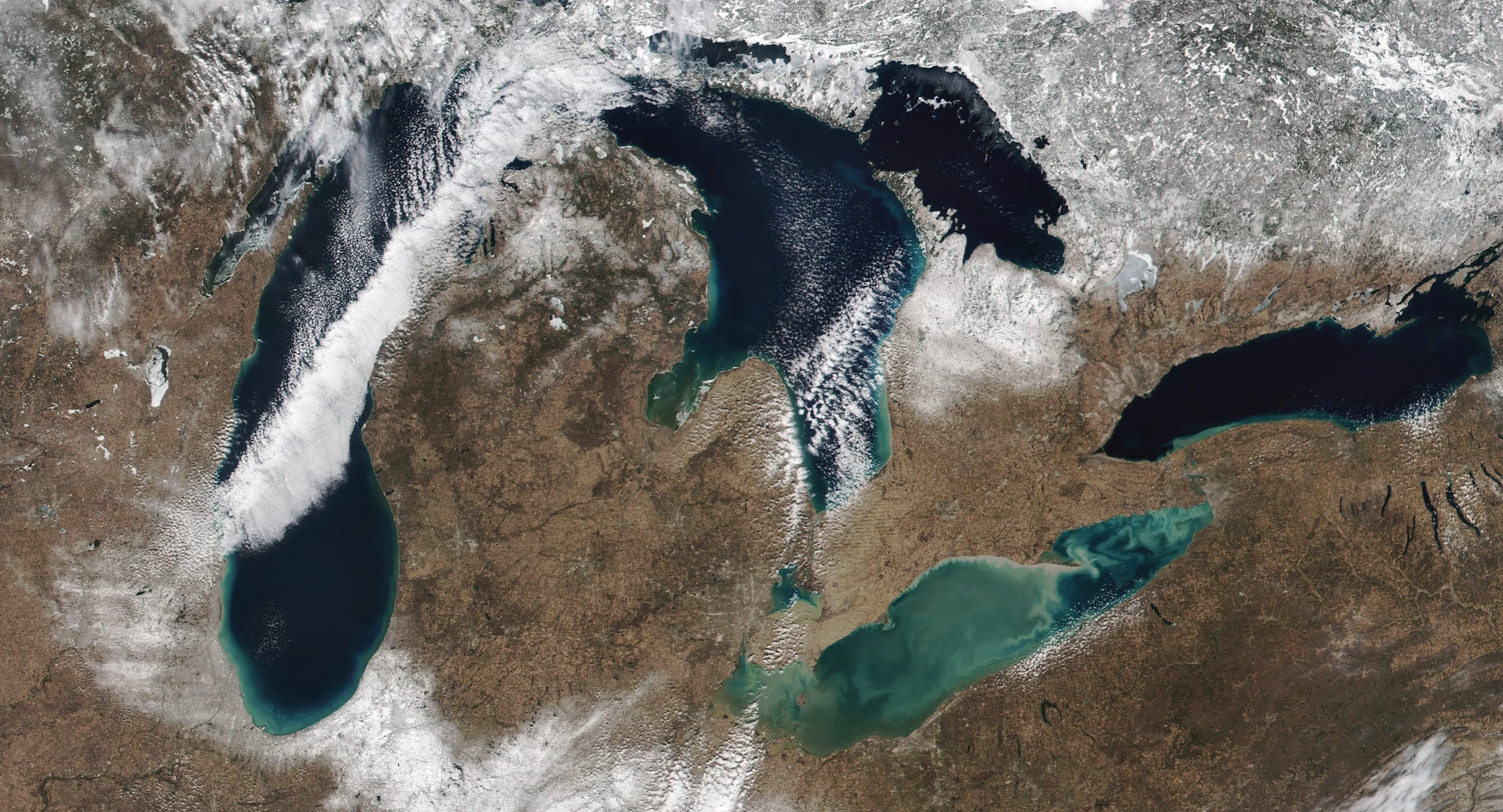
Unseasonably high temperatures throughout the region also exacted a historic toll on the Great Lakes. Ice cover historically peaks on the five lakes around the end of February and early March as winter’s chill grips these vital bodies of water.
This year, however, we’ve seen an unprecedented lack of lake ice across the region. All five lakes were virtually clear of ice by the end of February. The last day of the month saw just 3.35 percent of the Great Lakes covered with ice, most of which was confined to the shallow waters of Lake Huron’s North Channel.
A normal season would see total ice coverage exceed 40 percent by the beginning of March.
El Niño and climate change are likely contributors
El Niño likely played a critical role in February’s warmth. Persistent upper-level ridges over Central Canada—a hallmark of strong El Niño winters—created favourable conditions for above-seasonal temperatures.

A storm track over the western and central Great Lakes often put southern Ontario on the warm side of nearby storms, helping boost temperatures even further as winds blew across the border.
The drumbeat of warm temperature records is also a glaring example of our changing climate. Sea surface temperatures are running at summertime levels across much of the Atlantic Ocean. The world just experienced its hottest 12-month period on record. Warm temperature extremes are more likely as the atmosphere’s baseline temperatures continue to rise.
Header image courtesy of NOAA/NASA.


