Still more spectacular late summer warmth to grace southern Ontario
If you weren't ready for the fall-like temperatures that were felt during the long weekend, the weather pattern setting up across southern Ontario this weekend will provide a chance at a re-do.
Although many consider the Labour Day long weekend as the unofficial end to summer, there's still plenty of the late season warmth to go around in southern Ontario as we make our way through this first week of September.
MUST SEE: Record summer fuels extreme water temperatures, tropical trouble brewing?
A sprawling area of high pressure has helped to keep significant rain stateside, as parts of the U.S. Northeast picked up between 200-275 mm of rain locally to start this week.
In fact, the I-95 was shut down in both directions as conditions worsened on Monday, with officials urging Rhode Islanders to avoid any unnecessary travel due to the significant flooding. Some drivers were stranded for hours.
Route 10 in Providence was also closed in both directions.
"An elongated slow moving system brought flooding rains to a drought stricken region of the U.S. Northeast on Monday," says Kelly Sonnenburg, a meteorologist at The Weather Network. "While parts of Rhode Island and Massachusetts are currently facing extreme drought conditions, the excessive amount of rain was too much for the regions to handle with interstates flooded and buildings collapsing."
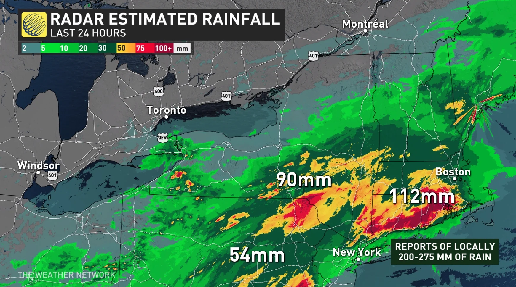
Systems like this can often impact areas closer to home, as well, but this time we can thank the area of high pressure for keeping the flooding rains south of the border.
The only impacts felt in southern Ontario this week will be some extra cloud cover for communities along the southern Great Lakes and the chance for some isolated showers on Wednesday.
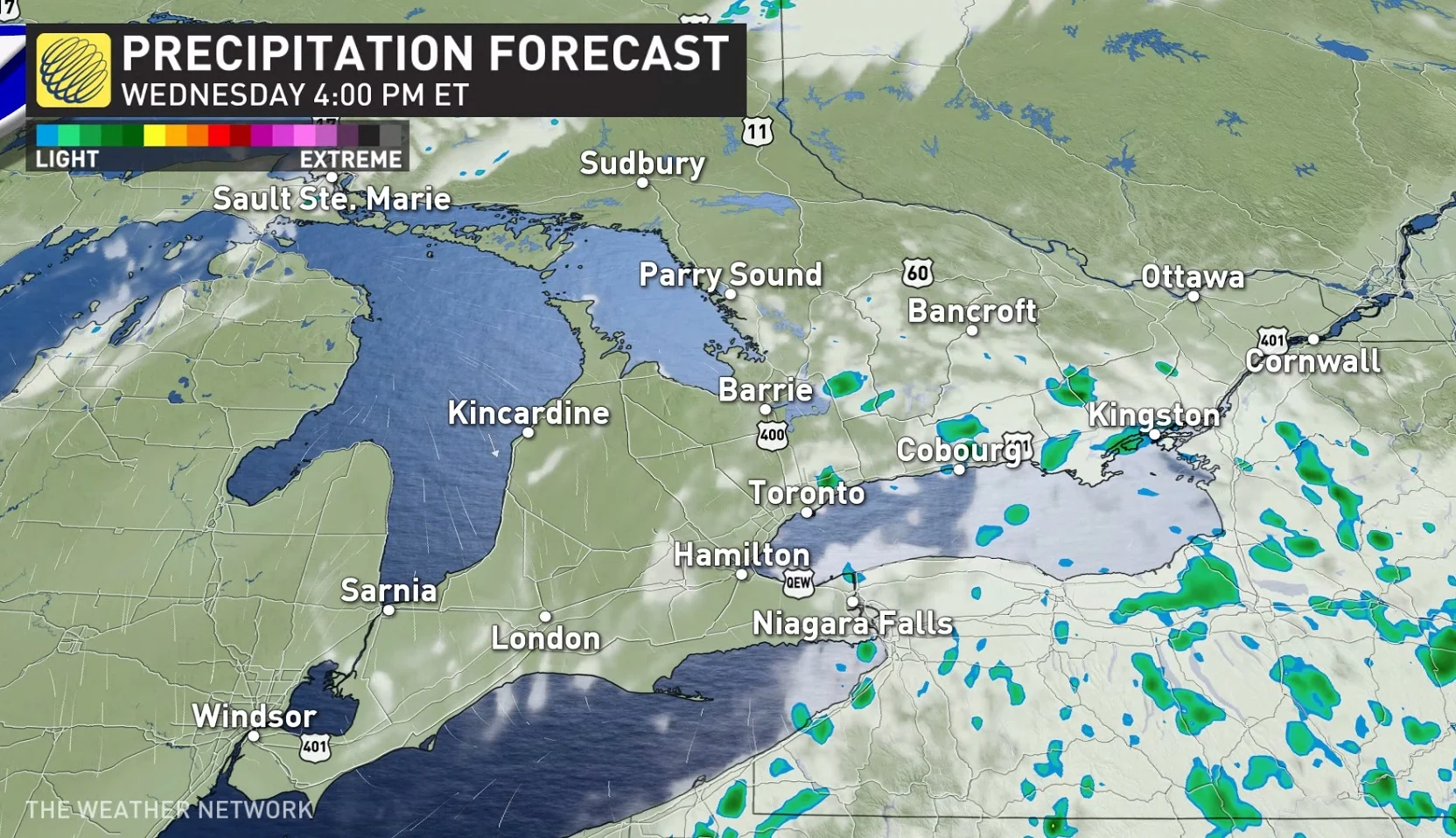
Waterspouts along the southern Great Lakes may also develop under favourable weather conditions Wednesday over Lake Erie and Lake Ontario.
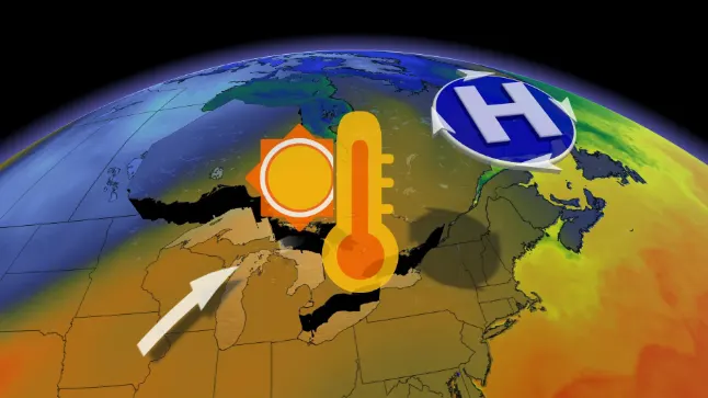
That's thanks to some slightly cooler air aloft squeezing and funneling from east to west between the area of high pressure to the north and the low-pressure system sending significant rain across the south.
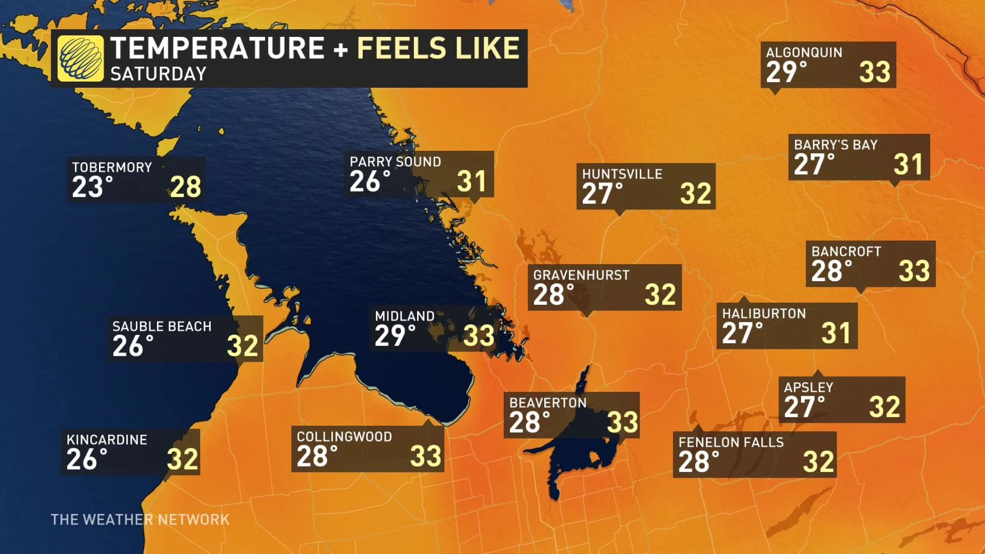
Spectacular late summer weather will then return to southern Ontario late this week and into the start of this weekend, with abundant sunshine and high temperatures into the mid to upper 20s expected.
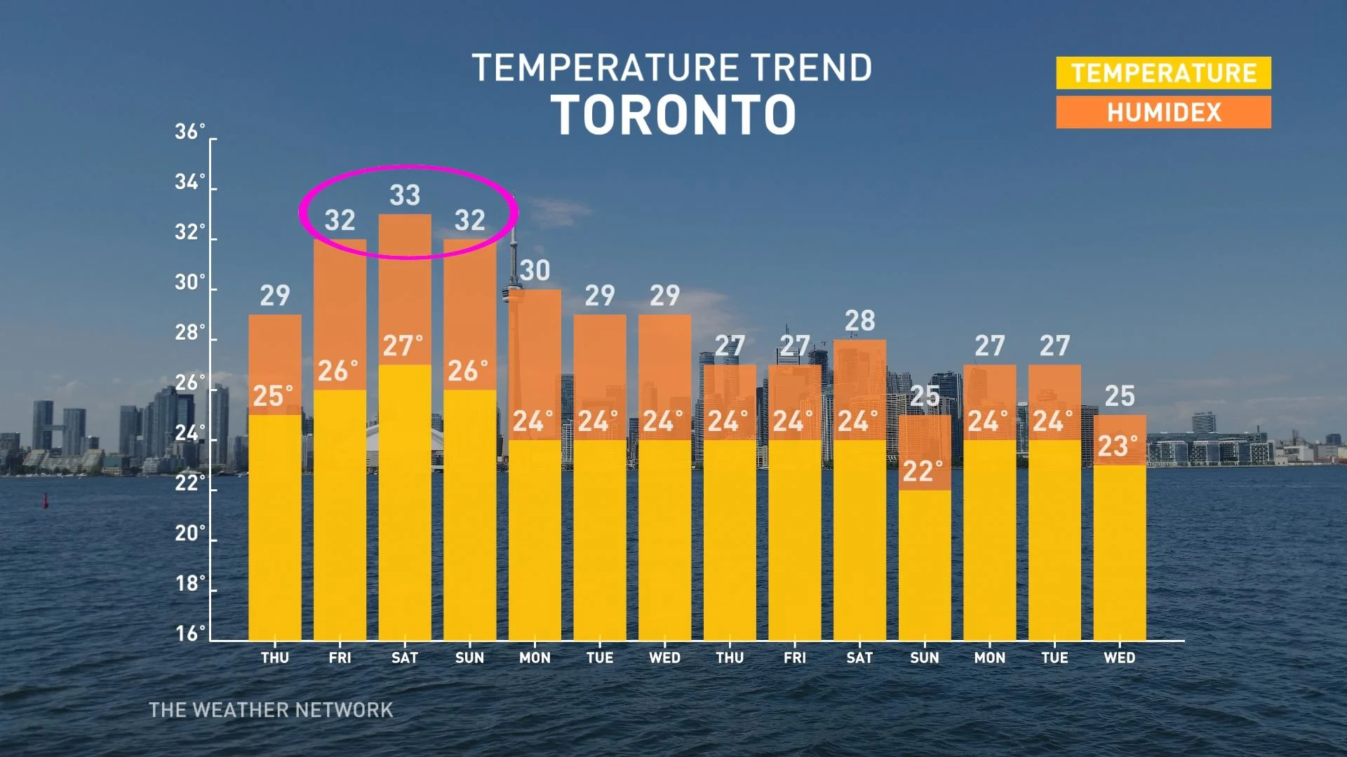
A few spots could even hit 30°C, feeling more like the middle of the summer.
Humidity will build through the day on Saturday, with very sunny and warm conditions persisting.
